Severe thunderstorms across the Deep South

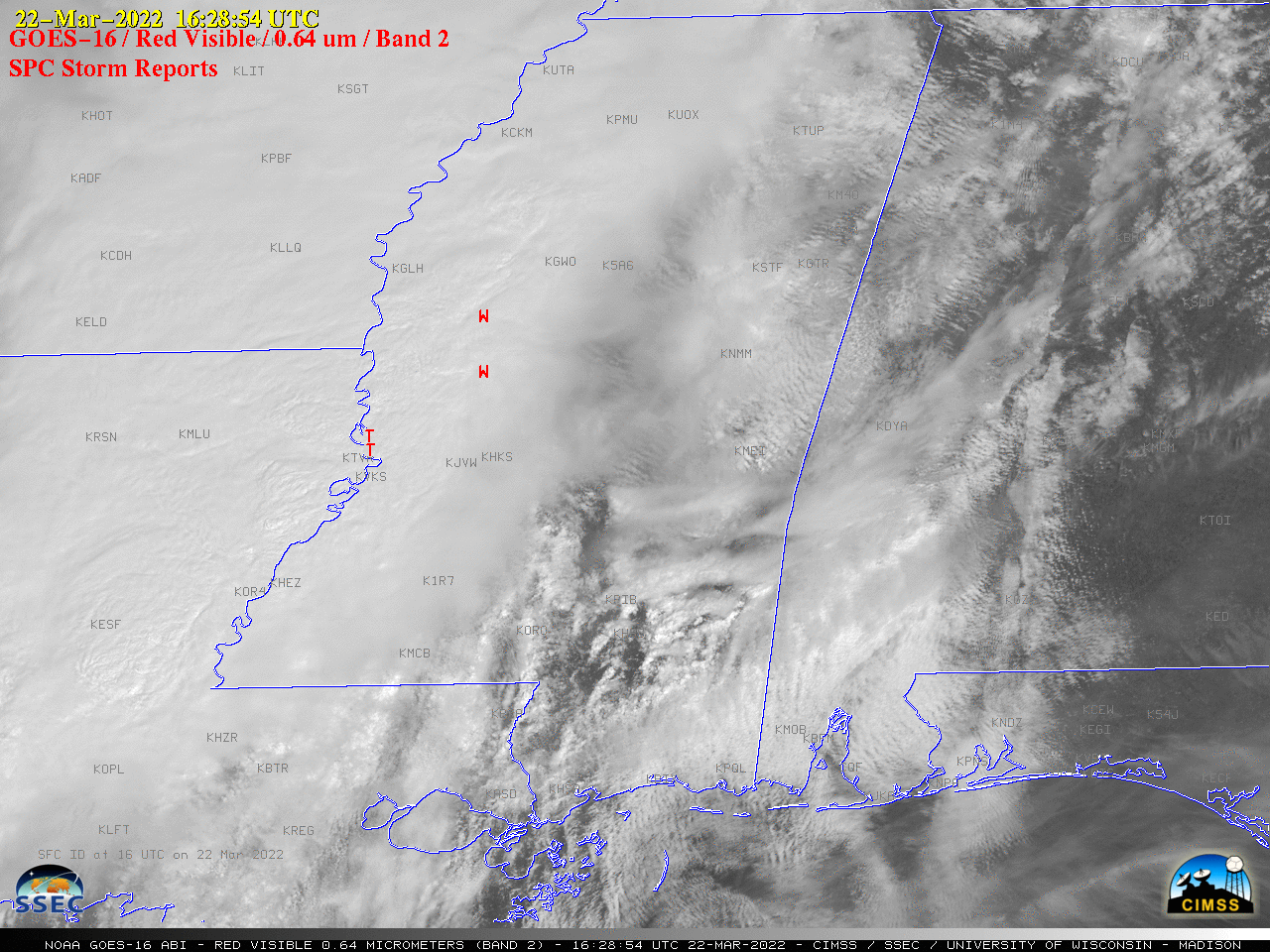
GOES-16 “Red” Visible (0.64 µm) images, with time-matched SPC Storm Reports plotted in red [click to play animated GIF | MP4]
1-minute Mesoscale Domain Sector GOES-16 (GOES-East) “Red” Visible (0.64 µm) images (above) include time-matched SPC Storm Reports — and showed some of the widespread severe weather produced by thunderstorms that developed ahead of a cold front which was moving eastward across the Deep South on 22 March 2022.
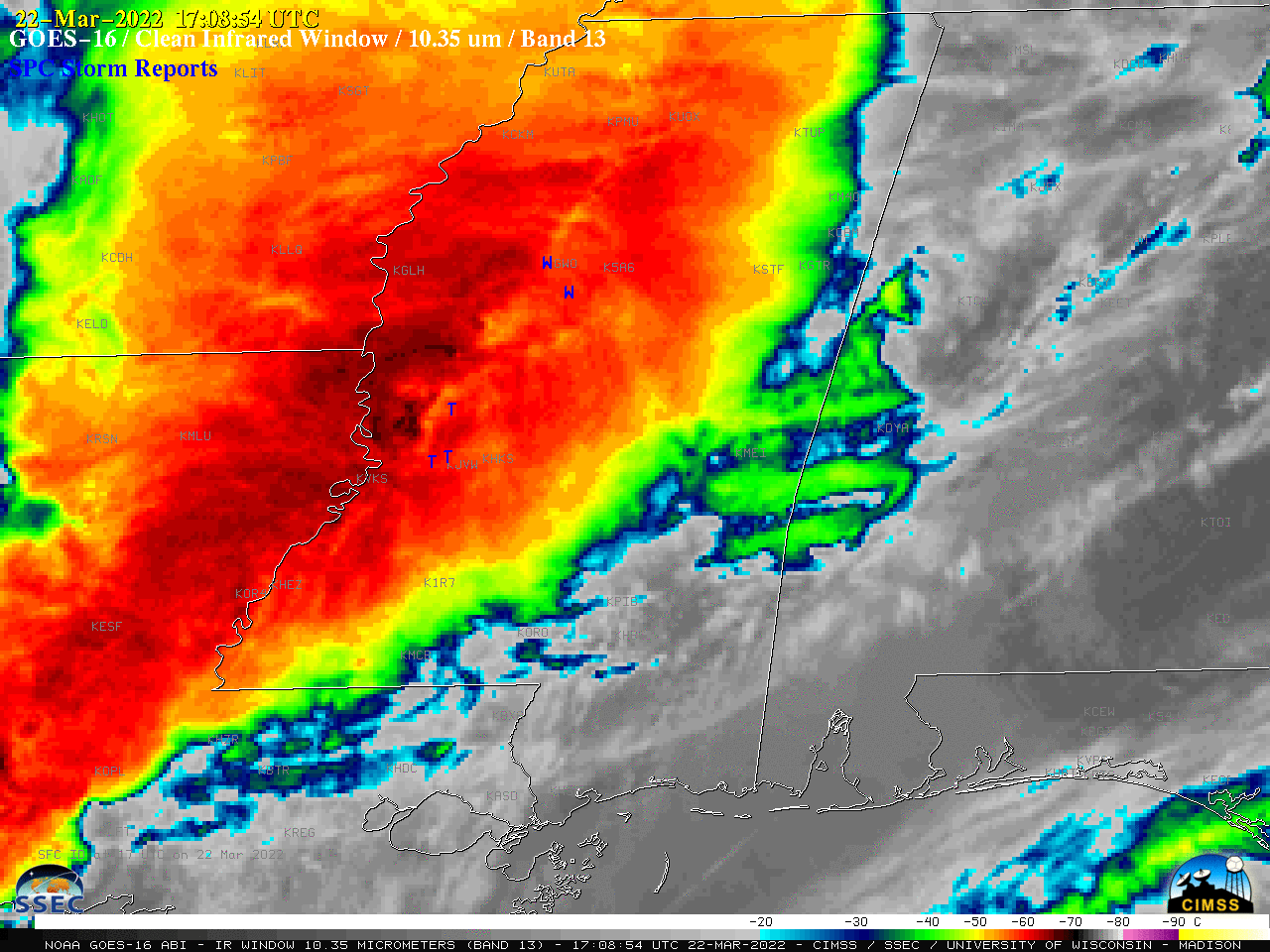
The severe weather persisted for several hours past sunset, as displayed below by GOES-16 “Clean” Infrared Window (10.35 µm) images ending at 0416 UTC on 23 March (11:16 pm CDT on 22 March).

GOES-16 “Clean” Infrared Window (10.35 µm) images, with time-matched SPC Storm Reports plotted in blue [click to play animated GIF | MP4]
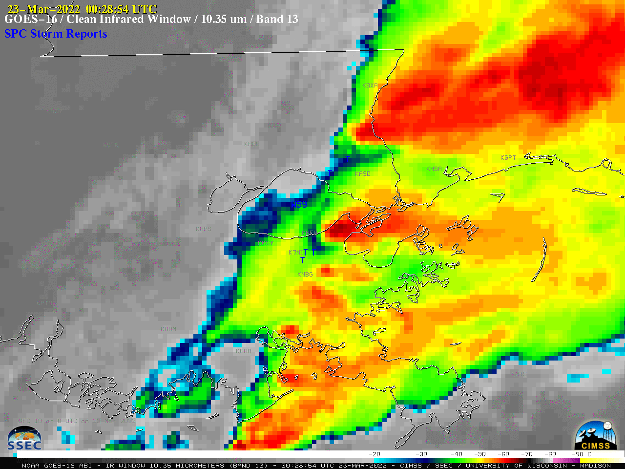
A closer look at the development of a supercell thunderstorm that produced an EF-3 tornado in Arabi (within the eastern portion of the Greater New Orleans metropolitan area) is shown below.

GOES-16 “Clean” Infrared Window (10.35 µm) images, with time-matched SPC Storm Reports plotted in blue [click to play animated GIF | MP4]

