Mesovortices over the Great Lakes
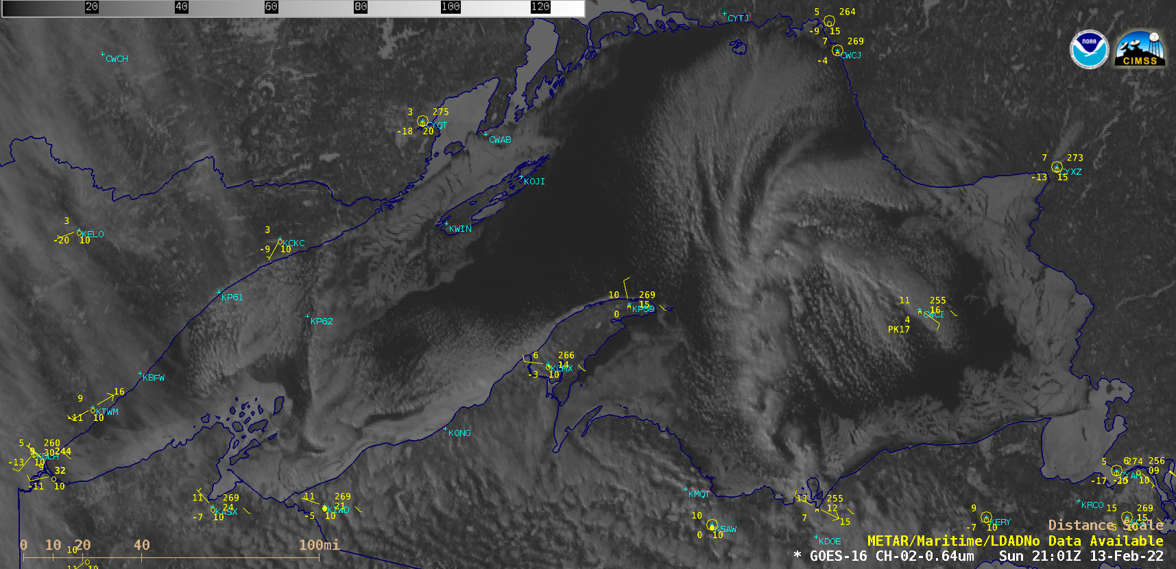
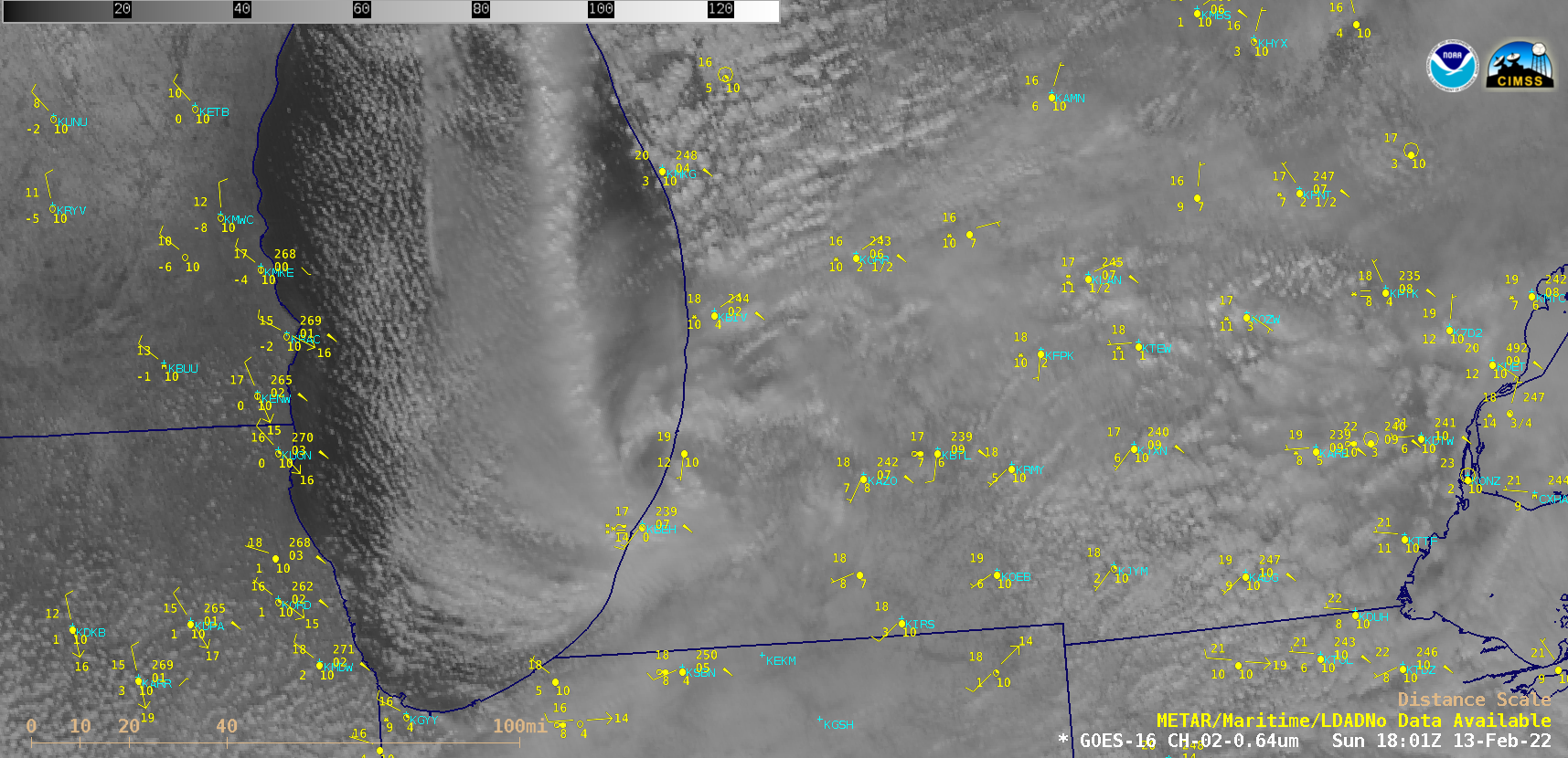
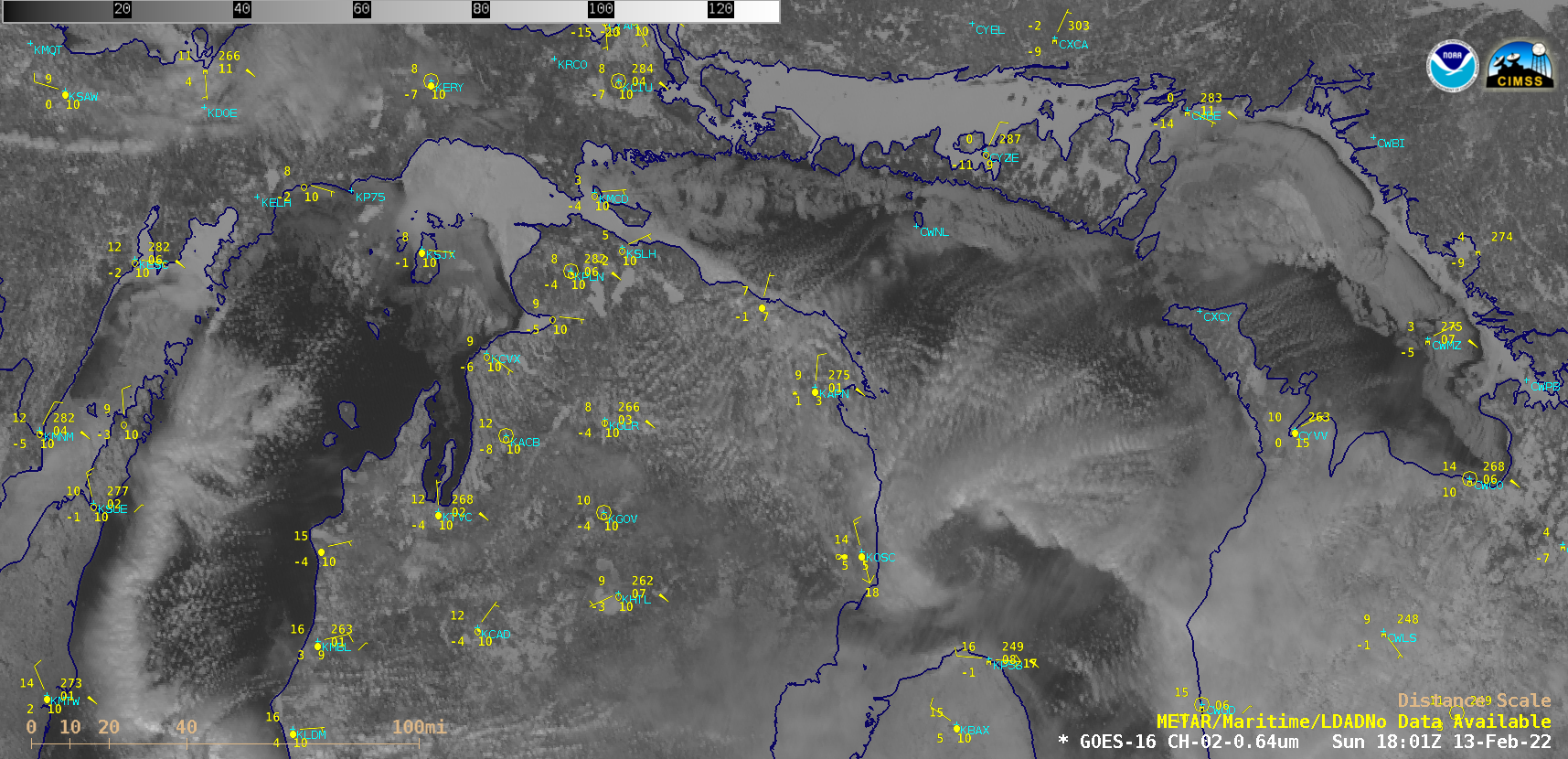
GOES-16 (GOES-East) “Red” Visible (0.64 µm) images (above) showed a string of mesovortices over the eastern portion of Lake Superior, along with a small, isolated mesovortex just offshore in the western portion of Lake Superior on 13 February 2022. Increasing ice coverage was also seen along the edges of the lake.Farther to the east, GOES-16 Visible images showed a large and well-defined mesovortex over Lake Huron, with smaller mesovortices along a northern Lake Michigan cloud band (below).
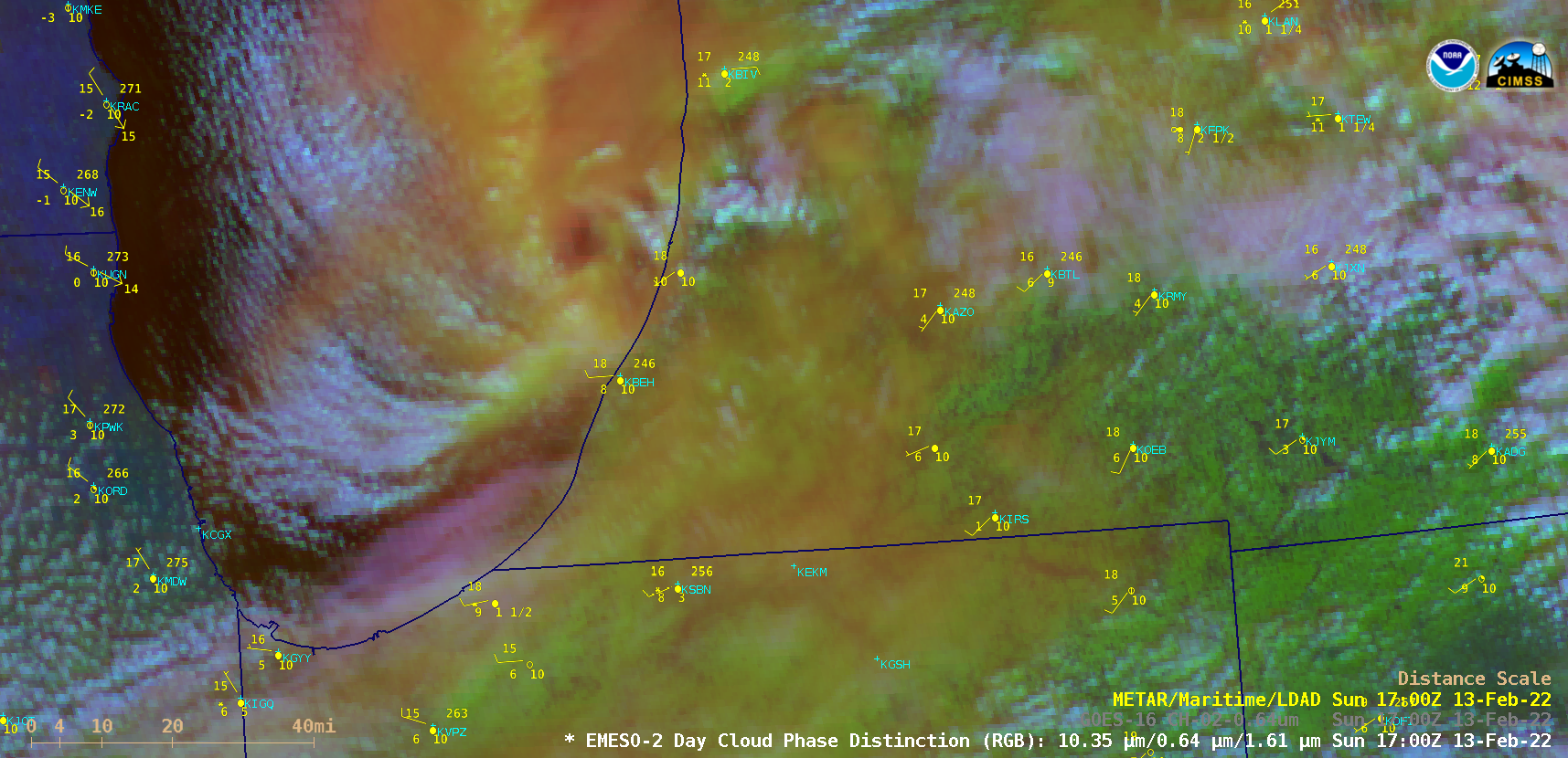
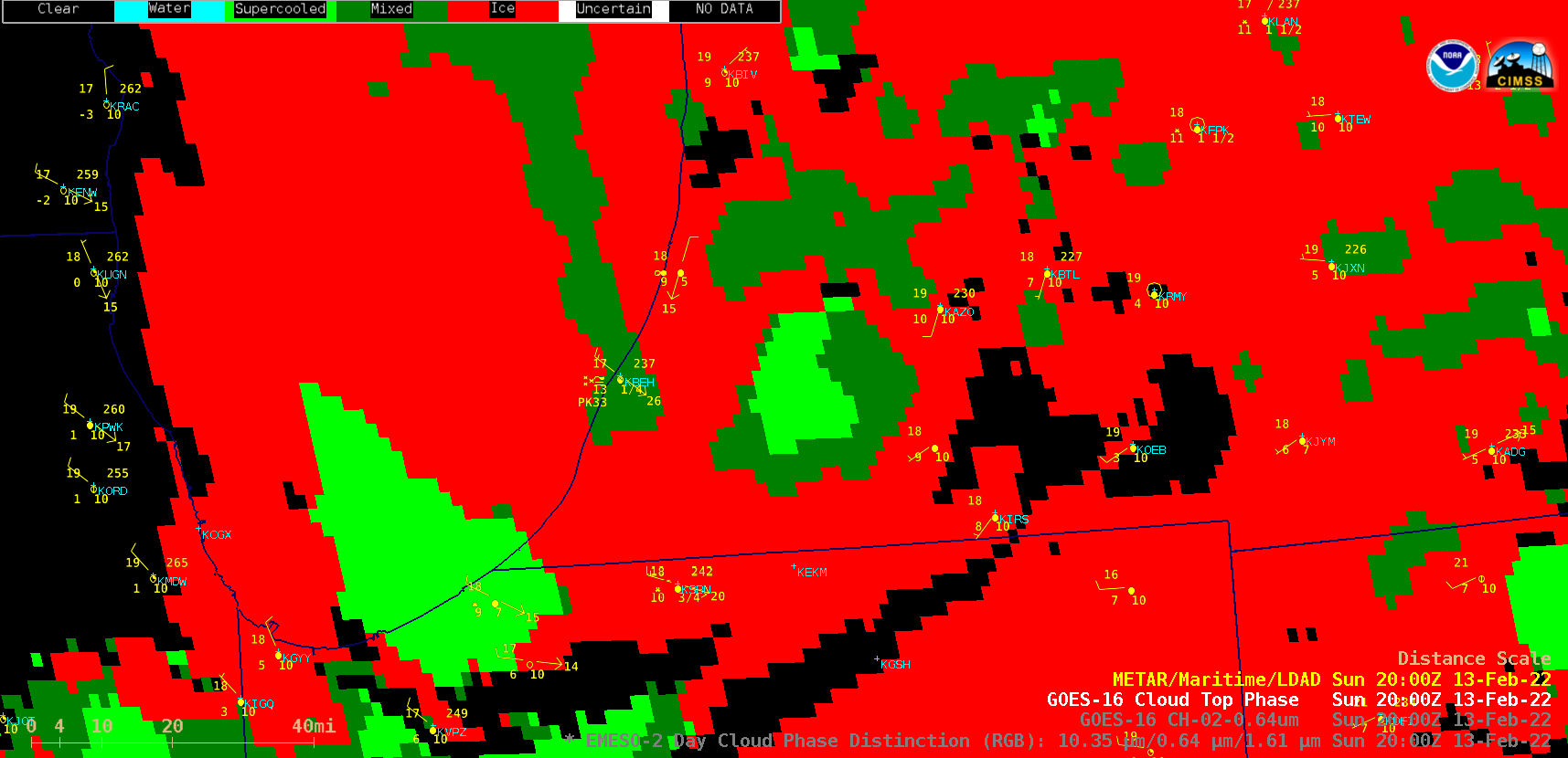
Finally, over southern Lake Michigan a distinct mesovortex developed along the southern end of a long lake cloud band that began to move inland across far southwestern Lower Michigan (below). A closer look at the Lake Michigan vortex using 1-minute Mesoscale Domain Sector GOES-16 Day Cloud Phase Distinction RGB images (below) portrayed the shades of green indicative of glaciating convective clouds around the core of the mesovortex and the trailing Lake Michigan band. The confluence of the western periphery of the mesovortex with the trailing lake cloud band produced a prolonged period of heavy snow at Benton Harbor (KBEH) and up to 12 inches of snowfall at downwind locations in Berrien County, Michigan. In a sequence of 1-minute GOES-16 Cloud Top Phase Distinction RGB and Cloud Top Phase derived product images from 2000-2100 UTC (below), the supercooled/mixed phase core of the inland mesovortex was surrounded by a ring of ice phase clouds — while the adjoining Lake Michigan cloud band was classified as a mixed-phase feature as it began to move inland.