Strong winds over Lake Michigan
GOES-16 “Veggie Band” near-infrared imagery (Band 3, 0.86 µm), above, (from the CSPP Geosphere website, click here for a link to the animation at that website) shows an early-season Fall cyclone over lower Michigan. During the animation, RADARSAT Constellation Mission Satellite 1 (RCM-1) was in a descending pass down Lake Michigan. Synthetic Aperture Radar winds from that satellite (from this website) produced a complex windfield over extreme eastern Lake Superior (just before 1152 UTC) and over Lake Michigan (just before 1153 UTC), as shown below.
It is interesting to consider the influence of prominences along the western shore of lower Michigan, such as Big Sable and Little Sable points, as well as Sleeping Bear Dunes on the distribution of winds. There seems to be lighter winds in the lee of those regions in this northerly wind regime. Also, consider the wind funneling through outlets over Lake Huron, and being blocked by the islands in northern Lake Michigan.
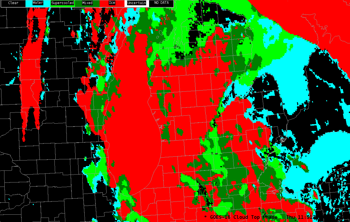
SAR winds are affected by ice in clouds. That might be the cause of the very strong winds indicated to be just offshore or southwestern lower Michigan, and over the Lake Michigan south of 43 N and east of 87 W. GOES-16 Cloud-top phase does show ice over the entire Lake, as shown below.
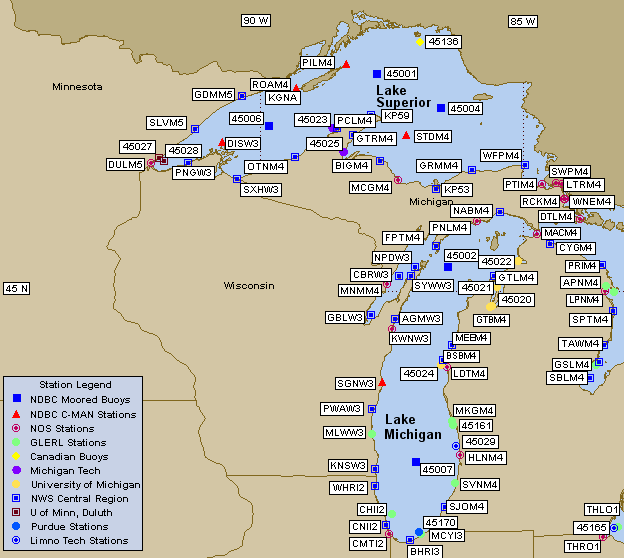
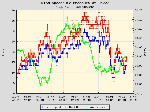
The National Data Buoy Center oversees a large portfolio of moored buoys (and C-MAN sites) that monitor the winds, and these buoys can be used to see how the SAR winds compare to observations. For example, the winds at buoy 45007 around 1100 UTC on 23 September, as shown in the plot below, were around 25 knots with gusts to almost 35 knots.
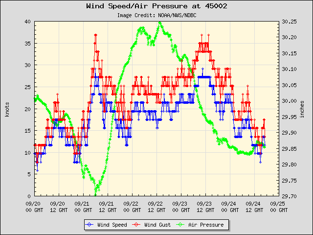
Winds at buoy 45002 (above) peaked at around 1200 UTC: 27 knots with gusts to 35 knots.
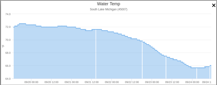
Strongs winds in early Autumn act to cool the lake. The Lake Surface Temperature plot, below, from this site, shows the cooling at buoy 45007 that occurred with the winds.
