Surface low off the coast of Florida

GOES-16 “Red” Visible (0.64 µm) and “Clean” Infrared Window (10.35 µm) images [click to play animation | MP4]
GOES-16 Visible and Infrared images on the following day (below) showed that the surface low had remained quasi-stationary as it transitioned to its occluded phase. Thunderstorm development persisted farther offshore over the warm waters of the Gulf Stream — a few overshooting tops exhibited infrared brightness temperatures of -60ºC and colder.
![GOES-16 “Red” Visible (0.64 µm) and "Clean" Infrared Window (10.35 µm) images [click to play animation | MP4]](https://cimss.ssec.wisc.edu/satellite-blog/images/2021/03/210321_goes16_visible_infrared_FL_anim.gif)
GOES-16 “Red” Visible (0.64 µm) and “Clean” Infrared Window (10.35 µm) images [click to play animation | MP4]
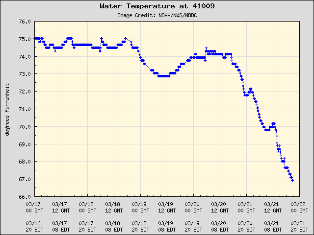
Plot of Water Temperature at Buoy 41009