NUCAPS Lapse Rates ahead of a line of convection in lower Michigan
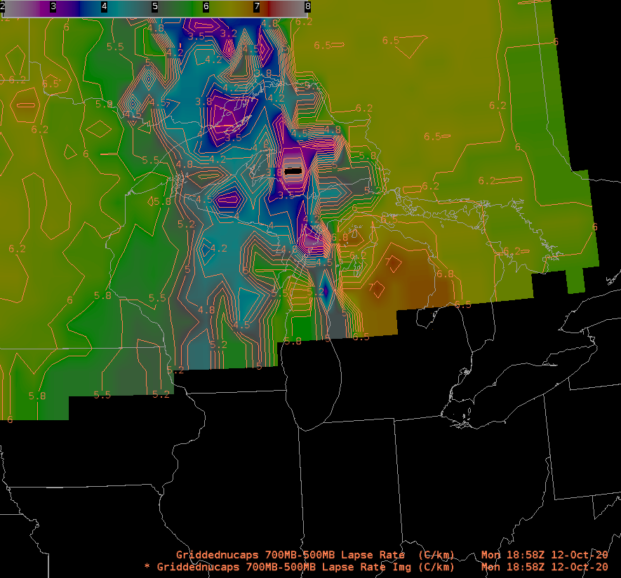
Radar imagery from the upper midwest at 1858 UTC, below, showed convection moving into lower Michigan. NUCAPS thermodynamics, above, suggest that the convection would not dissipate in Michigan. An elevated mixed layer with lapse rates of 7 C/km between 500 and 700 mb is indicated.
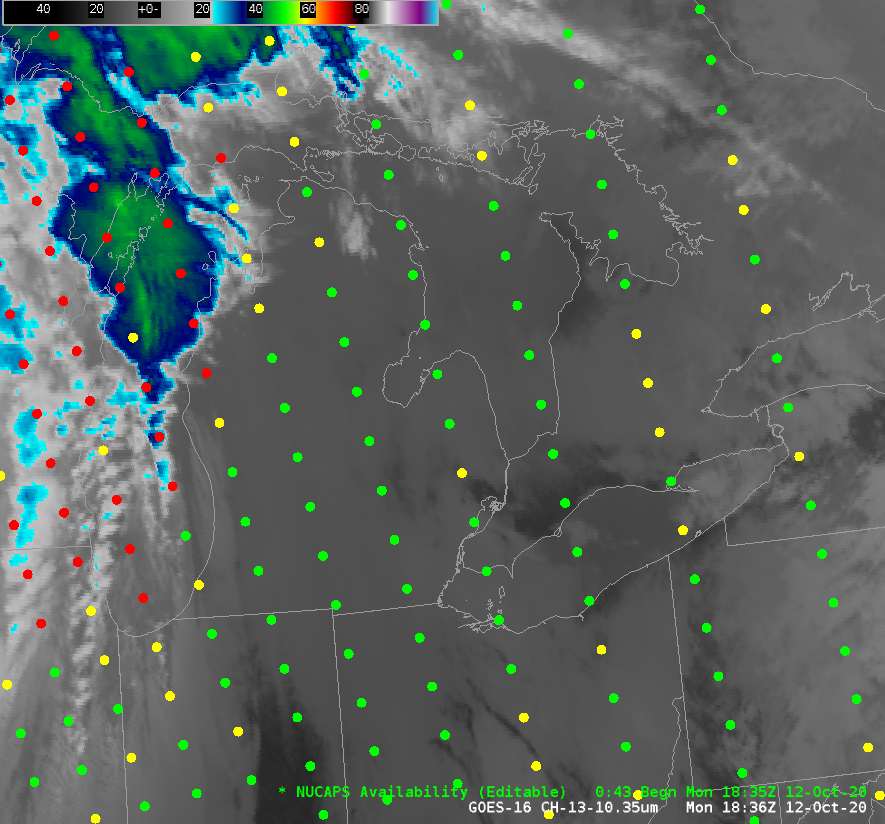
NUCAPS Points for the afternoon pass over Michigan are shown below. Lower clouds are apparent over much of lower Michigan, but the NUCAPS Soundings did converge to values. The sounding point over southwest Michigan, here, and for just southwest of Saginaw Bay, here, show the steep mid-level lapse rates. NUCAPS Lapse Rates can also be viewed at this website from SPoRT; Lapse rates of 850-700 and 700-500 are available.

GOES-16 Infrared Imagery (10.3 µm) and NUCAPS Availability points, 1836 UTC on 12 October 2020 (click to enlarge)
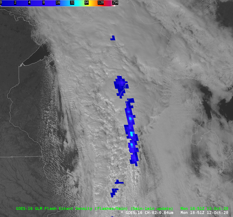
GOES-16 Visible imagery (0.64 µm), below, along with GLM Observations of Flash Extent Density, show how the convection continued across lower Michigan.


