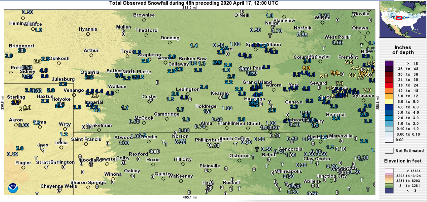
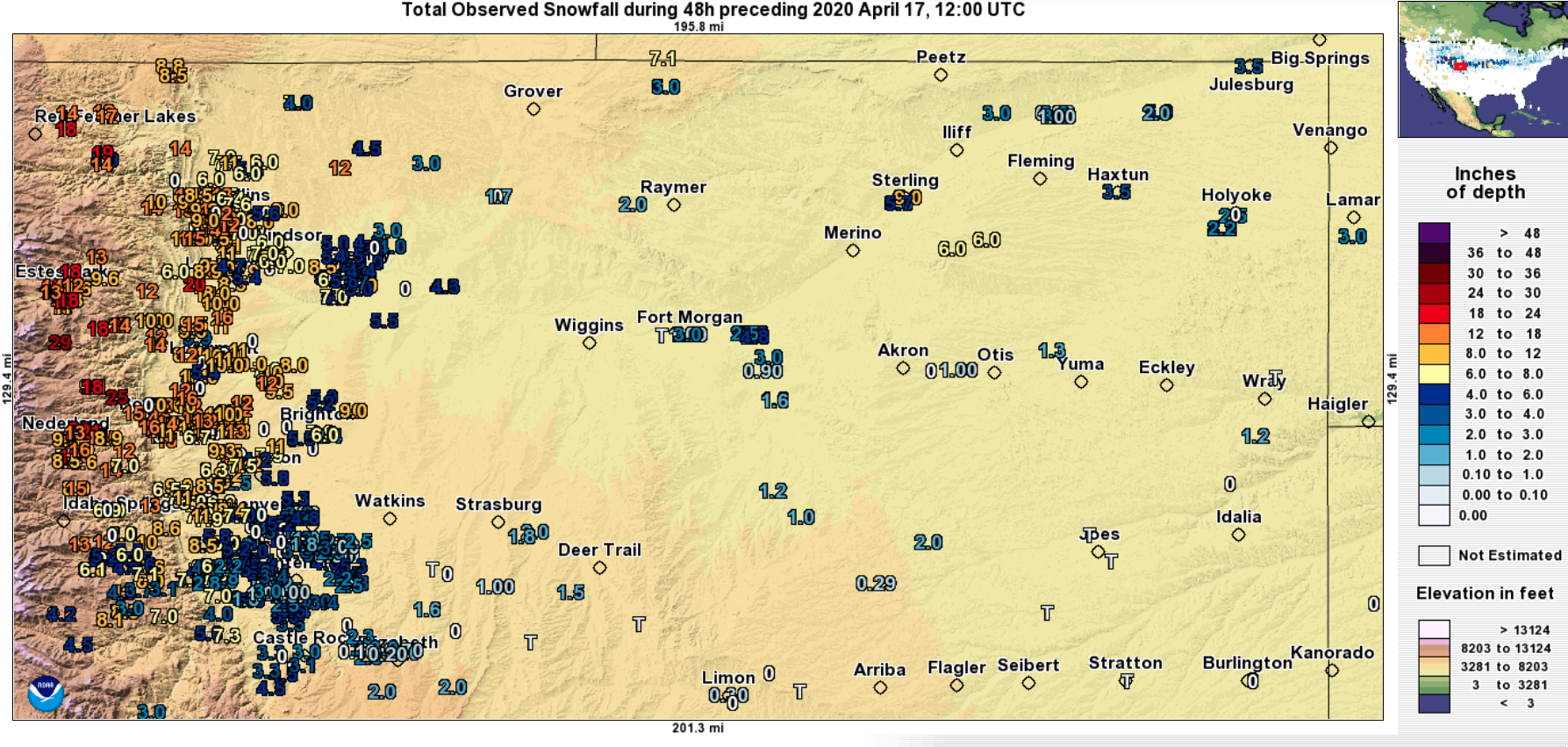
Melting snow cover across the High Plains and Midwest

GOES-16 “Red” Visible (0.64 µm) and Day Cloud Phase Distinction RGB images [click to play animation | MP4]
A closer look at the eastern segment of the snow cover over eastern Nebraska, southern Iowa and northern Missouri (below) showed the effect of snow-cooled surfaces on suppressing the formation of cumulus clouds as diurnal heating increased into the afternoon hours. Surface air temperatures warmed into the upper 40s to low 50s F in areas where the snow melted — but were held in the upper 30s to low 40s F where deeper snow cover existed near the Iowa/Missouri border (where storm total amounts were as high as 12-16 inches).
![GOES-16 Day Cloud Phase Distinction RGB images [click to play animation | MP4]](https://cimss.ssec.wisc.edu/satellite-blog/images/2020/04/200417_goes16_dayCloudPhaseDistinctionRGB_NE_KS_IA_MO_snowmelt_anim.gif)
GOES-16 Day Cloud Phase Distinction RGB images [click to play animation | MP4]