Vertically-propagating frontal gravity wave over Georgia
![GOES-16 Low-level (7.3 µm), Mid-level (6.9 µm) and Upper-level (6.2 µm) Water Vapor images [click to play animation | MP4]](https://cimss.ssec.wisc.edu/satellite-blog/images/2020/03/200314_goes16_waterVapor_GA_anim.gif)
GOES-16 Low-level (7.3 µm), Mid-level (6.9 µm) and Upper-level (6.2 µm) Water Vapor images [click to play animation | MP4]
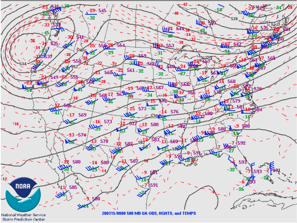
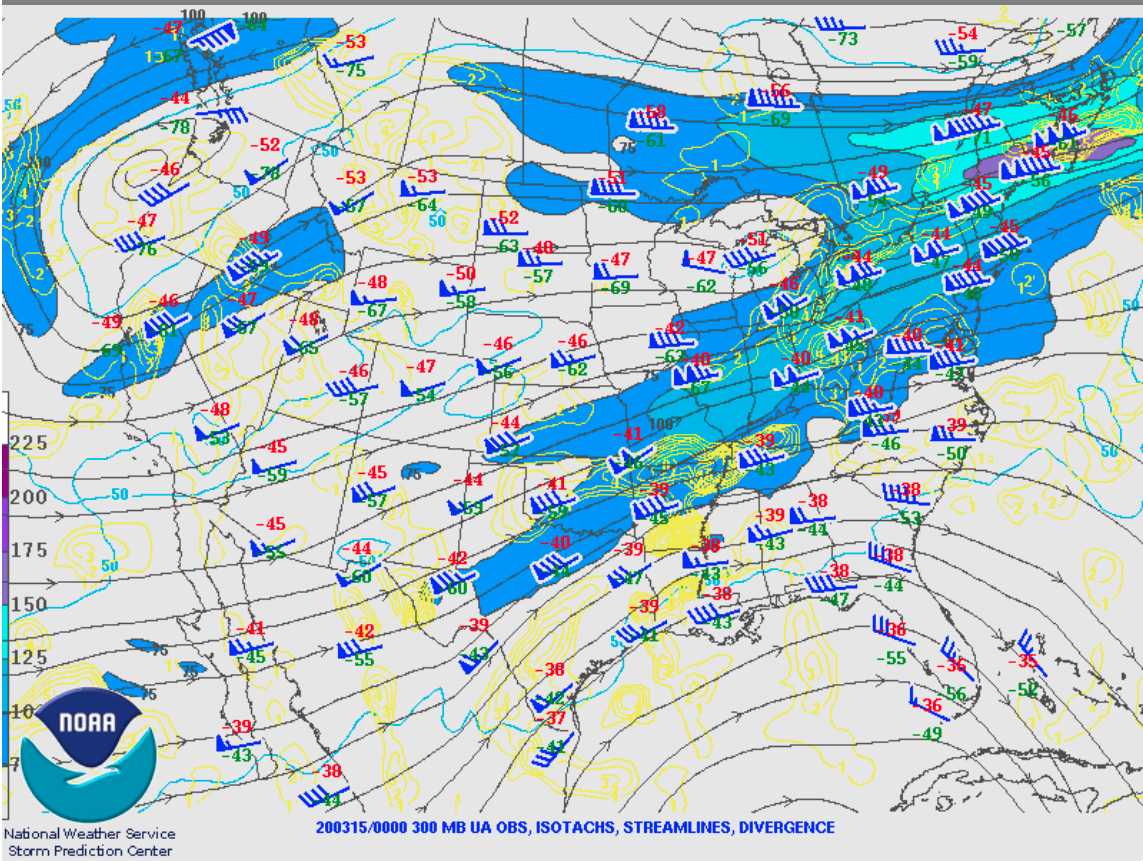
Plots of GOES-16 Water Vapor weighting functions calculated using rawinsonde data from Charleston, South Carolina, Jacksonvlle, Florida and Peachtree City, Georgia are shown below. With abundant moisture aloft, much of the sensed radiation was from middle to upper troposphere — giving an indication of the depth of these vertically-propagating frontal gravity waves..
![GOES-16 Water Vapor weighting functions at Charleston, South Carolina [click to enlarge]](https://cimss.ssec.wisc.edu/satellite-blog/images/2020/03/200315_00z_kchs_wv_wf.png)
GOES-16 Water Vapor weighting functions at Charleston, South Carolina [click to enlarge]
![GOES-16 Water Vapor weighting functions at Jacksonville, Florida [click to enlarge]](https://cimss.ssec.wisc.edu/satellite-blog/images/2020/03/200315_00z_kjax_wv_wf.png)
GOES-16 Water Vapor weighting functions at Jacksonville, Florida [click to enlarge]
![GOES-16 Water Vapor weighting functions at Peachtree City, Georgia [click to enlarge]](https://cimss.ssec.wisc.edu/satellite-blog/images/2020/03/200315_00z_kffc_wv_wf.png)
GOES-16 Water Vapor weighting functions at Peachtree City, Georgia [click to enlarge]