Mesospheric airglow waves over the Northern Plains
![VIIRS Day/Night Band (0.7 µm) and Infrared Window (11.45 µm) images from NOAA-20 (0740 UTC) and Suomi NPP (0831 UTC) [click to enlarge]](https://cimss.ssec.wisc.edu/satellite-blog/wp-content/uploads/sites/5/2019/09/190902_noaa20_suomiNPP_viirs_dayNightBand_infraredWindow_N_Plains_mesospheric_airglow_waves_anim.gif)
VIIRS Day/Night Band (0.7 µm) and Infrared Window (11.45 µm) images from NOAA-20 (0740 UTC), Suomi NPP (0831 UTC) and NOAA-20 (0921 UTC) [click to enlarge]
Closer views centered on the convection are shown below. Cloud-top infrared brightness temperatures in both South Dakota and Nebraska were -70ºC and colder in the NOAA-20 images (which are mislabeled as Suomi NPP), and -80ºC and colder in the Suomi NPP image. Bright white “lightning streak” signatures associated with the thunderstorms were more apparent in these closer views.
![VIIRS Day/Night Band (0.7 µm) and Infrared Window (11.45 µm) images from NOAA-20 (0740 UTC), Suomi NPP (0831 UTC) and NOAA-20 (0921 UTC) [click to enlarge]](https://cimss.ssec.wisc.edu/satellite-blog/wp-content/uploads/sites/5/2019/09/190902_noaa20_suomiNPP_viirs_dayNightBand_infraredWindow_N_Plains_mesospheric_airglow_waves_zoom_anim.gif)
VIIRS Day/Night Band (0.7 µm) and Infrared Window (11.45 µm) images from NOAA-20 (0740 UTC), Suomi NPP (0831 UTC) and NOAA-20 (0921 UTC) [click to enlarge]
Interesting! Day Night Band from #SuomiNPP and #NOAA20 #VIIRS early this morning caught stunning mesospheric gravity waves. But why they are so far displaced to the west from likely culprit convection in central SD and NE? Skeptical its due to parallax. @CIMSS_Satellite pic.twitter.com/ZmL1fcXB1L
— Carl Jones (@northflwx) September 2, 2019
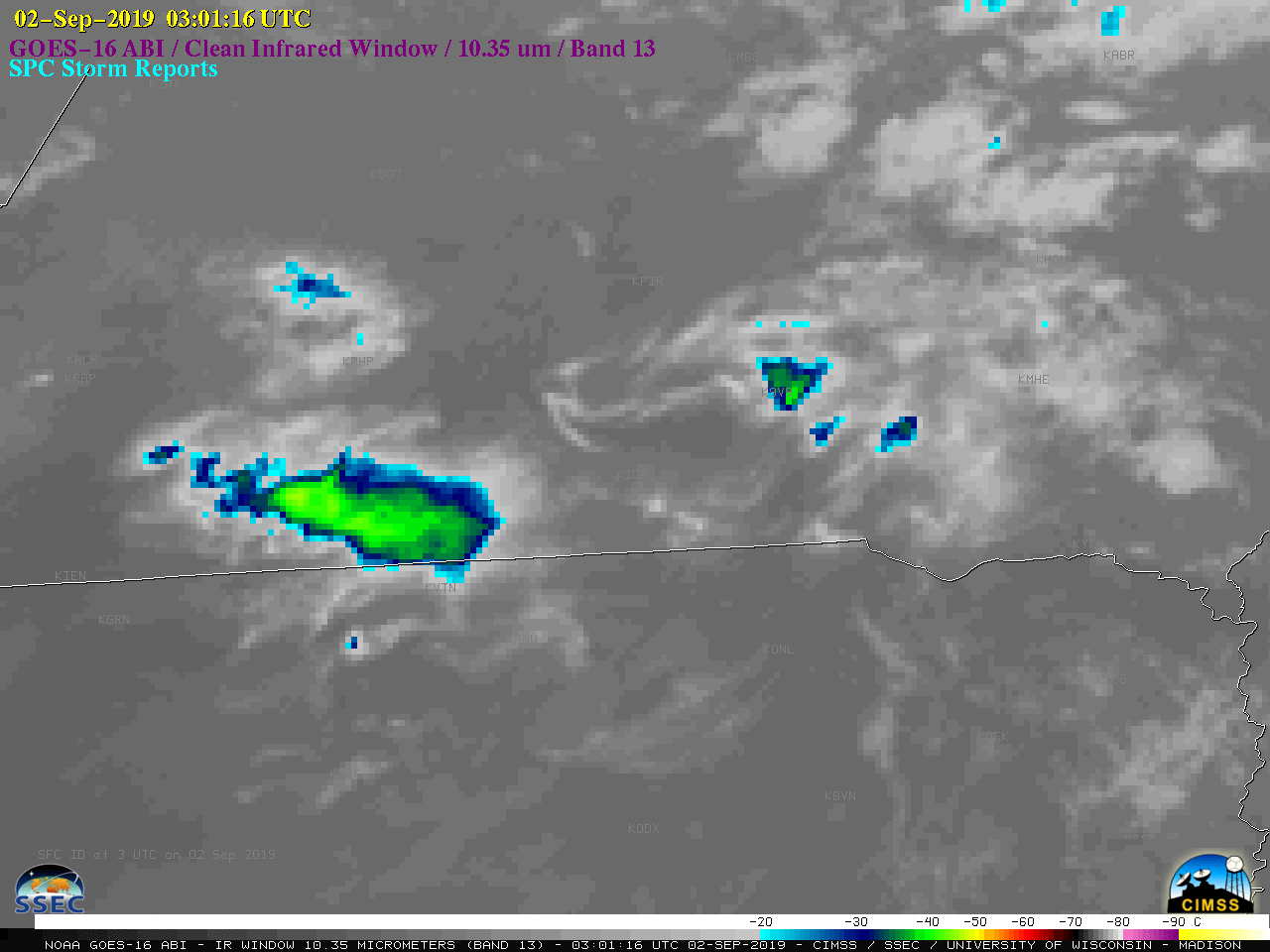
GOES-16 “Clean” Infrared Window (10.35 µm) images, with SPC storm reports plotted in cyan [click to play animation | MP4]