Signature of ice accrual across South Dakota and Minnesota
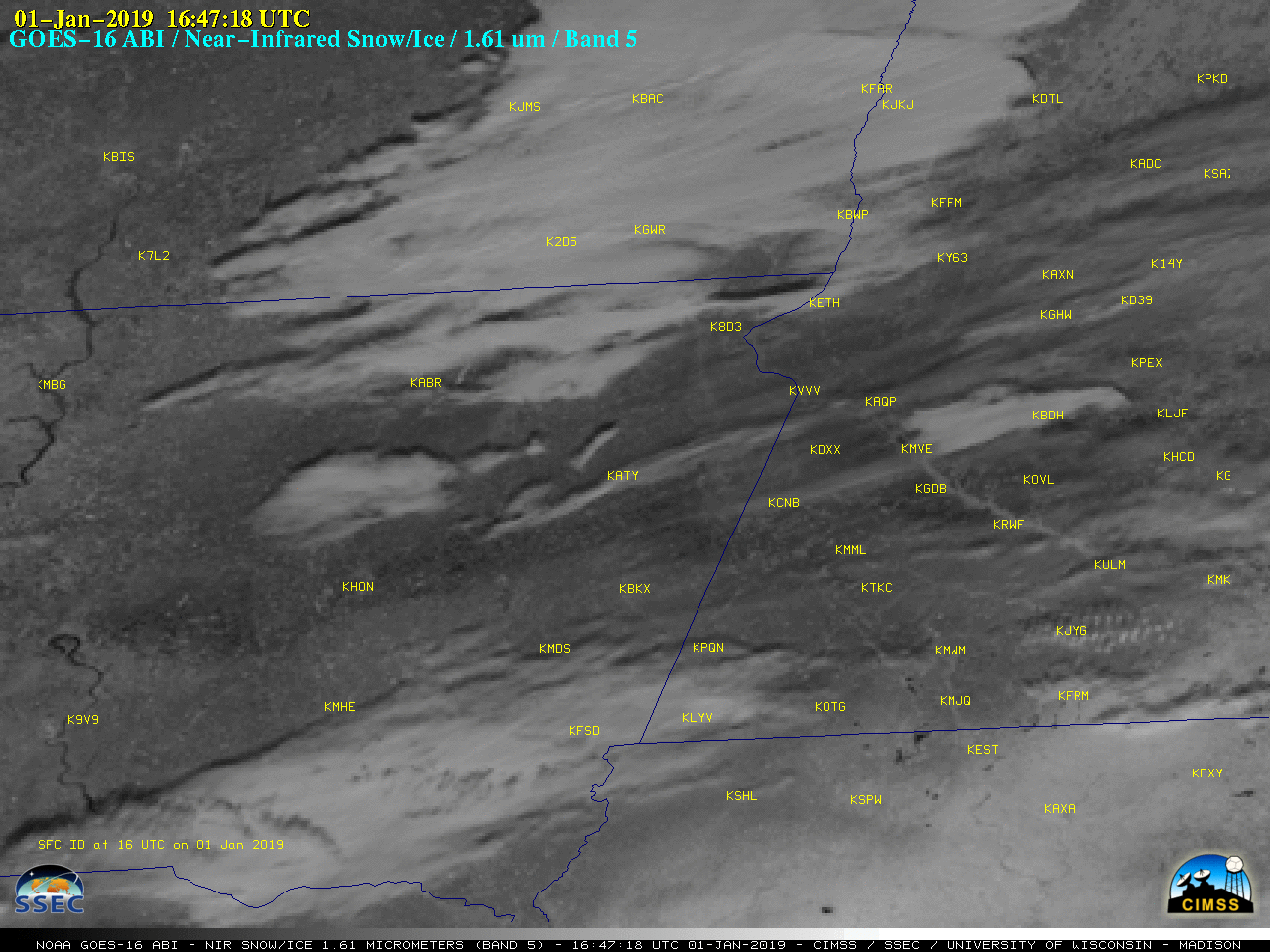
GOES-16 Near-Infrared “Snow/Ice” (1.61 µm) images [click to play animation | MP4]
As seen in a plot of ABI Spectral Response Functions (below), snow and ice are efficient absorbers of radiation (and therefore exhibit a low relectance) at the 1.61 µm wavelength, making them appear darker on the Snow/Ice imagery — and since ice absorbs more strongly than snow, it appears as the darkest shades of gray/black. Strong northerly winds in the wake of the precipitation event then swept the residual ice-crusted snow cover clear of any new snowfall.
![Plots of Spectral Response Function for ABI Bands 1-5 [click to enlarge]](https://cimss.ssec.wisc.edu/satellite-blog/wp-content/uploads/sites/5/2019/01/ABI_Bands1-5_SRF.jpg)
Plots of Spectral Response Function for ABI Bands 1-5 [click to enlarge]
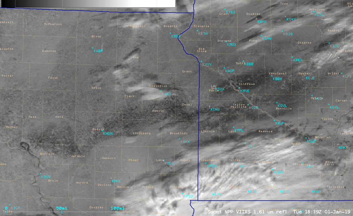
VIIRS Near-Infrared “Snow/Ice” (1.61 µm) images from NOAA-20 (at 1839 UTC) and Suomi NPP (at 1931 UTC) [click to enlarge]