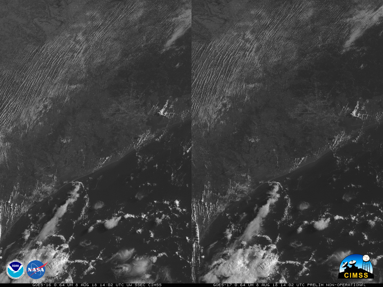
Stereoscopic views of convection along the Texas Gulf Coast

GOES-16 (left) and GOES-17 (right) visible (0.64 µm) imagery showing convection near Houston TX on 8 August 2018 (Click to play mp4 animation)
GOES-17 Imagery in this post is preliminary and non-operational.
GOES-16, operational as GOES-East at 75.2º W Longitude, and GOES-17, in a check-out mode at 89.5º W Longitude, viewed convection in and around Houston TX (apparent in the clear skies at the start of the animation) on 8 August 2018 (Click here for animated gif). Stereoscopic views of this convection (achieved by crossing your eyes until 3 images appears, and focusing on the image in the middle) reveal the three-dimensional nature of the convection, in particular the effects of an outflow boundary propagating northward towards Houston.