TROWALs in a storm
Occluded strong systems will occasionally display features that suggest the presence of a TROWAL, or a TROugh of Warm air ALoft. The midwestern snowstorm of 1 December 2006 was no exception. The pressure analysis below over the Infrared (channel 4 from GOES 12) data, which data has been stretched, shows an occluded system in east-central Illinois. Other features of note include the obvious snow band in Missouri, Kansas and Oklahoma that is speckled by the heat of unfrozen lakes.
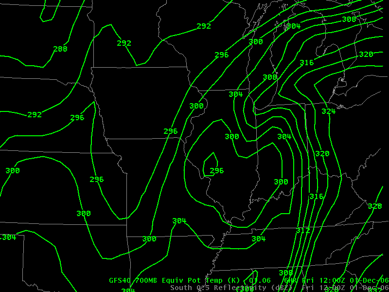
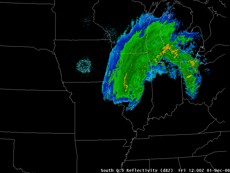
A signature of a TROWAL is a thin tongue of warm air north of the occluded system. Conceptual models of storms, such as those by Carlson (warm and cold conveyor belts) suggest warm air off to the east of the storm in the warm conveyor belt. The GFS 700-mb Theta-E analysis below, for example, shows a narrow tongue of warm air stretching along the southern Lake Michigan shoreline. This corresponds well with the position of strong echo returns from radar.

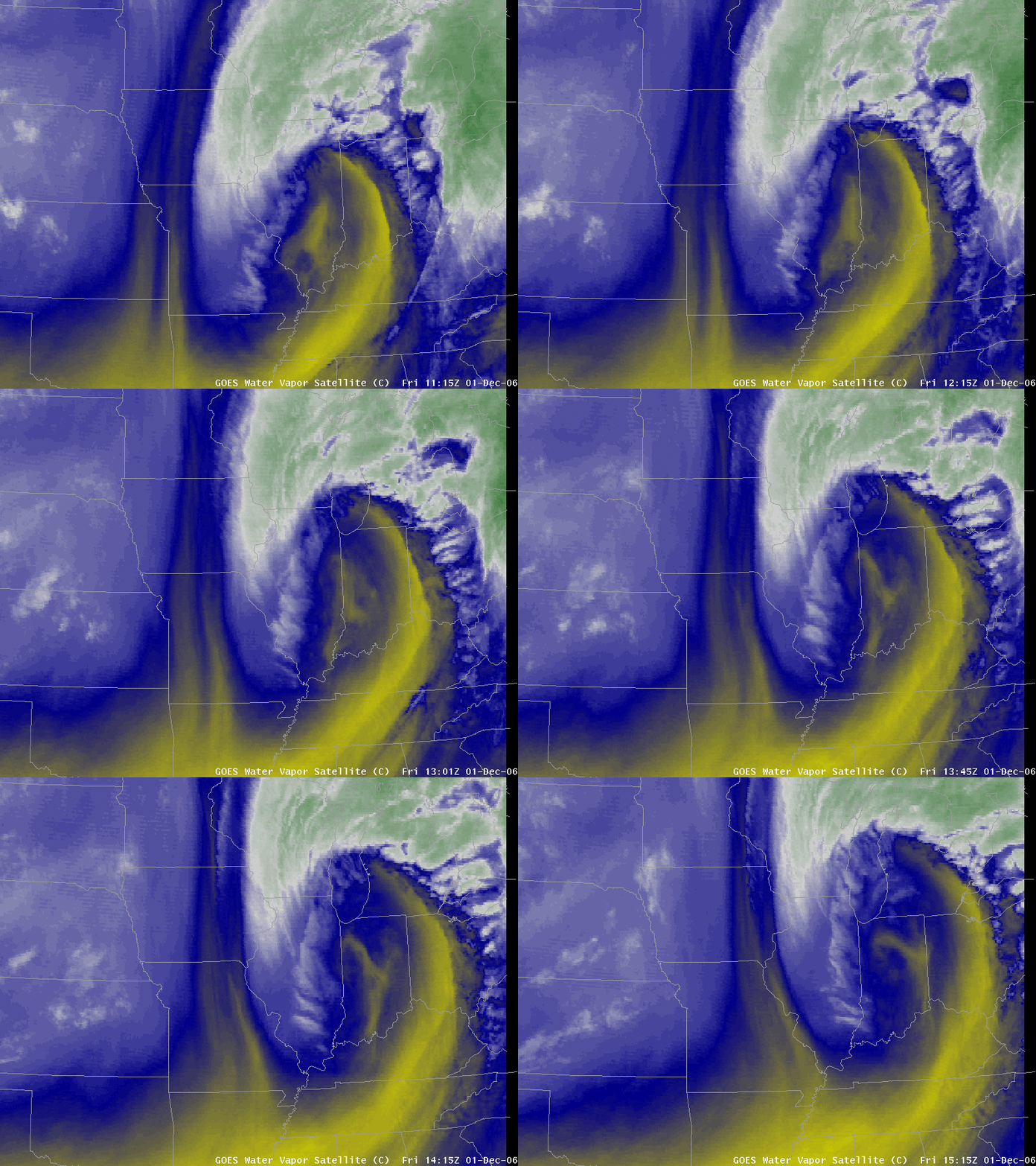
The inference to draw from these images is that warm and moist air drawn north in the TROWAL air stream helps to sustain precipitation very near the dry slot. Consider the water vapor loop below, that shows redevelopment of precipitation over southern Lake Michigan, precipitation that subsequently moves over the western shoreline. Where is the moisture source for this developing precipitation? Strong forcing of the coupled jets will produce vigorous ascent, but unless an airstream, such as a TROWAL airstream, supplies moisture, the ascent will not yield heavy precipitation. During this storm, heavy snowfalls over eastern Wisconsin suggest the presence of a TROWAL airstream that is confirmed in thermodynamic fields (above) between the surface and 500 mb.


