Tropical Depression #3 forms off the East Coast of the United States
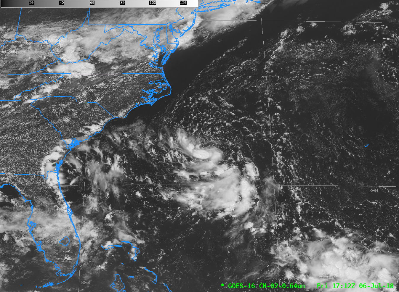
Tropical Depression Three has formed in the Atlantic Ocean southeast of Cape Hatteras. The visible animation above (click the image to play an animated gif) shows strong convection with overshooting tops mostly south and west of a low-level circulation. The cold front over the eastern United States, and an upper-level Low that is moving inland over Florida, are also apparent. Because the depression is within GOES-16’s CONUS Domain, 5-minute imagery is available to monitor this system.
A variety of GOES-16 images and products can be used to discern whether this storm will develop (The National Hurricane Center suggests slow motion and slow development: Click here for details).
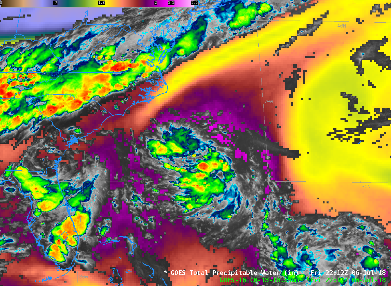
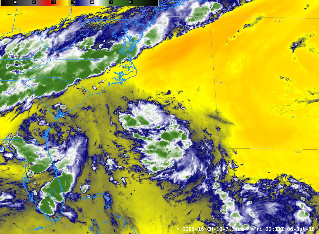
The low-level Water Vapor field, below (7.34 µm) from 2122 UTC, shows little dry air in the path of the storm. The Total Precipitable Water derived from GOES-16 ABI data similarly shows rich moisture surrounding the storm.

GOES-16 Clean Window Infrared (Band 13, 10.3 µm) imagery superimposed upon GOES-16 Estimates of Total Precipitable Water, 2212 UTC on 6 July 2018 (Click to enlarge)
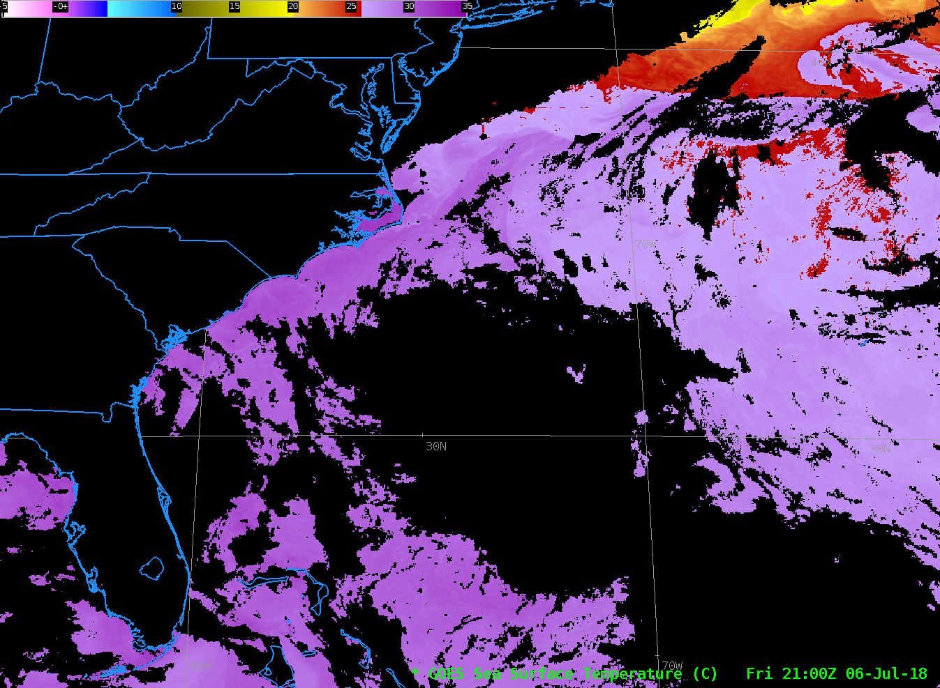
GOES-16 Estimates of Sea Surface Temperature, below, color-enhanced such that waters warmer than 27 º C are violet, shows warm surface waters. Gulf Stream temperatures, northwest of the Depression, are at 30-31 º C.
For more information on this system, please see the website of the National Hurricane Center and the CIMSS Tropical Weather Website.


