October snowfall on the Big Island of Hawai’i
McIDAS images of GOES-15 (GOES-West) 6.5 µm water vapor channel data (above; click image to play animation) showed an upper-level low that moved from east to west over the Hawaiian Islands during the 13 October – 14 October 2014 period. This low forced the development of widespread showers and thunderstorms, especially over the Big Island of Hawai’i — and even produced some snowfall in the highest elevations around the summits of Mauna Kea and Mauna Loa. Some excerpts from Area Forecast Discussions issued by the National Weather Service at Honolulu on 13 October:
FXHW60 PHFO 131350
AFDHFOAREA FORECAST DISCUSSION
NATIONAL WEATHER SERVICE HONOLULU HI
400 AM HST MON OCT 13 2014
[…]
FORECAST MODELS HAVE BEEN CONSISTENTLY CALLING FOR 500 MB TEMPERATURES BETWEEN -12 AND -13C WITHIN THE CORE OF THE COMPACT UPPER LOW. THIS IS EXCEPTIONALLY COLD FOR OCTOBER
[…]
FORECAST MODELS SHOW THAT THIS FEATURE WILL HOLD AS IT MOVES OVER THE BIG ISLAND LATER TODAY INTO TONIGHT…LIKELY PRODUCING ACCUMULATING SNOW OVER THE SUMMITS ABOVE 12000 FT. AS A RESULT…A WINTER WEATHER ADVISORY HAS BEEN ISSUED.
[…]=====
FXHW60 PHFO 140152
AFDHFOAREA FORECAST DISCUSSION
NATIONAL WEATHER SERVICE HONOLULU HI
330 PM HST MON OCT 13 2014
[…]
THE SUMMITS OF THE BIG ISLAND HAVE BEGUN TO REPORT SNOWFALL ACCUMULATION…AND THIS WILL CONTINUE WITH A COUPLE OF INCHES POSSIBLE OVERNIGHT.
[…]
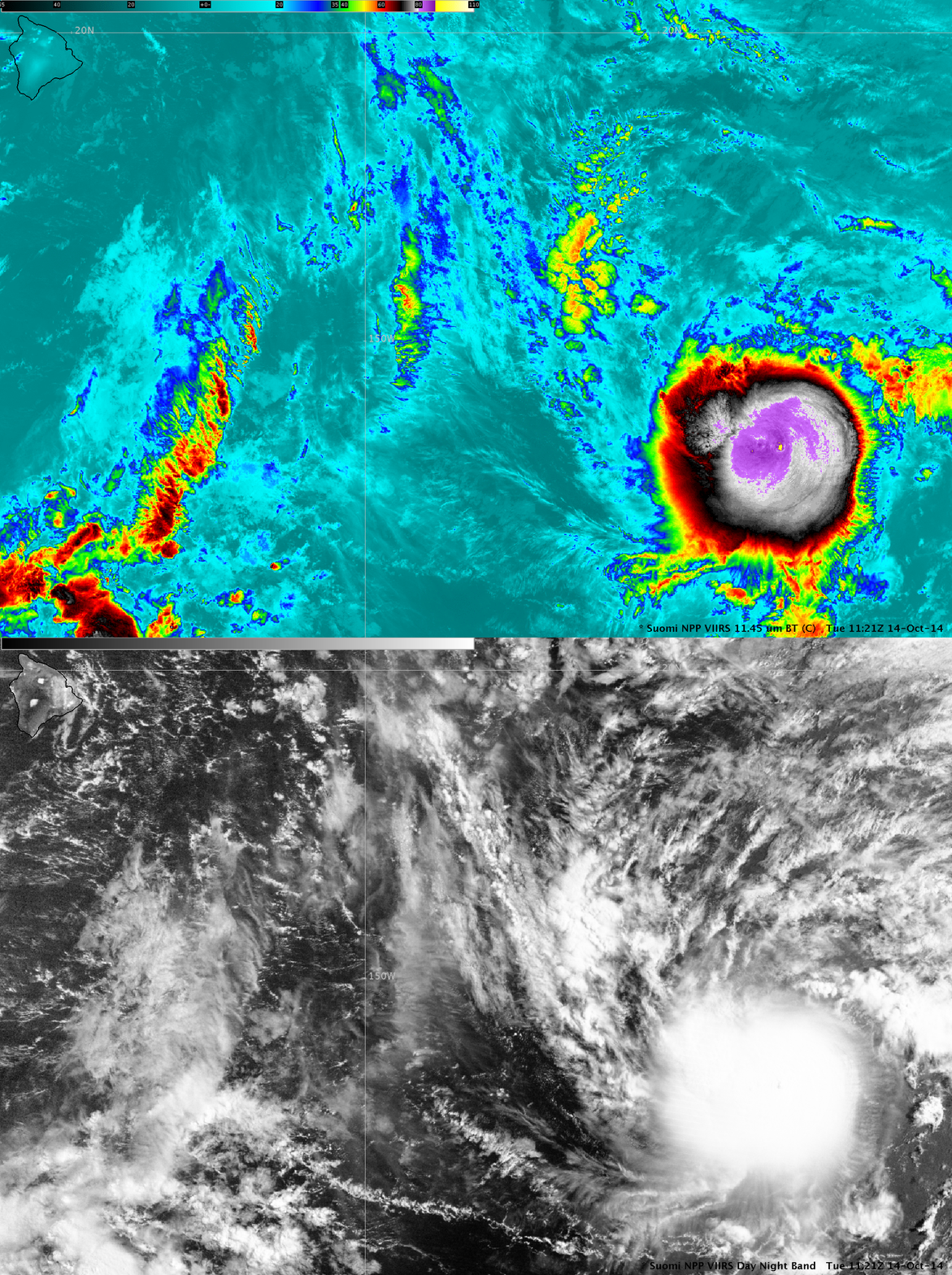
While examining a nighttime (11:21 UTC or 1:21 am local time) comparison of AWIPS II images of Suomi NPP VIIRS 0.7 µm Day/Night Band (DNB) and 11.45 µm IR channel data covering Tropical Storm Ana (below), the main feature of interest was the inner core of cloud-top IR brightness temperatures as cold as -86º C (yellow color enhancement) associated with Ana — however, equally interesting was the appearance of a pair of bright white features in the middle of the Big Island on the DNB image (which highlighted the areas of snow cover that remained at the higher elevations).
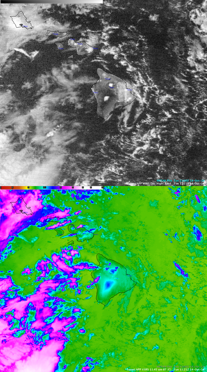
A closer view comparing the VIIRS DNB and IR images centered over the Big Island (below) seemed to suggest that the 2 patches of bright snow cover (well-illuminated by a nearly Full Moon) were located along the western slopes of Mauna Kea and Mauna Loa. A similar comparison of the DNB image and high-resolution topography can be seen here.
An animation of GOES-15 0.63 µm visible channel images during the following daylight hours of 14 October (below; click image to play animation) revealed the gradual melting of the 2 patches of high-elevation snow cover as temperatures rose from around freezing into the 50s F near the summits (Cooperative observations).


