Interesting features seen on Suomi NPP VIIRS Day/Night Band images

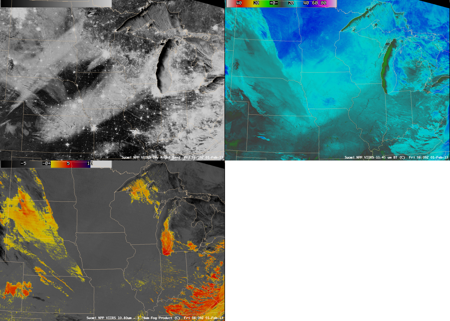
Suomi NPP VIIRS 0.7 µm Day/Night Band, 11.45 µm IR channel, and IR brightness temperature difference “fog/stratus product” images
On a comparison of AWIPS images of Suomi NPP VIIRS 0.7 µm Day/Night Band, 11.45 µm IR channel, and IR brightness temperature difference “fog/stratus product” data at 08:09 UTC or 2:09 AM local time on 01 February 2013 (above), one prominent feature that stood out across the middle of the Day/Night Band image was the broad swath of fresh snow cover that extended northeastward from Kansas to Wisconsin. This band of snow cover resulted from a winter storm that produced snowfall amounts as high as 4.0 inches in Kansas, 6.0 inches in Nebraska, 7.8 inches in Iowa, and 12.0 inches in Wisconsin on 29-30 January (snowfall map). The IR and “fog/stratus product” images indicated that some layers of stratus clouds were moving over the southwestern portion of the snow swath (over Kansas and Nebraska), but the edge of the snow swath could still be seen throgh these thin cloud features.
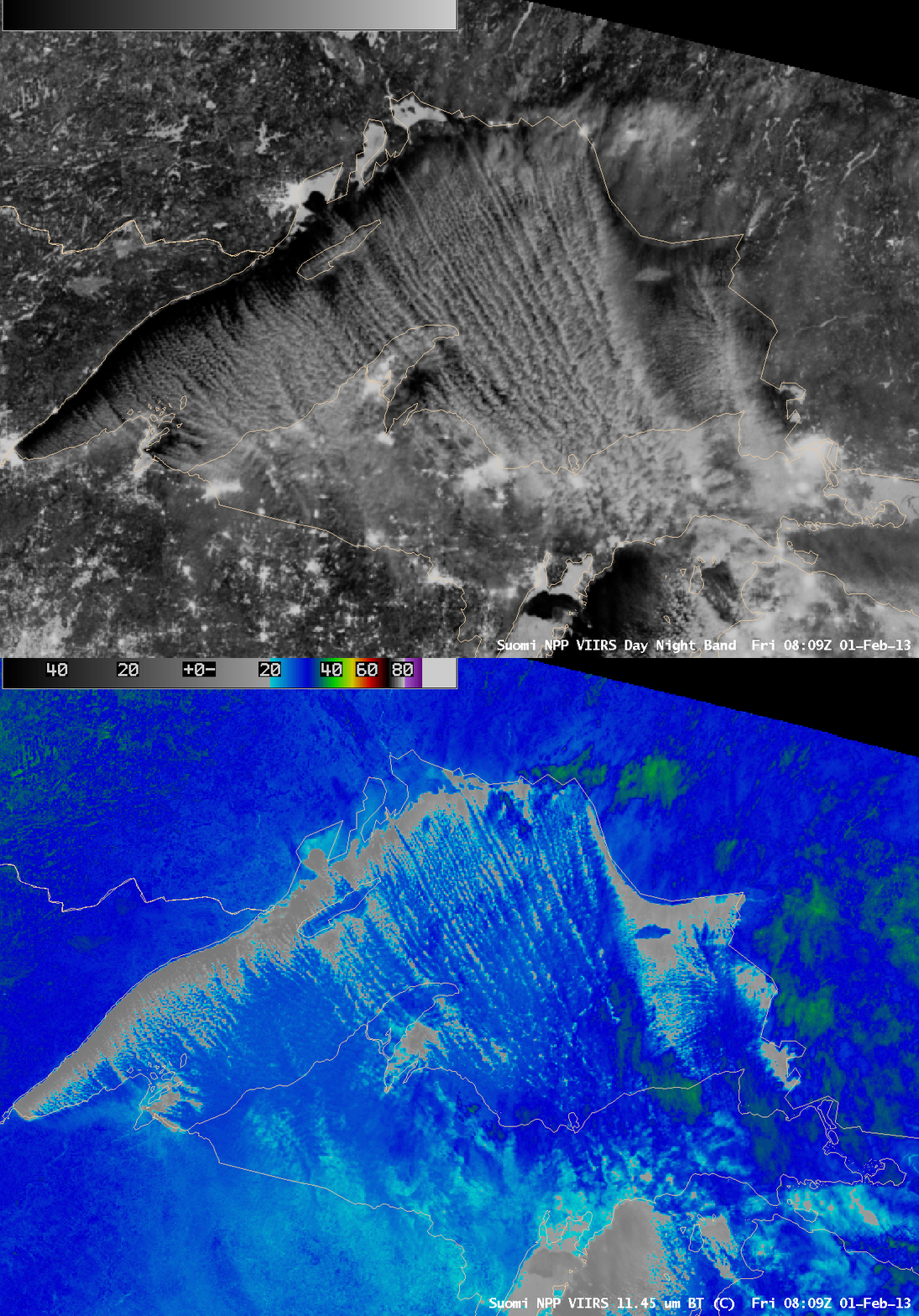
Cold air in the wake of the storm then caused laked-effect snows in excess of 12 inches across parts of the Upper Peninsula of Michigan. A close-up view of Lake Superior using the VIIRS Day/Night Band and IR channel images (below) showed the widespread lake-effect snow bands, which showed up nicely due to the “visible image at night” utility of the Day/Night Band (provided that there is adequate illumination by moonlight).
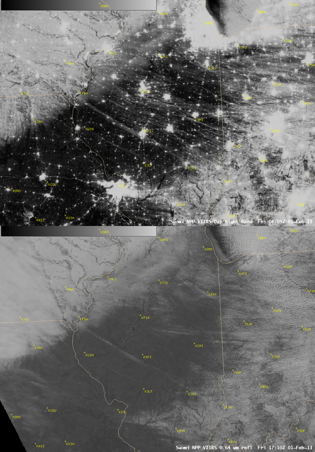
Also of interest were a series of long, very narrow streaks of snow cover across parts of Illinois — in particular, the one than ran just southwest of Springfiled KSPI — which could be seen on the Day/Night Band image at 08:09 UTC or 2:09 AM local time, and again during the daytime at 17:50 UTC or 11:50 AM local time (below).


