Fog and Low Cloud Detection at Night
It’s straightforward to differentiate between high clouds and the ground in infrared satellite imagery because of large temperature differences. As clouds get closer and closer to the surface, their temperature gets closer and closer to the surface temperature, and brightness temperature differences can become insignifcant. At night, when visible data are sadly lacking, what’s a forecaster to do? For example, look at the infrared image below. Where would you say the low clouds are over Texas? How certain are you?
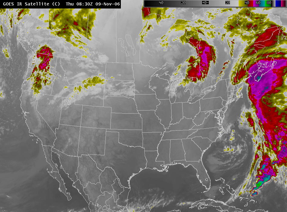
There are times when low clouds can be identified in standard 11-micron imagery, for example by masking surface terrain features that are usually visible — such as river valleys. So instead of seeing the feature in the image, a smooth surface is apparent. If you are unfamiliar with a region for which you are forecasting, however, or if the region is flat. . .
Satellites include other bands that can be useful at night. One is the 3.9-micron band on GOES, or the 3.7-micron band on MODIS. This band is important for low cloud detection because emissivity at that wavelength is smaller for low clouds and fog. Hence, less radiation is emitted and the cloud will appear to be colder. Consider the 3.9 micron image below from the same time as the 11-micron image above:
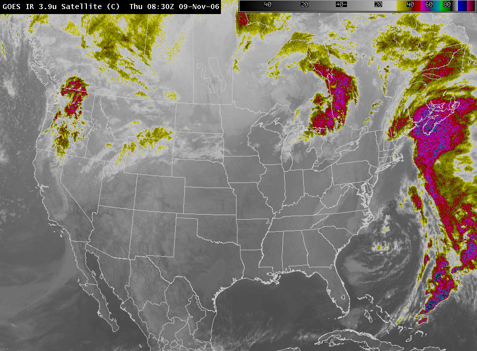
Consider the region in east-central Texas now. It shows somewhat colder in the 3.9-micron image than its surroudings — the difference in brightness temperature between the two images is about 4 K. A second region of apparent low cloudiness is the region in the Los Angeles basin, and offshore of Los Angeles near the Channel Islands. These differences become all the more distinct in a difference between the two channel temperatures is plotted:
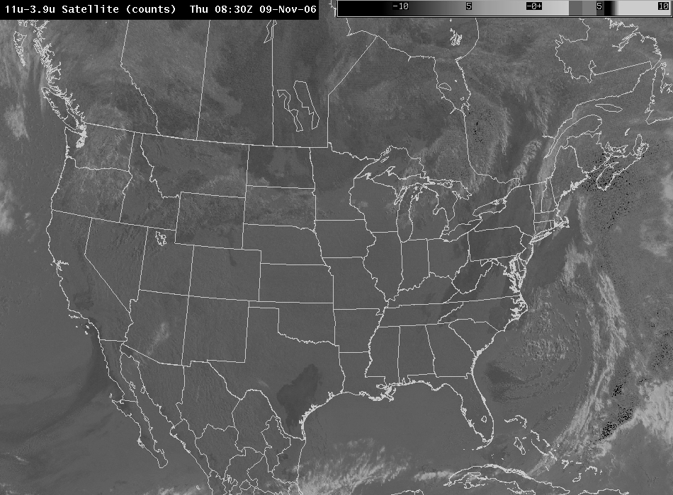
The dark regions of this map are where low clouds / fog are likely present. They show up because of colder brightness temperatures in the 3.9 micron band — thus the difference (11-3.9) is positive. This difference image will also highlight high cirrus clouds. Scattering by the ice crystals means more radiation will be detected by the satellite at 3.9 microns (compared to 11), and the cloud will thus appear warmer. The spectral difference over cirrus clouds will be negative. This is especially true during the day.
Similar behavior occurs in MODIS imagery:
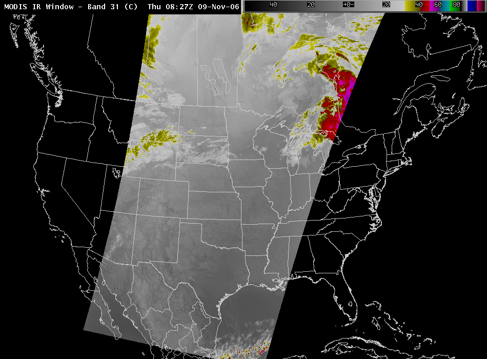
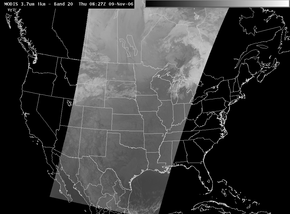
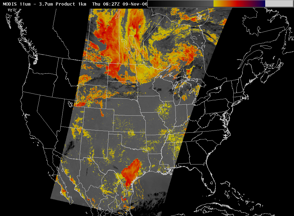
The color-enhancement here distinctly highlights the low clouds (yellow and orange, where 3.7-micron brightness temperatures are cooler) and the high clouds (black, where 3.7-micron temperatures are warmer).
The emissivity differences that allow low-cloud detection continue during the day; however, the differences are overwhelmed by the solar signal. In other words, much more radiation at 3.9 microns (compared to 11 microns) is reflected and scattered towards the satellite during the day. So the character of the difference between the two channels changes sign. During the day, the 3.9 micron brightness temperatures becomes warmer than the 11 micron brightness temperatures.
Cirrus clouds detection improves during the day, as the scattering from incoming solar radiation enhances the signal at 3.7 and 3.9 microns relative to 11 microns; the amount of solar radiation at 3.7-3.9 microns is larger than the amount at 11 microns, and ice crystals scatter 3.9-micron radiation more effectively.
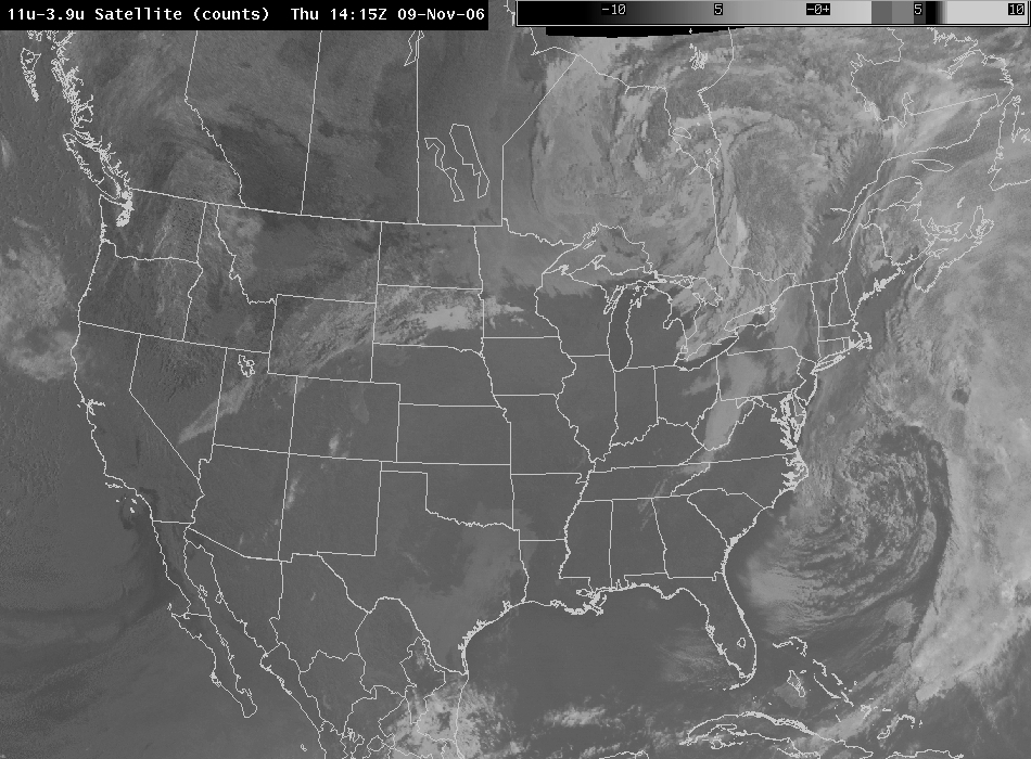
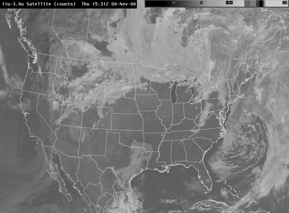
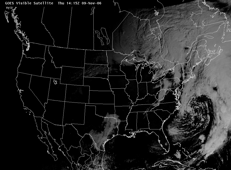
Note that in the 1415 UTC image above, the low clouds over east Texas shortly after sunrise now show as white — the temperature difference between the two bands is negative. Off the coast of California, where it’s still night-time, the temperature difference is still positive. In the 1531 UTC image below, the sun has risen over Southern California as well, and the character of the difference there flips as well.
The visible image below, from shortly after sunset, confirms the presence of clouds over east-central Texas.
More information on low cloud detection at night can be seen here.

