Meteorology » Weather Forecasting
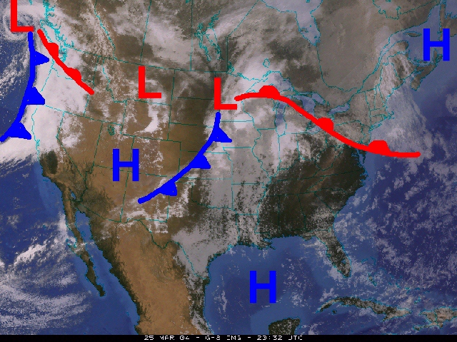
In the short term, a meteorologist can look at a single satellite image and tell where the mild air is, where the cold fronts and warm fronts are, and even identify stormy weather. Animations of satellite imagery offer even greater amounts of information. This lesson considers satellite imagery and animation in the conext of short term weather forecasting.
In this lesson you will learn:
- Short term forecasting from satellite imagery
- High and Low pressure systems
- Fronts and air masses
- Station weather plots
Time requirement
This lesson will take you approximately 45 minutes to complete.