Detecting turbulence from Satellites
Clear Air Turbulence can be a significant aircraft hazard, occasionally causing injuries and long delays. (See, for example, here and here for two recent examples. The second example resulted in a 6-hour delay (Link))
At the upper-tropospheric boundary between air masses, vertical shearing at the jet stream combined with the ageostrophic convergence of polar, subtropical and stratospheric air produces a region known for its potential for clear air turbulence called a “tropopause fold.†These features are evident in satellite-observed upper tropospheric water vapor by the large-scale spatial gradients in brightness temperature, which define boundaries between the air masses. The tropopause fold extends from this boundary to a limited distance into and underneath the wetter air mass.
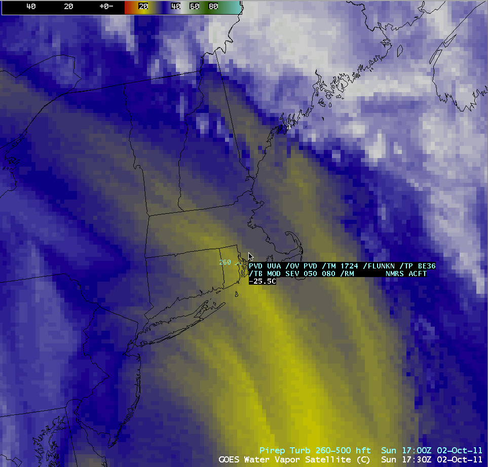
Thus, water vapor imagery can be used to infer large changes in vertical motion that can herald the presence of turbulence in the atmosphere. For example, in the region of turbulence shown in the water vapor imagery above, the yellow enhancement — warm brightness temperatures — suggest water vapor concentrated lower in the atmosphere (subsidence); bluer enhancements — colder brightness temperatures — suggest water vapor that is concentrated higher in the atmosphere (rising motion).
The Tropopause Folding Turbulence Prediction (TFTP) product locates these regions in the atmosphere and identifies the sections most likely to produce turbulent flight conditions for aircraft. The upper-tropospheric water vapor channel of the GOES-R Advanced Baseline Imager (primary: channel 8, backup: channel 9) is the source for resolving gradients that reveal the horizontal distribution of tropopause folds. An ancillary numerical weather model constrains these features vertically in the atmosphere. The four key output products consist of two fields that define the lower and upper bounds of the turbulent volumes of air, and two fields that define the two flight directions that are the most susceptible to moderate or greater turbulence. For now, the GOES-East (or MODIS) water channels can be used as a proxy.
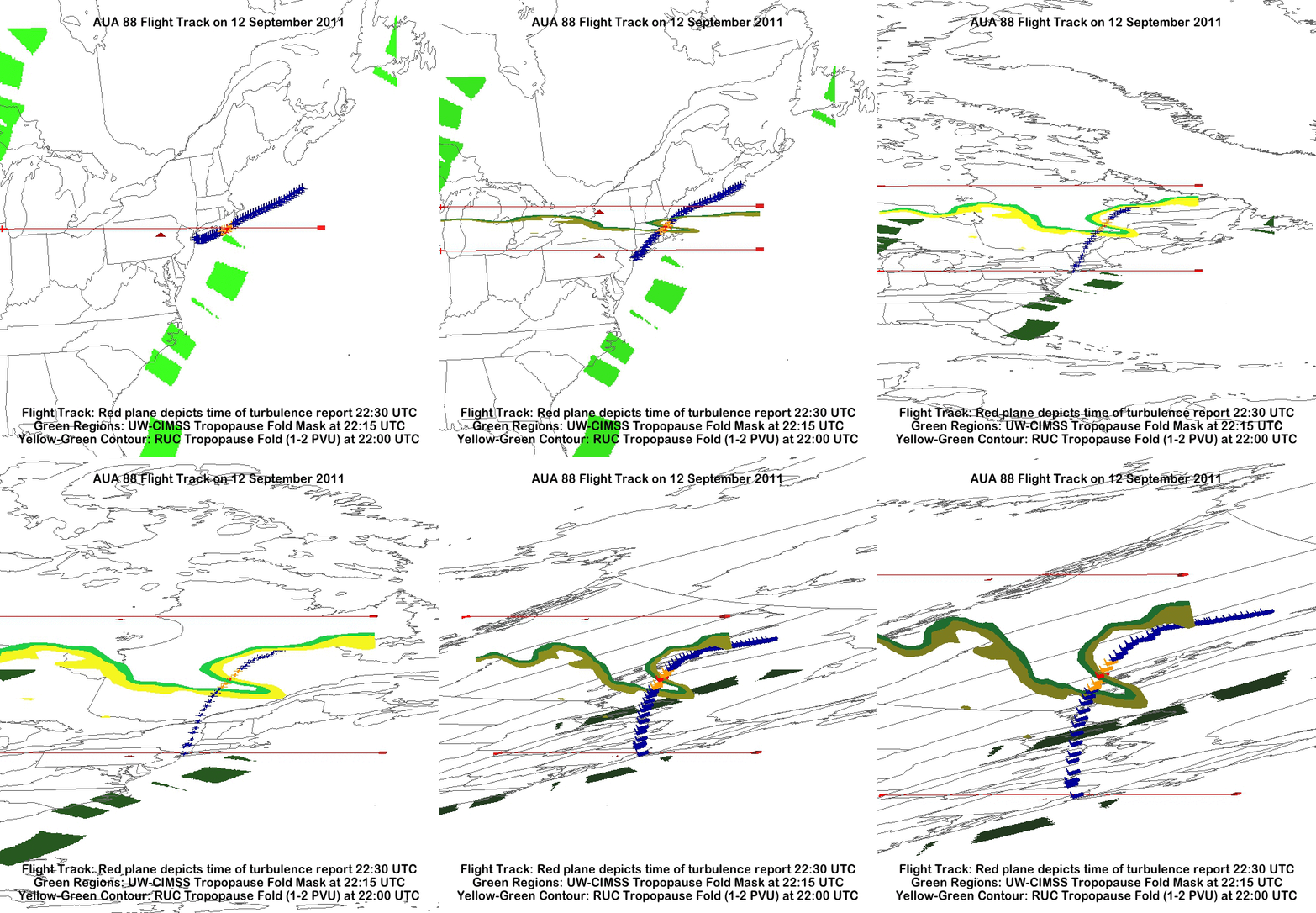
The animated gif above shows the predicted tropopause fold (green), model results that show the tropopause (yellow, the 1-2 PV Unit surface) for a turbulence event that occurred in September 2011 (link). Note that the strongest turbulence (red airplane icon) occurred as the plane traversed the fold.
The animation of water vapor imagery (above) centered on the time of the turbulence includes some key features. For example, the gradient in the water vapor field between the colder brightness temperatures over the Atlantic Ocean south of New England and the warmer brightness temperatures off the coast of New Jersey is tightening with time. There is also evidence of a jet feature propagating northeastward along the gradient from east of the mouth of Chesapeake Bay at the start of the loop to south of Long Island at the end of the loop. Both of these features are suggestive of an evolving tropopause fold.


