
The GOES-R and JPSS Satellite Era

GOES-R
Advanced Baseline Imager (ABI)
The ABI provides three times more spectral information (16 bands verses 5), four times the spatial resolution, and five times faster coverage than previous GOES. ABI is used for a wide range of applications related to severe weather, hurricanes, aviation, natural hazards, the atmosphere, oceans and cryosphere. When the GOES-R satellite (GOES-16) was launched in 2016 and started sending down data everyone was thrilled with the new improved imagery. It was a game changer for NWS meteorologists.
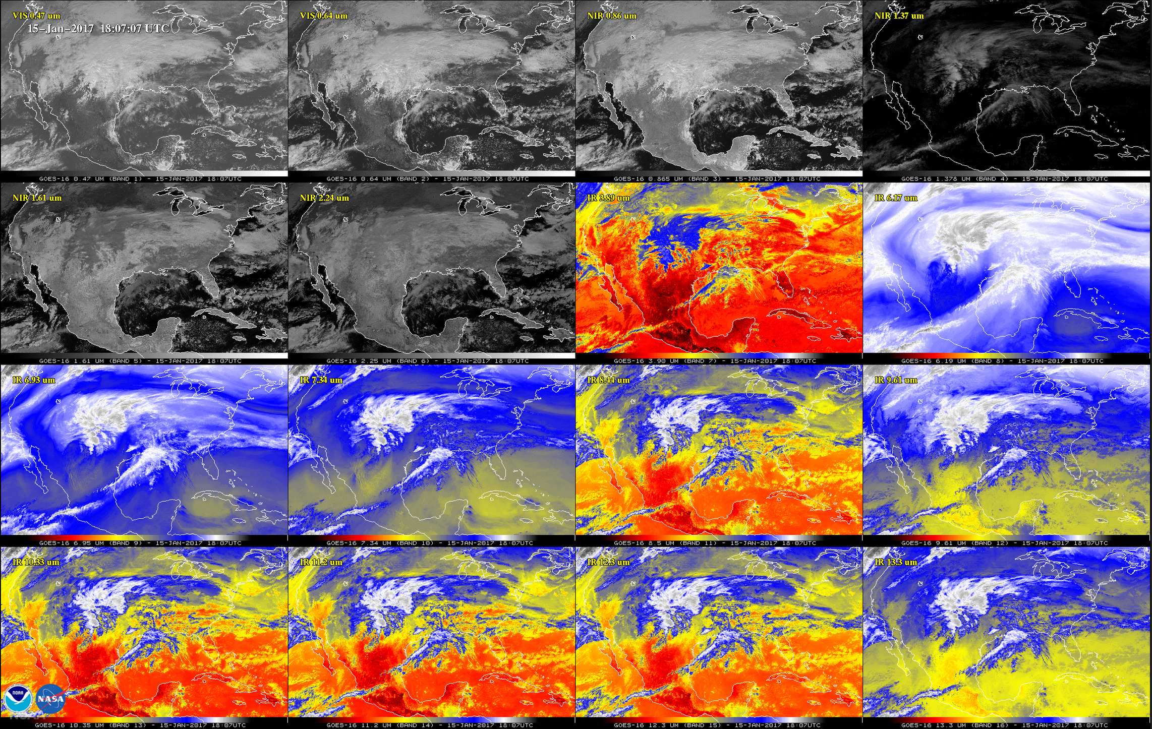
This 16-panel image was released in January 2017 and features the continental United States (CONUS) in the two visible, four near-infrared and 10 infrared channels on the new ABI flying on the GOES-16 satellite.
| 8 / 12 |