
The GOES-R and JPSS Satellite Era

Summary
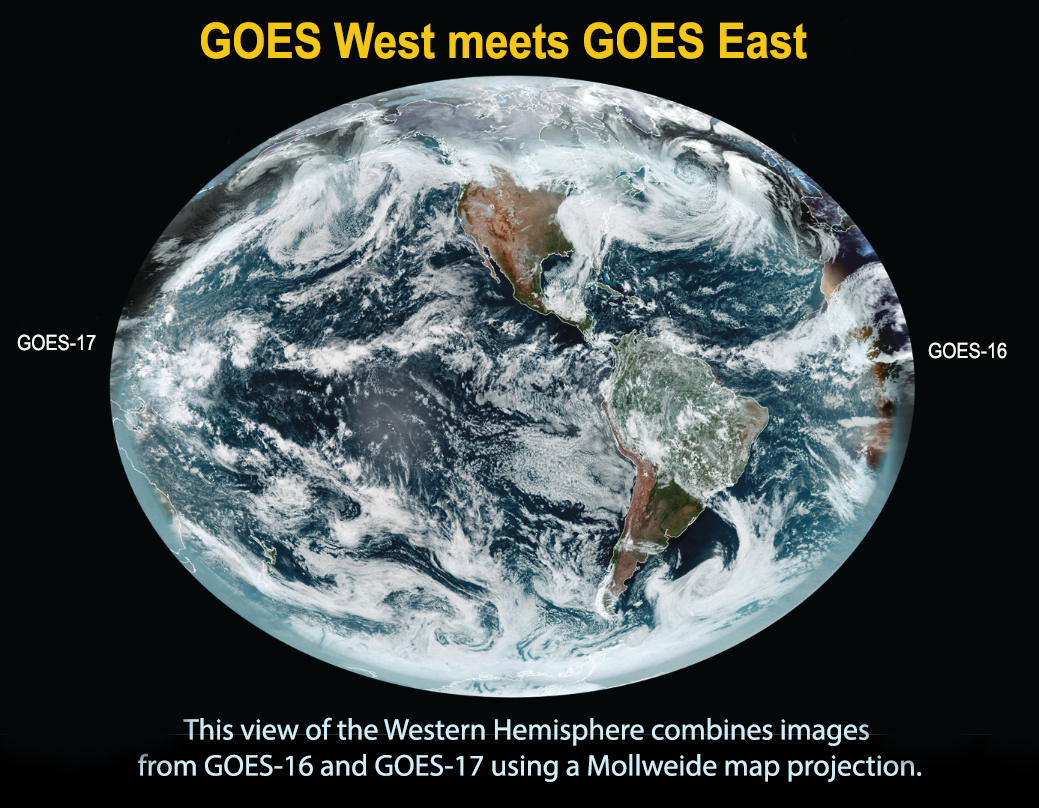
Polar and geostationary satellites are important and complementary components for weather forecasting, monitoring environmental conditions and mitigating the risks of severe weather. By orbiting above a fixed point on the Earth, GOES satellites provide imagery of the Western Hemisphere with very high temporal resolution. NOAA maintains two operational GOES satellites that are in orbit over the equator on each coast. GOES East stays at 75.2° W and GOES West at 137.2°W. NOAA also maintains an on-orbit spare GOES satellite in the event of an anomaly or failure of GOES East or GOES West. Meanhwile the JPPS satellites fly pole to pole while Earth rotates below. JPSS satellites provide images of higher spatial resolution covering the entire globe twice daily, with even more coverage over the poles.The combined data are used to support forecasting, aviation safety, and weather prediction models worldwide.
| 12/ 12 | ||||
| Home |