Learn more about the different types of satellite images by working through the following activities:
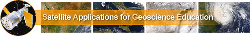
 1.To the right
is a visible image where the satellite radiometer collected reflected energy from the visible part of the electromagnetic spectrum, or 0.6 microns. You can change the appearance of the extracted section by changing the cloud thickness or the surface characteristics. Click on the image to the right to begin the activity.
1.To the right
is a visible image where the satellite radiometer collected reflected energy from the visible part of the electromagnetic spectrum, or 0.6 microns. You can change the appearance of the extracted section by changing the cloud thickness or the surface characteristics. Click on the image to the right to begin the activity.
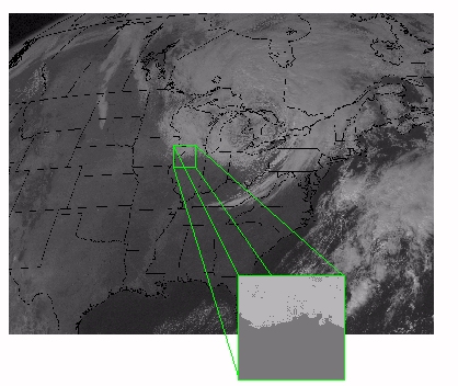
 2. The image to the right is an infrared (IR) image (10.7 microns) from a radiometer sampling the IR section of the electromagnetic spectrum. This is typical of the images you see on the TV weather. You can change the appearance of the extracted section by changing the cloud altitude (and its associated ambient air temperature) or the surface temperature. Click on the image to the right to begin the activity.
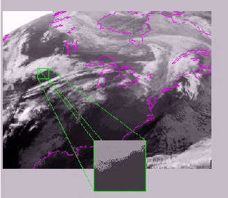
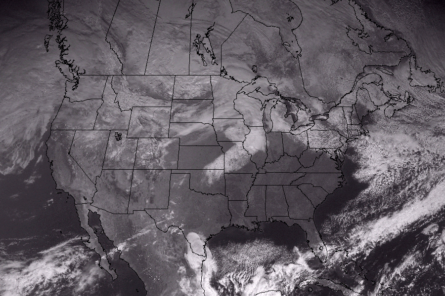
 3. This image is from the water vapor (near-infrared or 6.7 microns) section of the electromagnetic spectrum, where the atmosphere is largely opaque to radiation. For this reason, water vapor images supply information about the top of the atmosphere. Click on the image to the right to explore how cloud altitude
and upper tropospheric humidity alter the appearance of water vapor imagery.
3. This image is from the water vapor (near-infrared or 6.7 microns) section of the electromagnetic spectrum, where the atmosphere is largely opaque to radiation. For this reason, water vapor images supply information about the top of the atmosphere. Click on the image to the right to explore how cloud altitude
and upper tropospheric humidity alter the appearance of water vapor imagery.
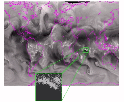
 4. Please review the fader to your right and alternate between visible, water vapor and infrared images to discern different cloud heights and snow cover. Can you see a swath of snow that outlines a storm track?