 |
July 18,1996 Oakfield Tornado Case Study |
 |
|
July 18,1996 Oakfield Tornado Case Study |
|
I. Cyclone: A General Overview of What Caused the Storms
II. Contouring of Surface and Upper Air Data
 A new interactive contour analysis exercise has been added (you draw the lines using the mouse).

The Oakfield tornado case study is also available as an educational packet for high school students. Introductory information on understanding the atmosphere and weather, as well as contouring, satellite, and radar analysis is included. Teachers or students who wish to find out more about this packet can call the University of Wisconsin-Madison's (UW) Cooperative Institute for Meteorological Satellite Studies(CIMSS) at (608) 263-7435.
This page was developed and constructed by Rhett Grauman through support from NOAA grant NA67EC0100.
This page was assembled with help from the following CIMSS and UW-Madison AOS scientists
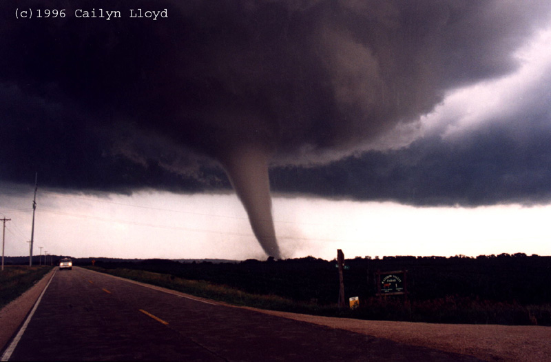
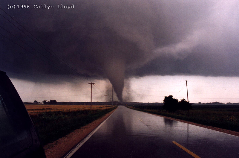
The above photos of the Oakfield tornado were taken by stormchaser Cailyn Lloyd. To see more outstanding photos of the Oakfield tornado as well as many others, check out her web page.
Any questions or comments can be sent to
jasonb@ssec.wisc.edu or toma@ssec.wisc.eduHigh school teachers and students who are interested in meteorology, Earth, and space sciences are invited to apply for the week long Wisconsin Space Grant Consortium summer workshop which introduces many of these exciting topics with hands on activities. For more information: Summer Workshop