The .RAO file contains sampled (10 sec) data from the UW 04:00 UTC CLASS launch (Chesser Farm) on 29 Sept 1993 from 1003 mb to 49.8 mb from file X9290400.CAM. It contains sampled levels from the NBW1672.WA2 ozone sonde above the UW sonde from 45mb to 5 mb for Alt, Press, and Temp. The .RAO file contains an interpolated ozone profile from 1003 mb to 5 mb from the NBW1672.WA2 (1z) ozone sonde launch. The file also contains a special surface level at 1018 mb designed to represent the ocean environment consistent with the HIS aircraft data. The surface temperature was set to 18.8 Celsius which is close to the temperature at the peak of the inversion layer in the Wallops 4z raob and close to the "radiometric" temperature derived from the HIS data and FASCODE. There are no direct measurements of the near surface air temperature offshore.
Note that the .RAO profile is nearly monotonic at the surface whereas the land-based sensors are characterized by a rapidly developing surface inversion from the radiative cooling of the land. For this reason this profile would need to be modified in its lowest levels for comparison with HIS aircraft data over land or for comparison with the groundbased AERI instrument by inclusion of a surface temperature inversion.
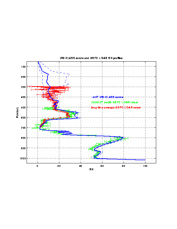
Another file, va092904_sig.asc , contains estimates of the sonde relative humidities based on comparisons with GSFC Raman LIDAR profiles. GSFC Raman LIDAR profiles (care of Harvey Melfi (UMBC/JCET) and Rich Ferrare (NASA GSFC)) in gif format and postscript format.
va092904.rao in gif format and postscript format.