07 May 1998 -- Smoke From Canadian Fires

|
|
|
|
|
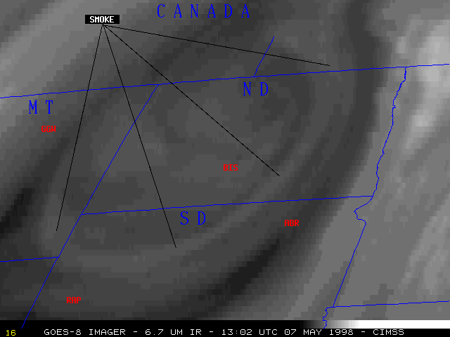
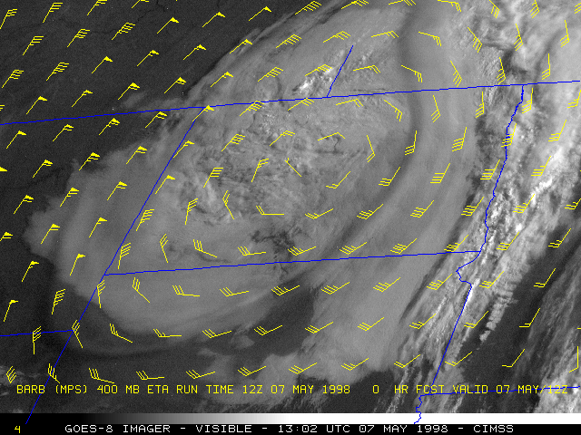
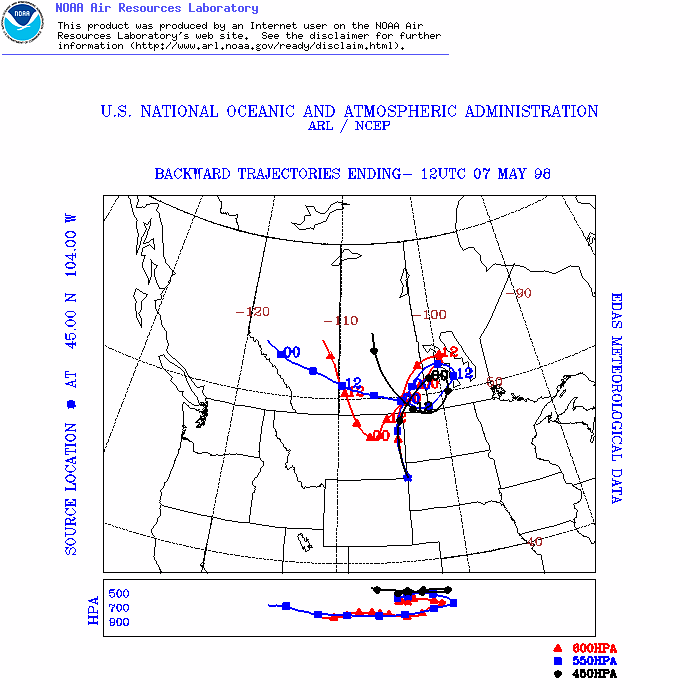
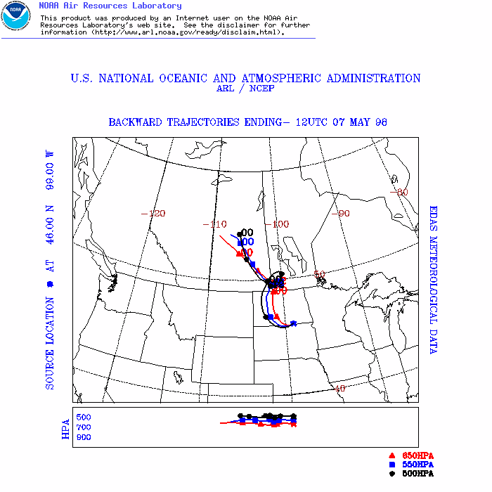
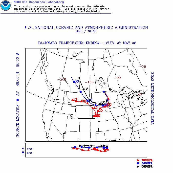
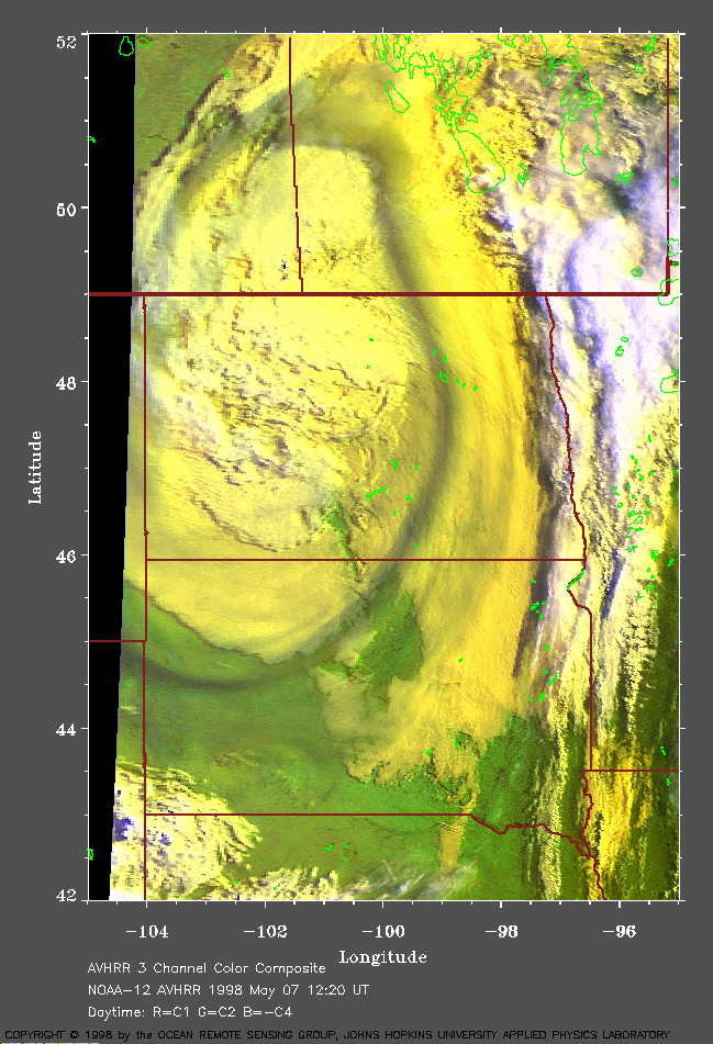
Several large fires were burning out of control across the Canadian province of Alberta during the first week of May 1998. Thick smoke drifted southward across the U.S./Canada border during 05 May and 06 May, and was eventually entrained into the circulation of a cyclone which was migrating southward across North Dakota on 07 May. Air mass trajectories from the NOAA Air Resources Lab suggest that the flow arriving at three points along the smoke filament (1. MT/WY/SD border | 2. SD/ND border | 3. ND/Canada border) originated over or near Alberta 2-3 days earlier.
In the GOES-8 visible imagery (above left), the elevated smoke appears hazy and casts a shadow against the tops of the stratiform cloud deck and bare ground below it. An enhanced AVHRR 3-channel color composite from NOAA-12 (courtesy of Johns Hopkins University Applied Physics Lab) also shows the shadowing due to low sun angle early in the day. According to a pilot report over eastcentral North Dakota, the top of the cloud deck was 4500 feet, with "hazy" conditions above.
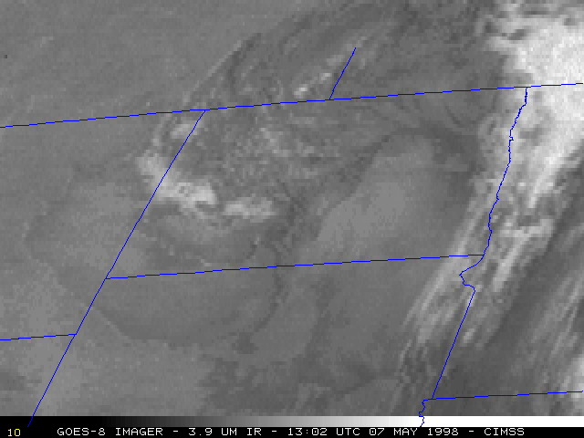
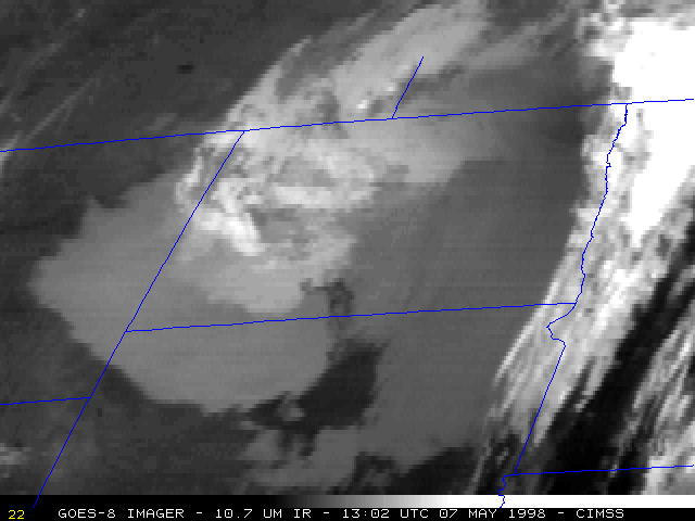
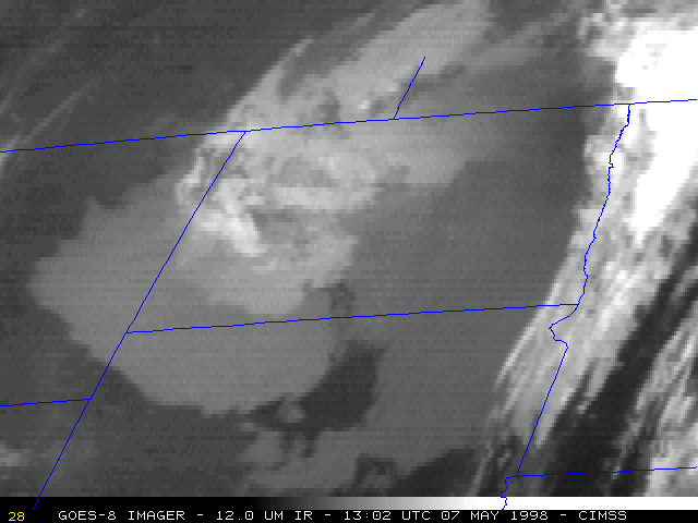
The narrow smoke feature is also evident on the GOES-8 6.7 micron InfraRed (water vapor) imagery (above right), as a band of cooler (lighter gray) brightness temperatures. The smoke is not apparent on any of the other GOES-8 shortwave or longwave IR channels (below), although there is a hint of slightly cooler 10.7 micron brightness temperatures along the smoke axis over cloud-free portions of South Dakota. An interactive Java comparison of all 5 GOES-8 imager channels shows the detection of the smoke by the visible and water vapor channels.
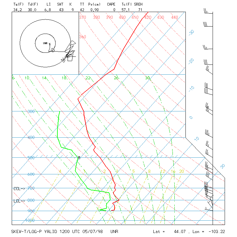
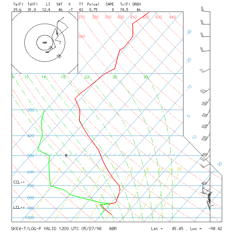
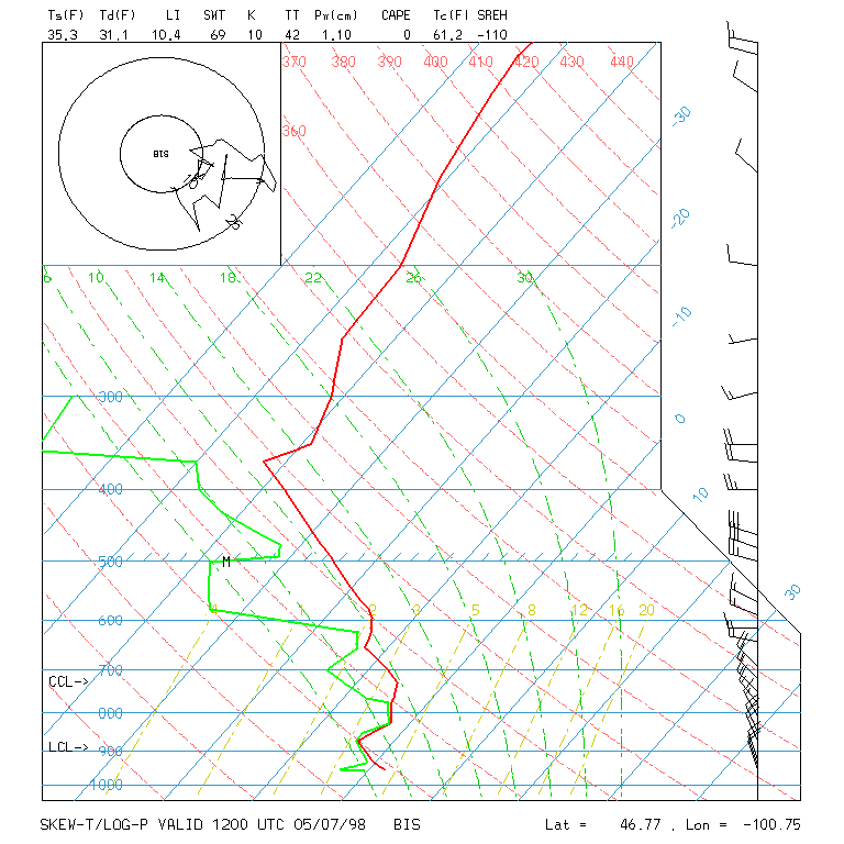
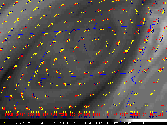
The elevated layer of smoke was not apparent on the shortwave and longwave IR imagery due to the fact that it was effectively "transparent" to upwelling thermal radiation passing through it at those wavelengths. The smoke was evidently lofted into the middle troposphere, and contained enough water vapor to be sensed by the 6.7 micron IR (water vapor) channel. Brightness temperatures at 6.7 microns along the smoke axis ranged from 237 to 240 K (-33 to -36 C) -- this corresponds to the 375 to 425 hPa layer (around 7 km in altitude) according to regional rawinsondes at Glasgow, MT, Rapid City, SD, Aberdeen, SD and Bismarck, ND. The smoke axis also seemed to align best with the 500-300 hPa winds from the ETA model analysis.
Two IR split window products (10.7 - 3.9 micron and 10.7 - 12.0 micron) also failed to discern the smoke feature being drawn cyclonically around the circulation over North Dakota.
|
|
|
Java animations of IR split window difference products: 10.7 - 3.9 um | 10.7 - 12.0 um