COMET Satellite Meteorology Course
Meteorological Sounders
Introduction
Instrument Schematic
GOES-8 Spectral Response and HIS Spectrum
GOES vs. POES
HIS/GOES-8 Comparisons, Spectra
HIS/GOES-8 Comparisons, Brightness Temperature
Characteristics of the Radiative Transfer Equation
Profile Retrieval From GOES Radiances
GOES Radiances
Basic Approach for retrievals
Retrieval Flowchart
GOES Retrieval Products by Band
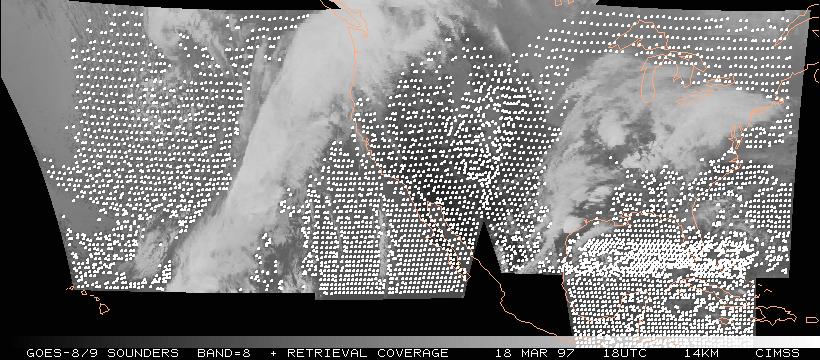
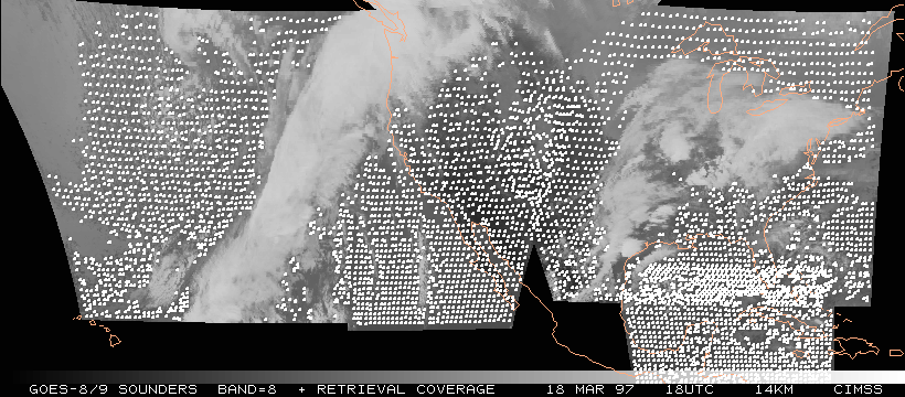
Retrieval Coverage (soundings)
Single Retrieval Comparison
Temperature Comparisons (All GOES vs. Rawinsondes)
Temperature Comparisons (Poor Guess GOES vs. Rawinsondes)
Water Vapor Comparisons (GOES vs. Rawinsondes)
Total Precipitable Water Comparisons (1999 data)
3-layer Precipitable Water Comparisons (1999 data)
Microwave radiometer
Hourly Time Series of Total Precipitable Water (GOES vs. Microwave)
Total Precipitable Water Comparisons (GOES vs. Microwave)
Total Precipitable Water Comparisons (GOES/AERI vs. Microwave)
Cloud Top Pressure: Background
CO2 Absorption Technique
Retrieval Coverage (cloud top pressure)
Cloud Top Pressure: Comparison with Pirep Observations
Cloud Top Pressure: Cloud climatology (large scale)
Cloud Top Pressure: Cloud climatology (regional)
Cloud Top Pressure: Future Work
Retrieval Coverage (precipitable water)
Precipitable Water (NGM and Rawinsonde vs. GOES)
Return Flow
Use of Sounder Data to Improve Forecasts: Approach
Impact of Clouds & Precipitable Water in NWP Models
EDAS/ETA Parallel Runs
Equitable Threat Score (Definition)
Impact of GOES/PW on Precipitation Forecasts (Winter)
Impact of GOES/PW on Precipitation Forecasts (Summer)
Impact of GOES/PW on Precipitation Forecasts (Forecast Time)
Impact of GOES/PW on Precipitation Forecasts (RUC)
Rationale for Derived Product Images (DPI)
Color Inhancements for Derived Product Images
Development of Derived Product Images for AWIPS
Precipitable Water Example: hourly animation
Oklahoma Tornado Outbreak (3 May 1999): Introduction
Oklahoma Tornado Outbreak (3 May 1999): Precipitable Water Evolution
Oklahoma Tornado Outbreak (3 May 1999): Lifted Index Evolution
Oklahoma Tornado Outbreak (3 May 1999): Location of Vertical Profiles for animation
Oklahoma Tornado Outbreak (3 May 1999): Evolution of vertical profiles
Oklahoma Tornado Outbreak (3 May 1999): Single vs. 3x3 Resolution
Moist Plume from Lake Michigan (20 Aug 1999): Introduction
Moist Plume from Lake Michigan (20 Aug 1999): Precipitable Water Distribution
Moist Plume from Lake Michigan (20 Aug 1999): Lower Layer Precipitable Water Distribution
Moist Plume from Lake Michigan (20 Aug 1999): Cumulus Cloud Distribution (Visible image)
Dry Line Convection (22 May 1995) -- Retrieved PW and Surface Reports
Dry Line Convection (22 May 1995) -- Retrieved PW vs. PW Guess
Dry Line Convection (22 May 1995) -- Retrieved LI vs. LI Guess
Outflow-Initiated Storms (03 Apr 1996) -- Lifted Index DPI
Oakfield, WI F5 Tornado (18 Jul 1996) -- Lifted Index DPI
Kansas Convective Outbreak (08 Jul 1997) -- Lifted Index DPI
Ohio Valley Tornado Outbreak (28 Mar 1997) -- Lifted Index DPI
Dry Slot in Upper Midwest Region (02 July 1997) -- Precipitable Water and Lifted Index DPI
SST Moisture Correction
SST Examples
Realization of Improved Products
GOES-10
Realtime GOES Sounder Products:
CIMSS
|
NOAA/NESDIS/FPDT
Radiative Transfer
|
CIMSS Home Page
|
COMET SatMet Page