|
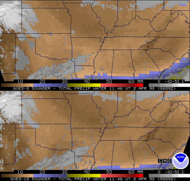
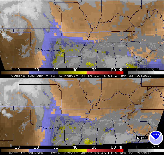
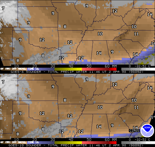
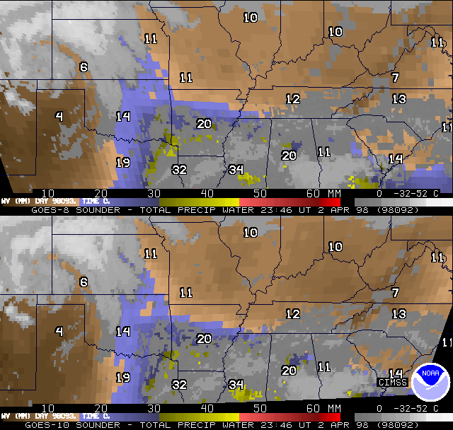
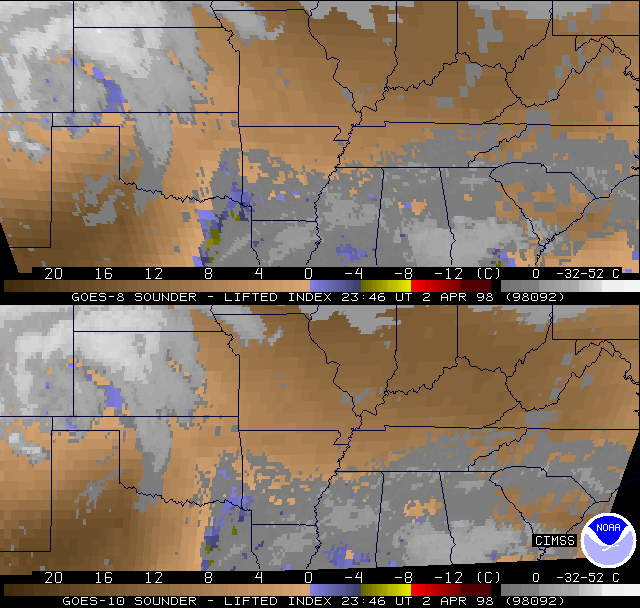
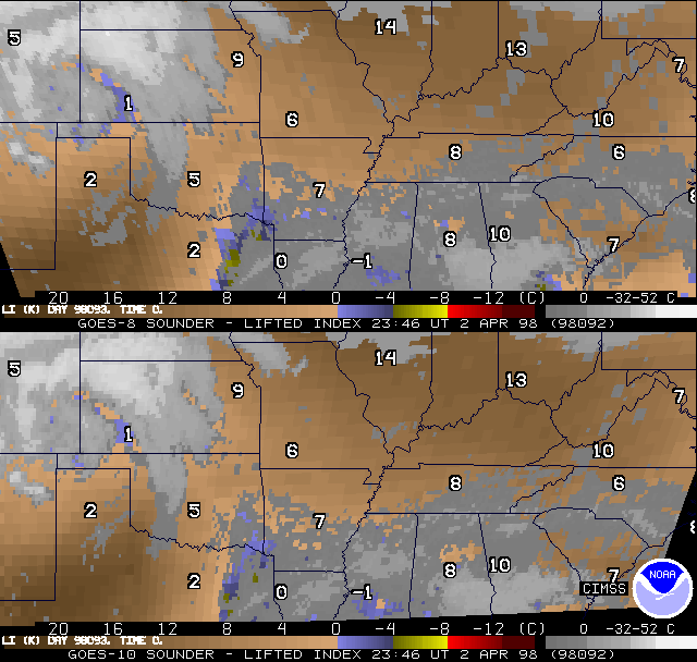
GOES-10 Total Precipitable Water Vapor Product compared to GOES-8...Shown are examples of co-located (Mercator re-map) GOES Sounder DPI for both GOES-8 and GOES-10 over the south central US. The return flow of moisture during the day on 2 Apr 1998 (98092) from GA across to E TX and northward to E KS is evident, as the total precipitable water (PW) Derived Product Images (DPI) between 12z and 00z show [G2P80921.GIF, G2P80922.GIF]. Similar comparisons with raob values overplotted [R2P80921.GIF, R2P80922.GIF] also show that the GOES-8 and GOES-10 products are substantially the same in their overlap region. Anticipated de-stabilization across the south central US was rather small as of 00z, as noted by the GOES Sounder lifted index (LI) DPI at that time [G2L80922.GIF, R2L80922.GIF]. The two satellites again appear much more similar than dissimilar. (Convection that first started just after 00z was near the LA/AR line, close to the only region showing LI values in the GOES DPI in the 0 to -4C range, despite extensive obscuring clouds. More convection developed later about 03z along the OK/AR line.)
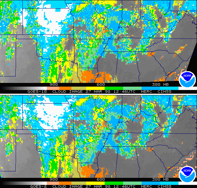
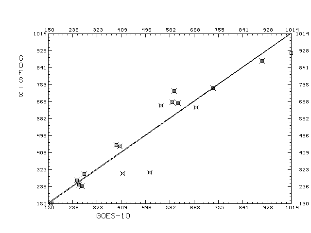
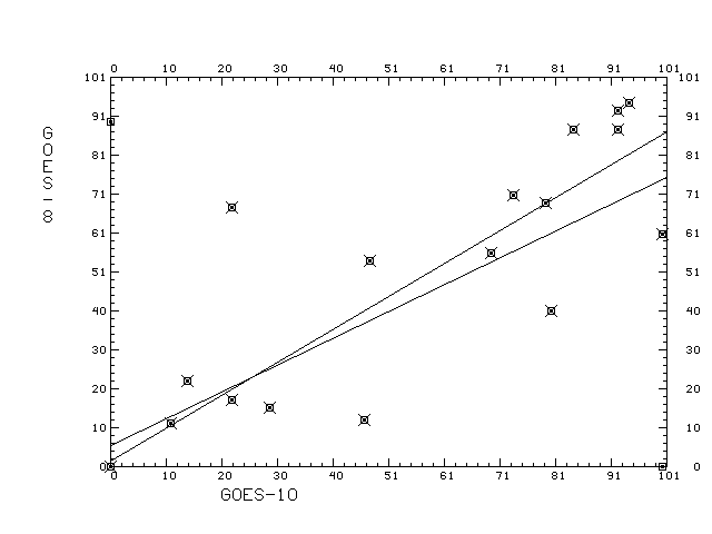
GOES-10 Cloud Product compared to GOES-8...GOES-10 Cloud top pressures from March 27, 1998 near 13 UTC are compared to GOES-8 are in good agreement. Scatter plots of co-located observations cloud top pressure for one time period is within 1 hPa on the average. Scatter plots of co-located observations effective cloud amount for one time period is within 2% on the average. A further explanation of the scatter diagrams is found in the table.
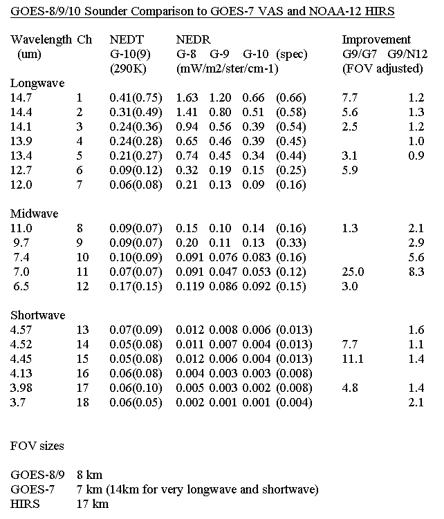
GOES-10 Space Noise Results...Special GOES-10 sounder sectors which include space views allow for the noise values to be determined by looking at the scatter of the uniform space. Preliminary indications from March 25 at 18:02 UTC show the GOES-10 noise seems to be the first sounder to to be within spec for all the channels (radiance table). The GOES-10 signal to noise values compared to other satellites. |