|
|
|
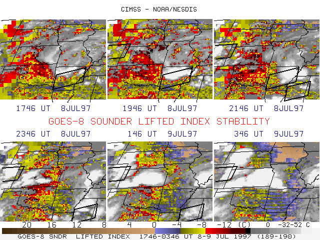
The western portion of an outflow boundary from a decaying nocturnal MCC remained semi-stationary over Kansas. This surface feature acted as a focusing mechanism for new convection later in the day. This 6-panel sequence of GOES-8 sounder Derived Product Imagery (DPI) Lifted Index (LI) illustrates the strong de-stabilization that occurred over central Kansas and northcentral Oklahoma during the afternoon hours.The Storm Prediction Center (SPC) had issued severe thunderstorm watches in anticipation of the convection over Arkansas and eastern Colorado, but the strong to severe convective activity over central Kansas was not covered by a watch. This activity produced several reports of hail (up to 1.75 inches diameter) and damaging wind gusts (up to 60 mph), along with heavy rainfall amounts of 4-6 inches across parts of Kansas. The pre-existing outflow boundary along with the strong and focused de-stabilization as indicated by the LI DPI sequence would seem to have presented supporting evidence to have considered an additional severe thunderstorm watch for that region.