Eruption of Lewotobi Laki-laki in Indonesia
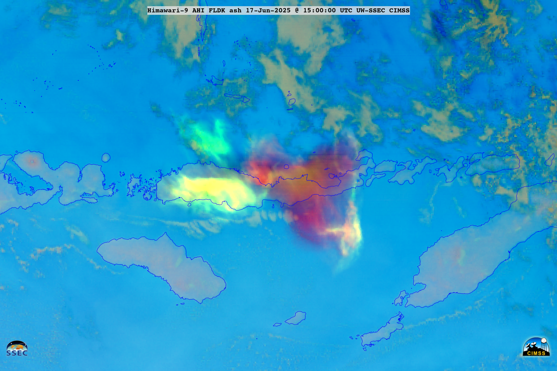
The Lewotobi Laki-laki volcano in Indonesia erupted at 0935 UTC on 17 June 2025 — and the radiometrically-retrieved Ash Height product from the NOAA/CIMSS Volcanic Cloud Monitoring site (above) indicated that some of the volcanic ash reached altitudes around 16.2 km (a 1645 UTC Darwin VAAC advisory listed ash to altitudes of FL530 or 53000 ft).The... Read More