Explosive eruption of the Hayli Gubbi volcano in Ethiopia
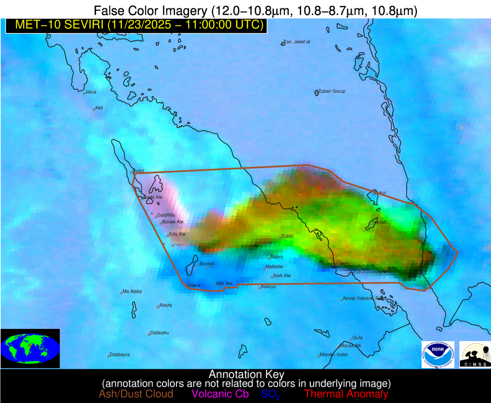
A EUMETSAT Meteosat-10 False Color RGB product from the NOAA/CIMSS Volcanic Cloud Monitoring site (above) showed the signature of a large volcanic cloud following the explosive eruption of Hayli Gubbi in Ethiopia, which began around 0830 UTC on 23 November 2025. Since this False Color RGB product uses the 8.7 µm spectral band (which... Read More