Snow cover across Colorado
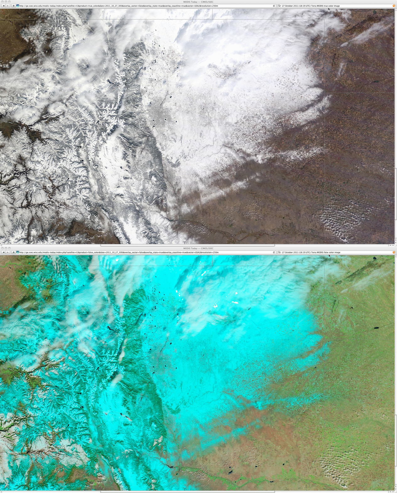
The first major winter storm of the season to affect the central Rocky Mountains region produced up to 19.9 inches of snowfall across parts of Colorado on 26 October 2011. On the following day, 250-meter resolution Terra MODIS true color and false color Red/Green/Blue (RGB) images from the SSEC MODIS Today site (above) showed a nice view of the resulting snow cover across northeastern Colorado (the snow cover was cyan-colored in the false color RGB image, with cloud features appearing as shades of white). The morning snow depths included 10 inches at Boulder and Greeley, with reports of 12 inches on the ground at a number of higher elevation stations.
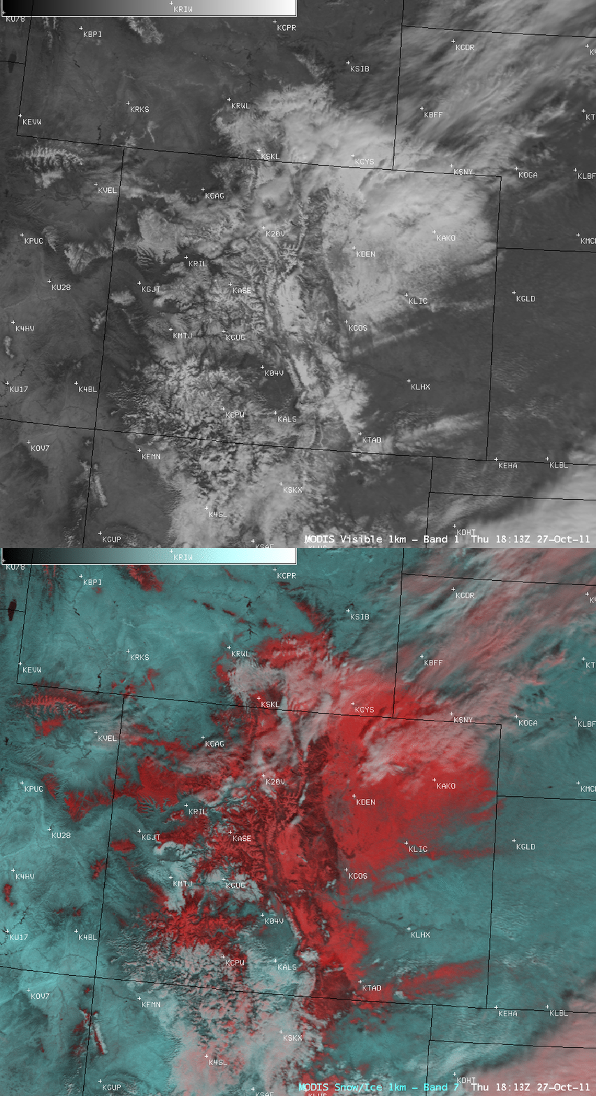
A corresponding AWIPS image comparison of 1-km resolution MODIS 0.65 µm visible channel data and a false color RGB image created using the 2.1 µm “snow/ice channel” (below) further demonstrated the utility of using RGB imagery to discriminate between snow cover (which appeared red in this second RGB image) and cloud features (which again appeared as lighter shades of white).
===============================================
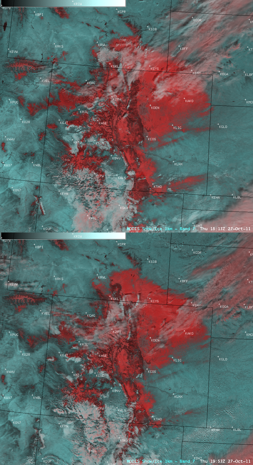
Some of the snow cover began to melt during the day across eastern Colorado, as could be seen in a comparison of the 18:13 UTC (12:13 PM local time) and 19:53 UTC (1:53 PM local time) MODIS false color RGB images (above). GOES-15 0.63 µm visible channel images at 15 minute intervals (below; click image to play animation) more clearly showed the temporal evolution of the melting snow cover.
CIMSS participation in GOES-R Proving Ground activities includes making a variety of MODIS images and products available for National Weather Service offices to add to their local AWIPS workstations. Currently there are 49 NWS offices receiving MODIS imagery and products from CIMSS.


