Swath of snow cover across parts of Virginia and North Carolina
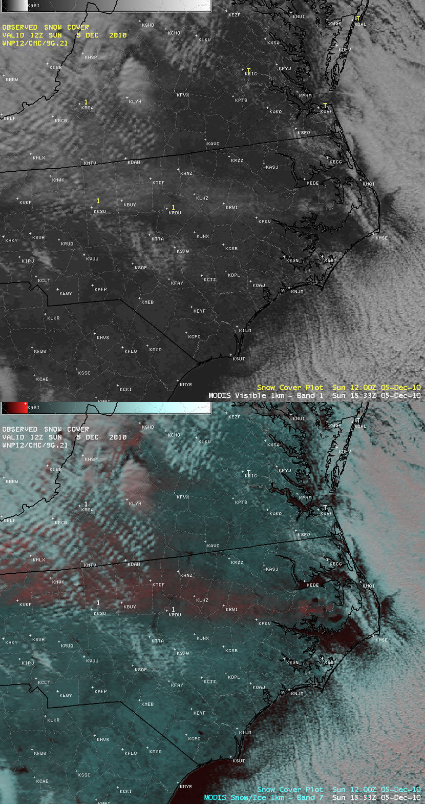
A comparison of AWIPS images of MODIS 0.65 µm visible channel data and a MODIS false-color Red/Green/Blue (RGB) image (created using the MODIS 0.65 µm visible and the 2.1 µm snow/ice channel images) revealed a swath of snow cover from southwestern Virginia all the way to extreme eastern North Carolina on the morning of 05 December 2010 (above).
Storm total snowfall amounts were as high as 3.0 inches with this event, which occurred on 04 December. While only two first-order stations (Greensboro KGSO and Raleigh KRDU) reported 1 inch of snow on the ground at 12 UTC on the morning of 05 December, the MODIS imagery showed that snow cover (which appeared as shades of red on the false-color RGB image) still remained across a number of counties to the east and southeast.
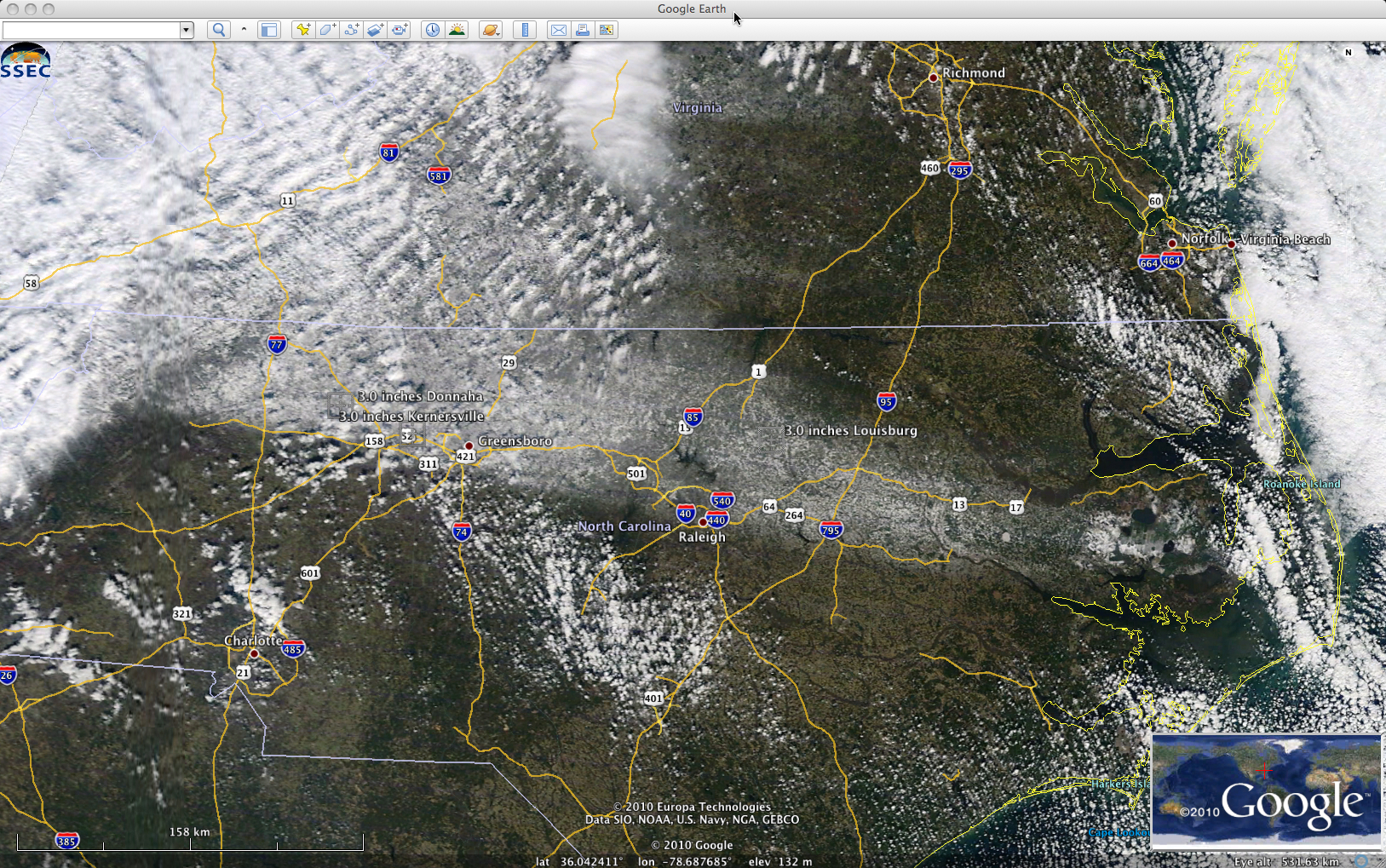
Better detail of the swath of snow cover across North Carolina can be seen using a 250-meter resolution MODIS true-color RGB image from the SSEC MODIS Today site (below; viewed using Google Earth).


