Strong jet stream over the eastern North Pacific Ocean
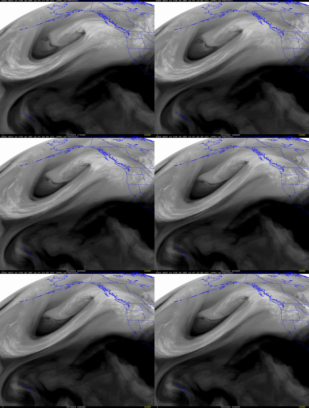
McIDAS images of GOES-11 6.5 µm water vapor channel data (above) showed evidence of a very strong jet stream oriented from southwest to northeast across the eastern North Pacific Ocean on 26 September 2010, approaching the coast of British Columbia, Canada. The features on the water vapor imagery were seen to be moving very quickly along the jet stream axis.
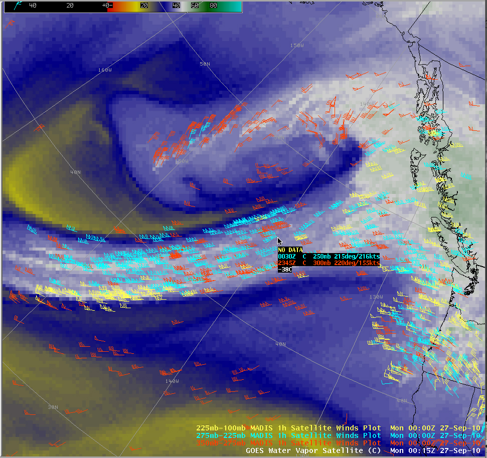
A GOES-11 water vapor image with an overlay of MADIS 1-hour atmospheric motion vectors at 00 UTC on 27 September (below) displayed one wind target with a speed of 216 knots at a pressure level of 250 hPa (located near 45 N latitude, 140 W longitude).
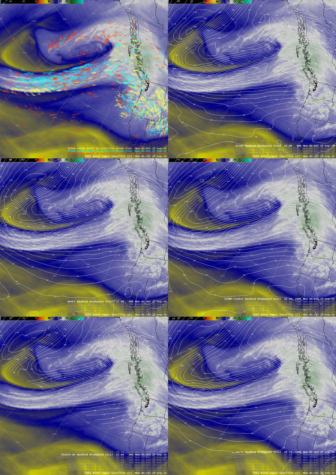
A comparison of these MADIS winds with a number of model forecasts of maximum wind speed at any level (below) demonstrated how much the models can underestimate the maximum wind speeds within the core of a strong jet stream: The ECMWF Low-Resolution model forecast maximum winds just over 140 knots, while the CRAS45 and the CMC Low-Resolution models had maximum winds of just over 150 knots. The GFS90 and the UKMET models were the strongest, with forecast winds speeds of just over 160 knots — but still far less then the 216 knots observed by the MADIS atmospheric motion vector product.


