Severe weather across southern Wisconsin
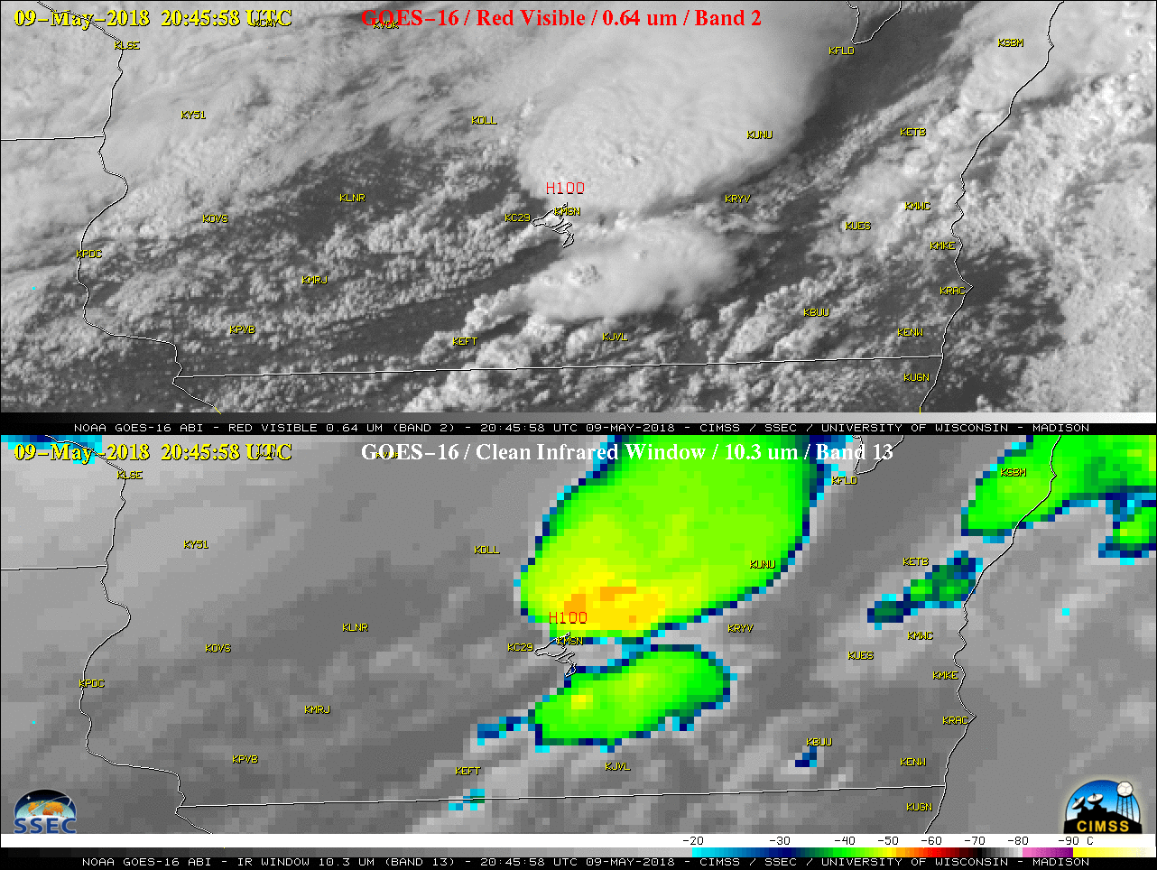
GOES-16 “Red” Visible (0.64 µm, top) and “Clean” Infrared Window (10.3 µm, bottom) images, with airport identifiers plotted in yellow and SPC storm reports plotted in red [click to play MP4 animation]
A comparison of Suomi NPP VIIRS Visible (0.64 µm) and Infrared Window (11.45 µm) images at 1923 UTC (below) showed the isolated thunderstorm as it was moving into northwestern Dane County. The rear inflow feeder bands were evident, and the minimum cloud-top infrared brightness temperature was -62 ºC.
![Suomi NPP VIIRS Visible (0.64 µm) and Infrared Window (11.45 µm) images [click to enlarge]](https://cimss.ssec.wisc.edu/satellite-blog/wp-content/uploads/sites/5/2018/05/180509_1923utc_suomi_npp_viirs_visible_infrared_WI_anim.gif)
Suomi NPP VIIRS Visible (0.64 µm) and Infrared Window (11.45 µm) images [click to enlarge]
![GOES-16 Rayleigh-corrected RGB images [click to play YouTube video]](https://cimss.ssec.wisc.edu/satellite-blog/wp-content/uploads/sites/5/2018/05/180509_goes16_color.jpeg)
GOES-16 Rayleigh-corrected RGB images [click to play YouTube video]