Eruptions of Popocatépetl in Mexico
GOES-16 Visible (0.64 µm, left) and Infrared Window (10.3 µm, right) images, with plots of hourly surface reports [click to play animation]
An eruption of Mexico’s Popocatépetl volcano — the largest since 2013 — occurred on 23 November 2017. The volcanic cloud was evident in GOES-16 “Red” Visible (0.64 µm) and “Clean” Infrared Window (10.3 µm) images (above) as it drifted southward. However, due to the relatively thin nature of the cloud (a result of low values of ash loading), 10.3 µm infrared brightness temperatures were quite warm (greater than -20ºC), making a height determination from the single-band infrared imagery alone rather difficult.
This example demonstrates the value of using multi-spectral image techniques to derive retrieved products — available from the NOAA/CIMSS Volcanic Cloud Monitoring site — such as Ash Height (below). In this case, the retrieved ash cloud height was 7 km or 24,000 feet (darker green enhancement0, even for portions of the cloud with relatively low ash loading.
————————————-
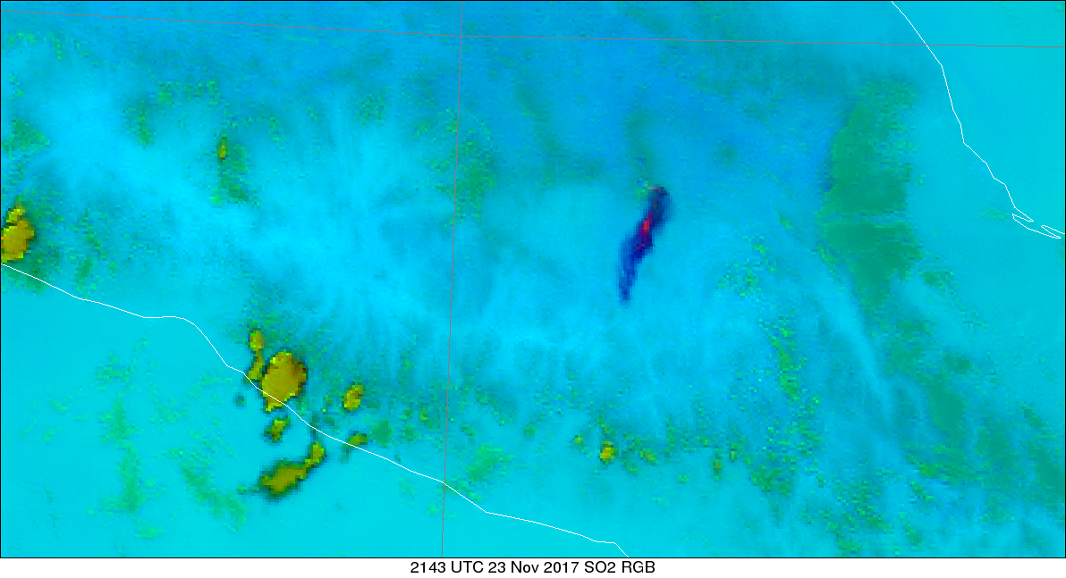
Two of the channels on GOES-16 detect radiation in parts of the electromagnetic spectrum where sulfur dioxide (SO2) absorbs radiation: Band 10 (7.3 µm, the low-level Water Vapor channel) and Band 11 (8.4 µm, the Infrared Cloud Phase channel, see in particular the figure on the first page of the Quick Guide). The SO2 Red-Green-Blue (RGB) Composite was designed to highlight volcanic plumes, using the Brightness Temperature Difference between the mid-level and low-level Water Vapor Channels (6.9 µm – 7.3 µm) as the Red Component, the Brightness Temperature Difference between the Clean Infrared Window (Band 13, 10.3 µm) and the Infrared Cloud Phase (Band 11, 8.4 µm) as the Green Component, and the Clean Infrared Window (Band 13, 10.3 µm) as the Blue Component. The eruption is obvious in the SO2 RGB imagery, below, with magenta and blue values apparent. The volcanic plume’s appearance differs markedly from that of the convection along the Pacific coast of Mexico south and west of the eruption.


![Ash Cloud Height product [click to play animation]](https://cimss.ssec.wisc.edu/satellite-blog/wp-content/uploads/sites/5/2017/11/171123_2123utc_ash_height_Popo.png)
![Ash Cloud Height product [click to play animation]](https://cimss.ssec.wisc.edu/satellite-blog/wp-content/uploads/sites/5/2017/11/haimage_07.png)
