Super Typhoon Nuri in the West Pacific Ocean
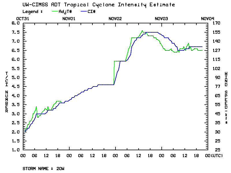
A plot of the Advanced Dvorak Technique (ADT) intensity estimation for Super Typhoon Nuri (above) shows that the tropical cyclone went through a period of rapid intensification early in the day on 02 November 2014, reaching Super Typhoon strength with sustained winds of 155 knots later in the day.
During this period of rapid intensification, MTSAT-2 10.8 µm IR channel images (below; click image to play animation; also available as an MP4 movie file) showed the development of a small “pinhole” eye (with a diameter of about 15 km); as the storm began to recurve to the north and northeast, a bit of trochoidal motion or “wobble” of the eye was also evident. The coldest cloud-top IR brightness temperatures were -88º C (darker violet color enhancement).
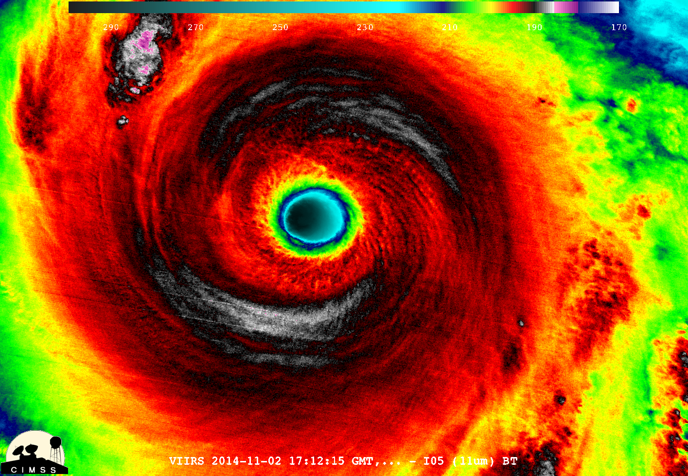
A 375-meter resolution Suomi NPP VIIRS 11.45 µm IR channel image (below; courtesy of William Straka, SSEC) showed great detail in the storm top temperature structure within the eyewall region of Nuri at 17:12 UTC or 2:12 am local time.
During the daylight hours, the COMS-1 satellite provided 15-minute interval 0.675 µm visible channel images (below; click image to play animation; also available as an MP4 movie file) which revealed the presence of mesovortices within the eye of Super Typhoon Nuri.
============================= Added 11/04/2014 =====================
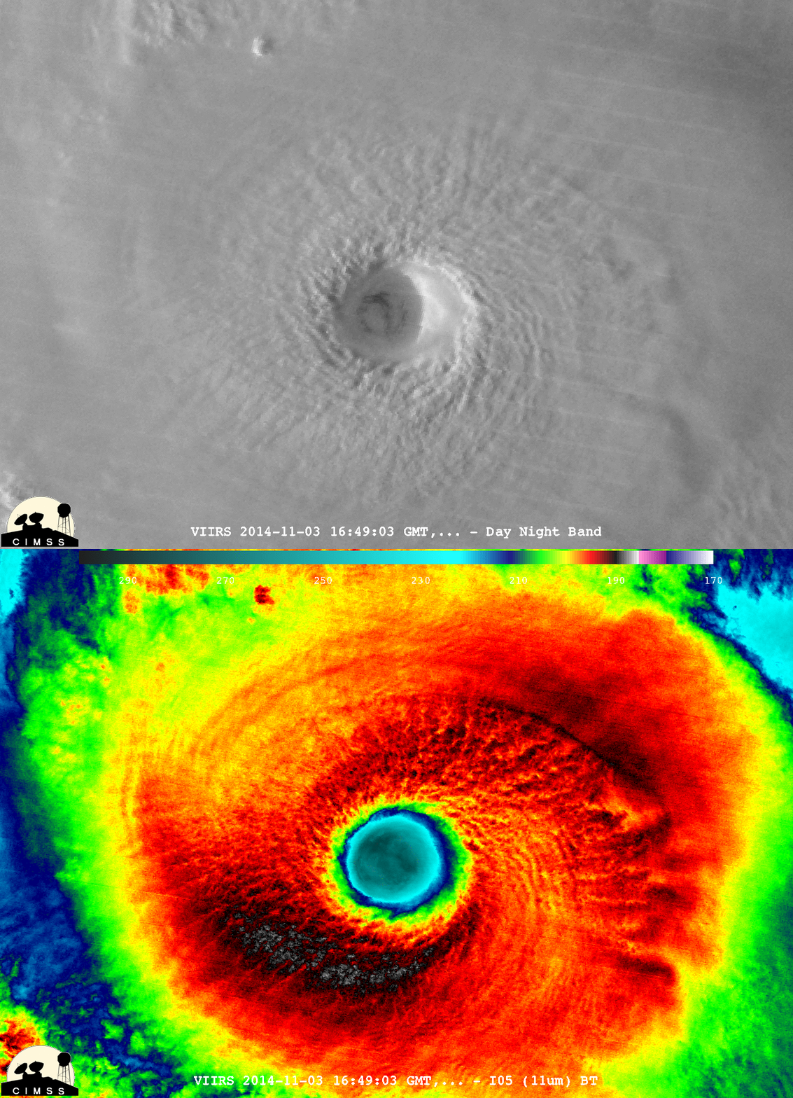
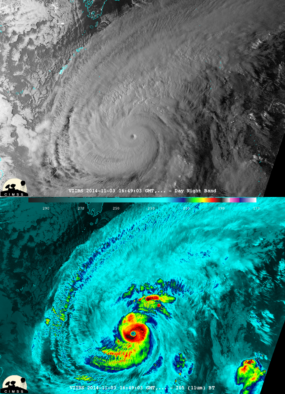
Suomi NPP VIIRS 0.7 µm Day Night Band and 11.45 µm Infrared imagery during the overnight hours (16:49 UTC or 1:49 am local time) on 03 November showed a strong, well-organized system. Ample illumination from the Moon in a Waxing Gibbous phase (94% of full) helped to highlight the “visible image at night” capability of the Day/Night Band.


