First snowfall of the season in northeastern Alaska
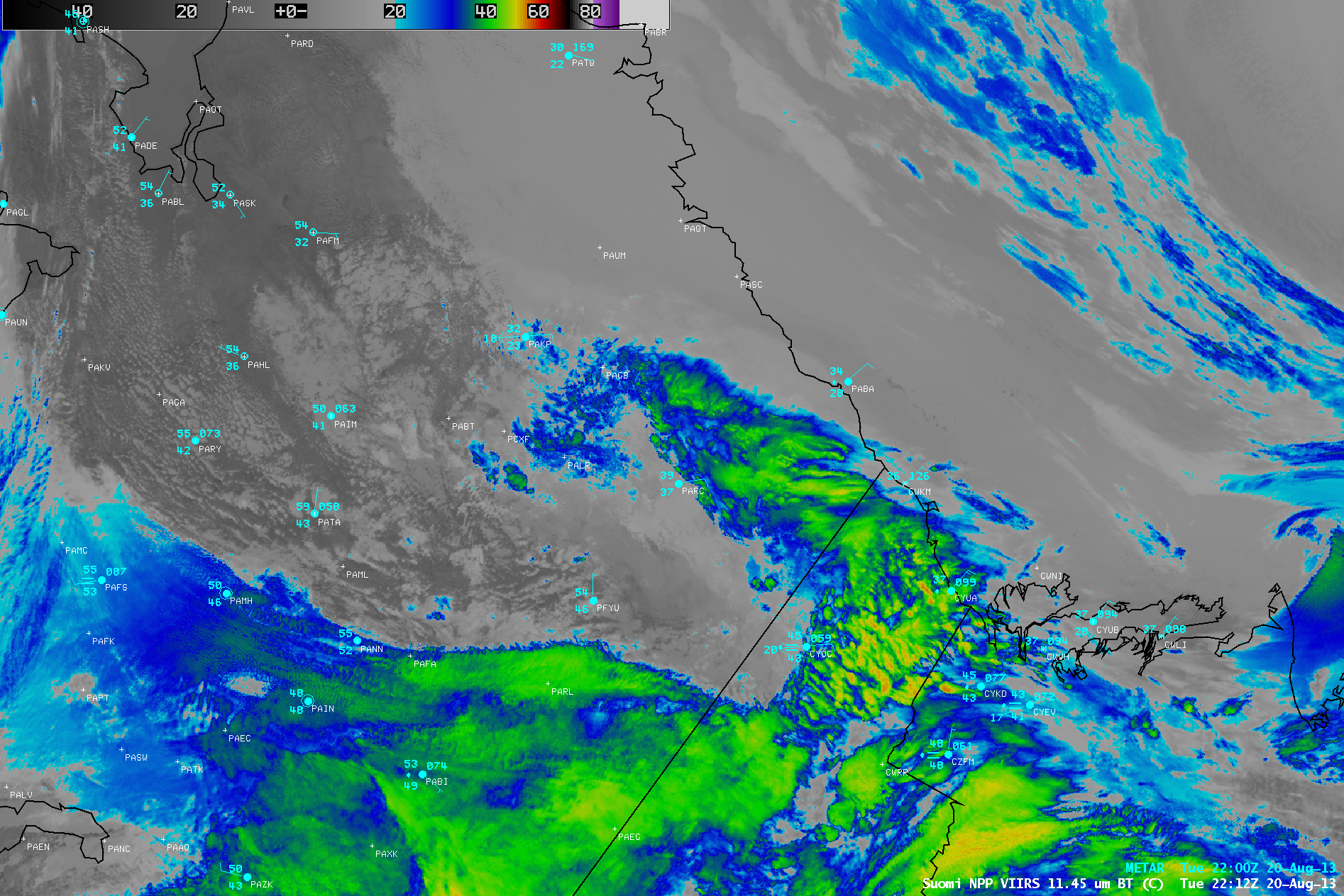
AWIPS images of Suomi NPP VIIRS 11.45 µm IR channel data (above; click image to play animation) showed the development of a cyclonic swirl of middle to high altitude clouds associated with an upper-level shortwave moving northward over northeastern Alaska on 20 August 2013. This disturbance helped to reinforce the northerly to northeasterly flow of unseasonably cold air across the Beaufort Sea and North Slope regions of Alaska, producing upslope winds along the Brooks Range — this scenario led to the first major snowfall of the season in northern Alaska, with eastern portions of the Brooks Range and North Slope regions receiving several inches of accumulation.
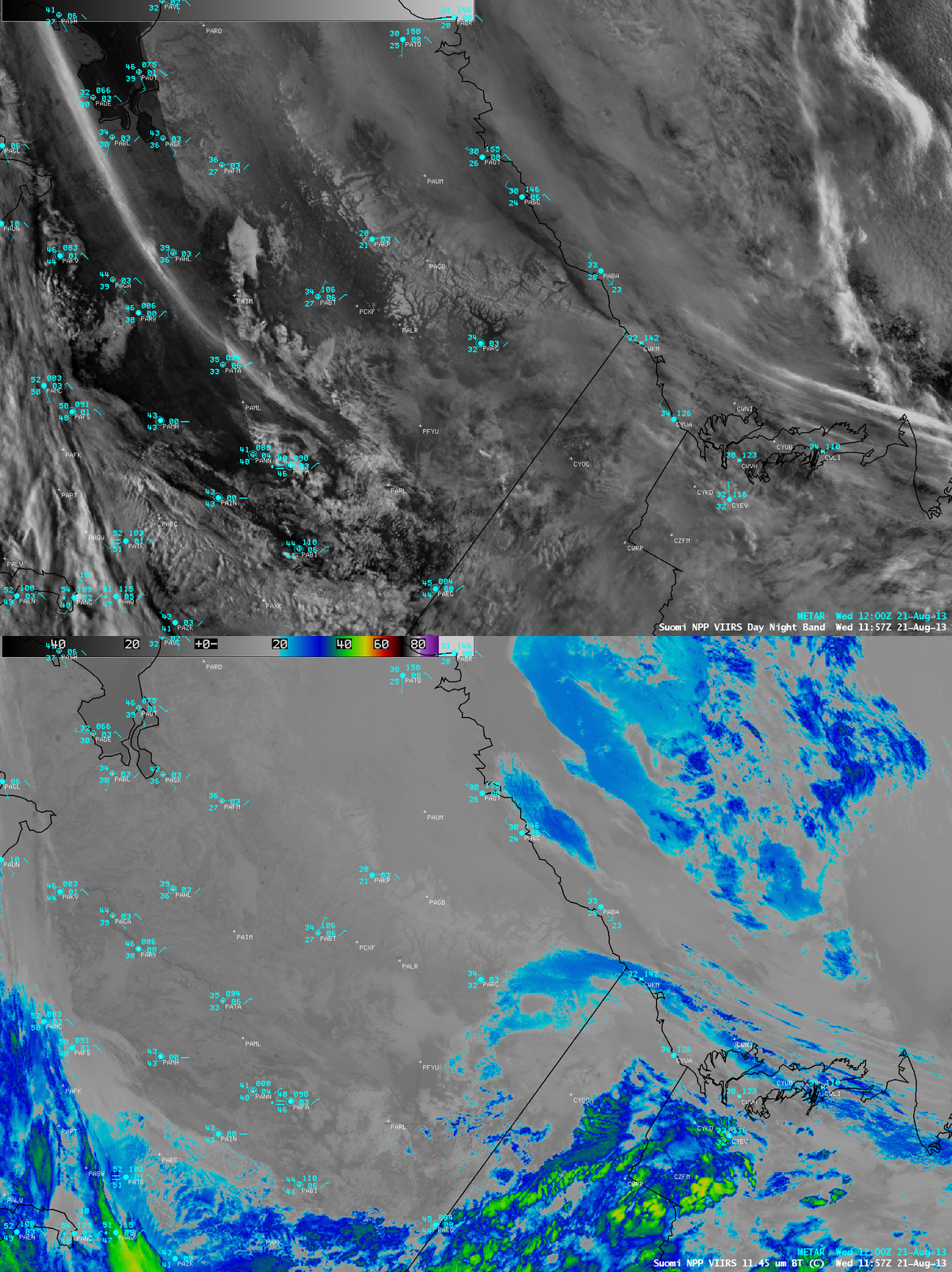
The first glimpse of snow cover appeared on a Suomi NPP VIIRS 0.7 µm Day/Night Band image at 11:57 UTC or 3:57 AM local time on 21 August (below), as clouds began to clear in the vicinity of Anaktuvuk Pass (PAKP) to Arctic Village (PARC) and points northward. The long and narrow bright streak seen over land in the western portion of the Day/Night Band image is the glow of the aurora borealis (note the lack of a signal there on the corresponding 11.45 µm IR channel image) — in contrast, the bright features seen over water in the eastern/northeastern portion of the Day/Night Band image were clouds becoming illuminated by the rising sun.
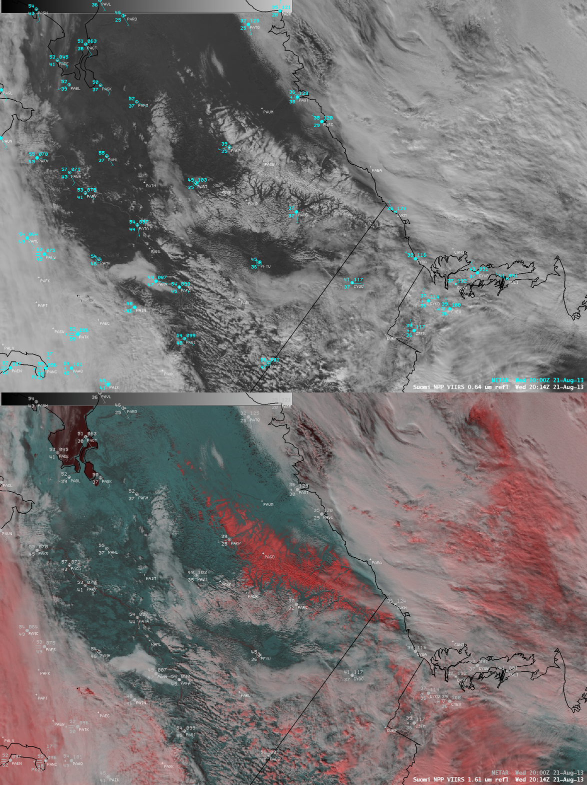
A mid-day comparison of Suomi NPP VIIRS 0.64 µm visible channel and false-color Red/Green/Blue (RGB) images at 20:14 UTC or 12:14 PM local time (below) revealed the areal extent of the fresh snow on the ground — new snow appeared as darker shades of red across the eastern Brooks Range and North Slope regions (in contrast to supercooled water droplet clouds, which appeared as varying shades of white). Snow depth reports ranged from 2-6 inches at 12 UTC. Note that clouds whose tops were composed of ice crystals also appeared as varying shades of red on the RGB image.
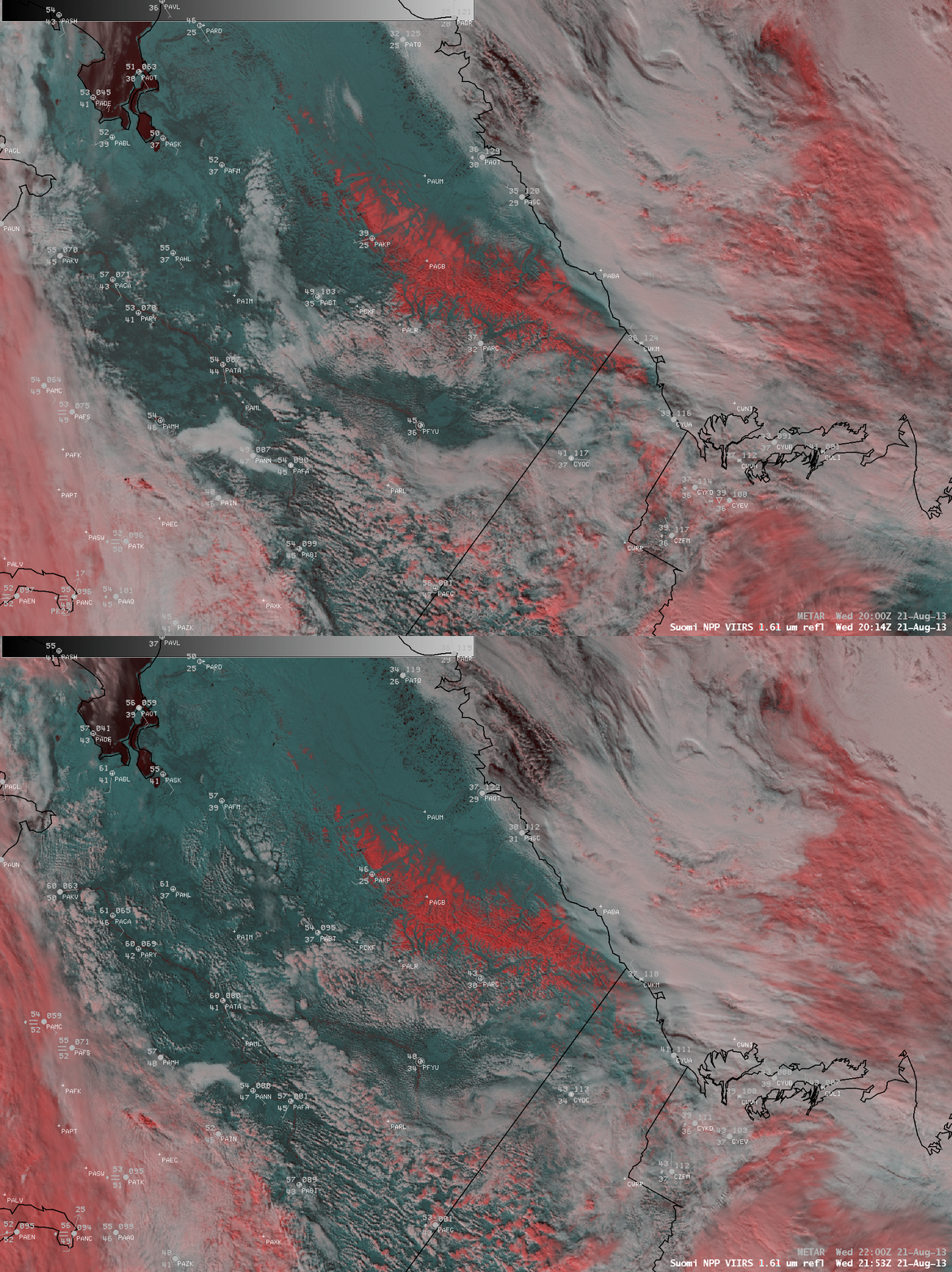
A comparison of two consecutive VIIRS false-color RGB images at 20:14 and 21:53 UTC (below) indicated that the outer edges of the snow cover were slowly melting, as surface air temperatures were able to recover into the 30s and 40s F over that region. With the combination of fresh snow cover, clearing skies, and light winds the morning low on 21 August was 23º F at Anaktuvuk Pass (PAKP); their high temperature on 20 August during the period of accumulating snow was just 36º F.


