53rd anniversary of the first image from a meteorological satellite
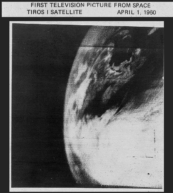
Today marks the 53rd anniversary of the first image from the meteorological satellite TIROS-1, which was available on 01 April 1960 (above). While TIROS-1 was only operational for 78 days, it provided a number of images of the Earth and cloud systems (including the first image of a tropical cyclone, over the South Pacific Ocean on 10 April 1960).
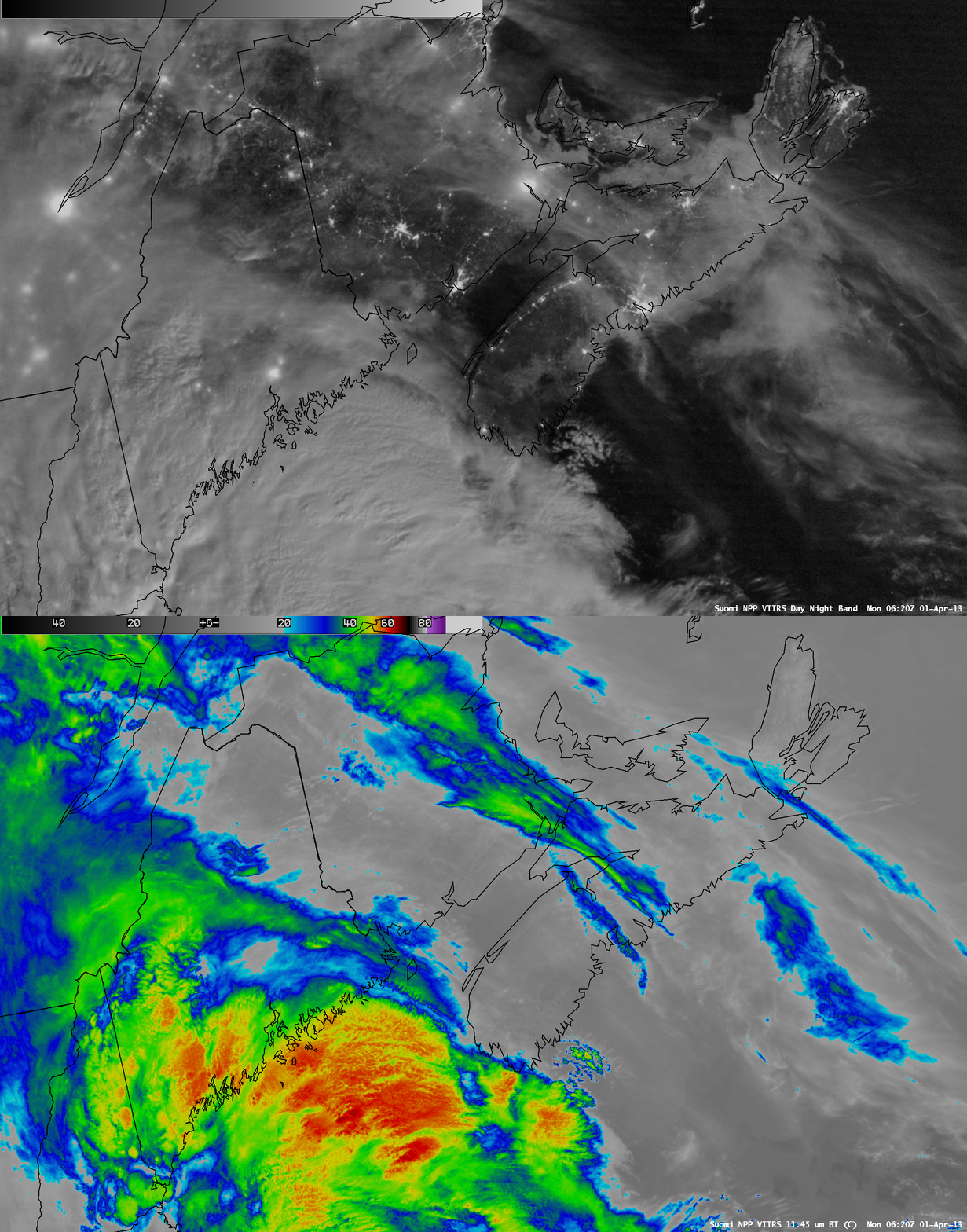
One example that demonstrates how satellite imagery has improved over the past 53 years is a nighttime comparison of AWIPS images of Suomi NPP VIIRS 0.7 µm Day/Night Band and 11.45 µm IR channel data (below), covering the same general region as shown on the first TIROS-1 image (Maine, and the Canadian Maritime provinces). With ample illumination from the moon (in the Waning Gibbous phase, at 67% of full), the Day/Night Band offered a “visible image at night” which showed such features as the extent of sea ice in the channels between Nova Scotia, Prince Edward Island, and New Brunswick, as well as a series of banded wave clouds associated with an undular bore off the southern coast of Nova Scotia. Subtle details regarding the location and cloud-top IR brightness temperature of overshooting tops could also be seen in the convective clouds off the coast of Maine.
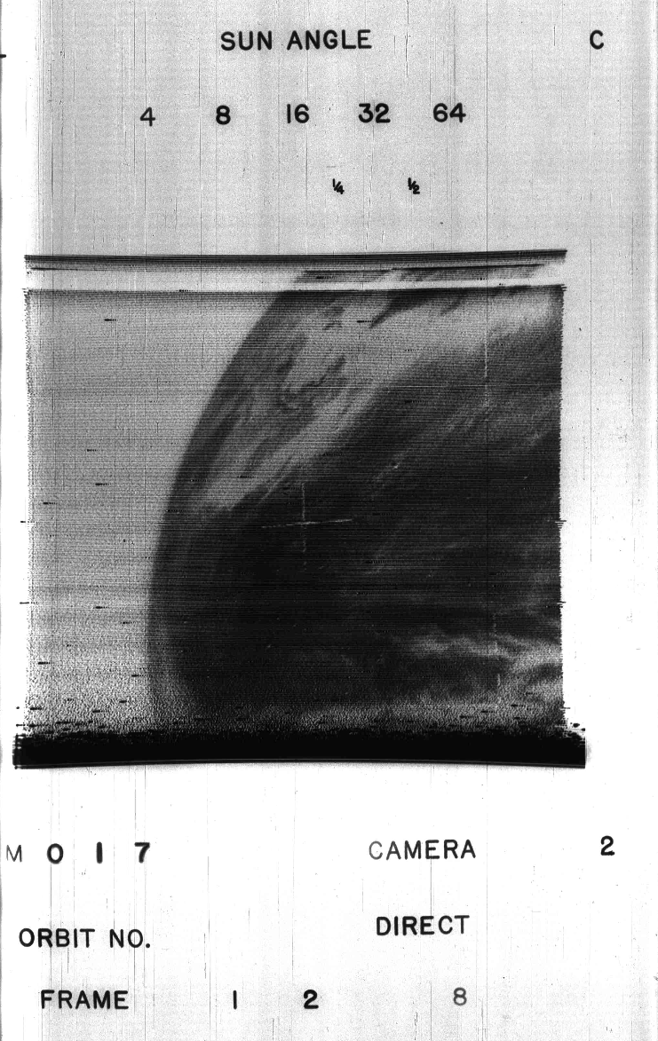
UPDATE: This information suggests that the TIROS-1 image shown at the top of this blog post was actually taken at 1608 UTC on 02 April 1960! Apparently the true “first image” from TIROS-1 was taken at 1331 UTC on 01 April 1960, shown below (courtesy of Rick Kohrs, SSEC). See


