Severe Convection in Montana
Severe thunderstorms developed across parts of Montana on 16 June 2007, producing heavy rainfall (2-6 inches), large hail (up to 3 inches in diameter), damaging winds (gusting to 89 mph), and isolated tornadoes (SPC storm reports). GOES-11 10.7µm InfraRed (IR) imagery (above; Java animation) indicated cloud top brightness temperature values were as cold as -68º C (dark red enhancement) with these storms.
A closer view using GOES-11 visible channel imagery (above; Java animation) shows the storms in the Billings (KBIL) and Glasgow (KGGW) regions. Of particular interest was the northernmost Glasgow storm, whose northwest-to-southeast track deviated from that of the other eastward or northeastward-moving areas of convection over eastern Montana that day. Also note that the southernmost Billings storm exhibited a well-defined anvil plume after about 00:00 UTC on 17 June — this anvil plume was quite apparent in the visible imagery, but did not seem to exhibit much of a signal in the IR imagery (below).
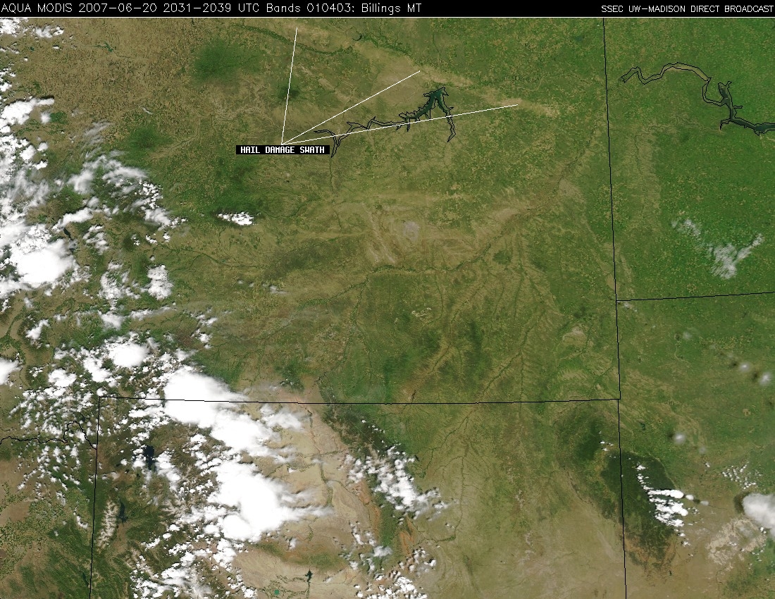
The large hail (driven by strong winds) from the northernmost Glasgow storm produced extensive damage to the wheat, alfalfa, and corn crops in that region — Tanja Fransen (WCM, NWS Glasgow) alerted us to the fact that the northwest-to-southeast oriented hail damage swath was clearly evident on Aqua MODIS true color imagery on 20 June, 4 days following the storm (below). A Java image fader applet allows a comparison between the MODIS images on 10 June (before the storm) and 20 June (after the storm), further highlighting hail damage swath. NWS Glasgow measured the damage swath to be about 285 miles long, and up to 12 miles wide (NWS public information statement).


