
1-minute Mesoscale Domain Sector GOES-18 (GOES-West) Shortwave Infrared (3.9 µm) images (above) displayed a pronounced thermal signature associated with the Franklin Fire, which began burning just north-northwest Malibu, California around 0644 UTC on 10th December 2024 (or 10:24 PM PST on 9th December). This wildfire was driven by strong Santa Ana winds, which helped it to increase rapidly in... Read More

1-minute GOES-18 Shortwave Infrared (3.9 µm) images, from 0631-2130 UTC on 10th December [click to play MP4 animation]
1-minute
Mesoscale Domain Sector GOES-18
(GOES-West) Shortwave Infrared (
3.9 µm) images
(above) displayed a pronounced thermal signature associated with the
Franklin Fire, which began burning just north-northwest Malibu, California around
0644 UTC on
10th December 2024 (or 10:24 PM PST on 9th December). This wildfire was driven by strong
Santa Ana winds, which helped it to increase rapidly in size and intensity — in fact, the Franklin Fire began to exhibit 3.9 µm brightness temperatures of 137.88ºC (the saturation temperature of GOES-18
ABI Band 7 detectors) beginning at 0855 UTC
(below), which persisted until 0947 UTC.
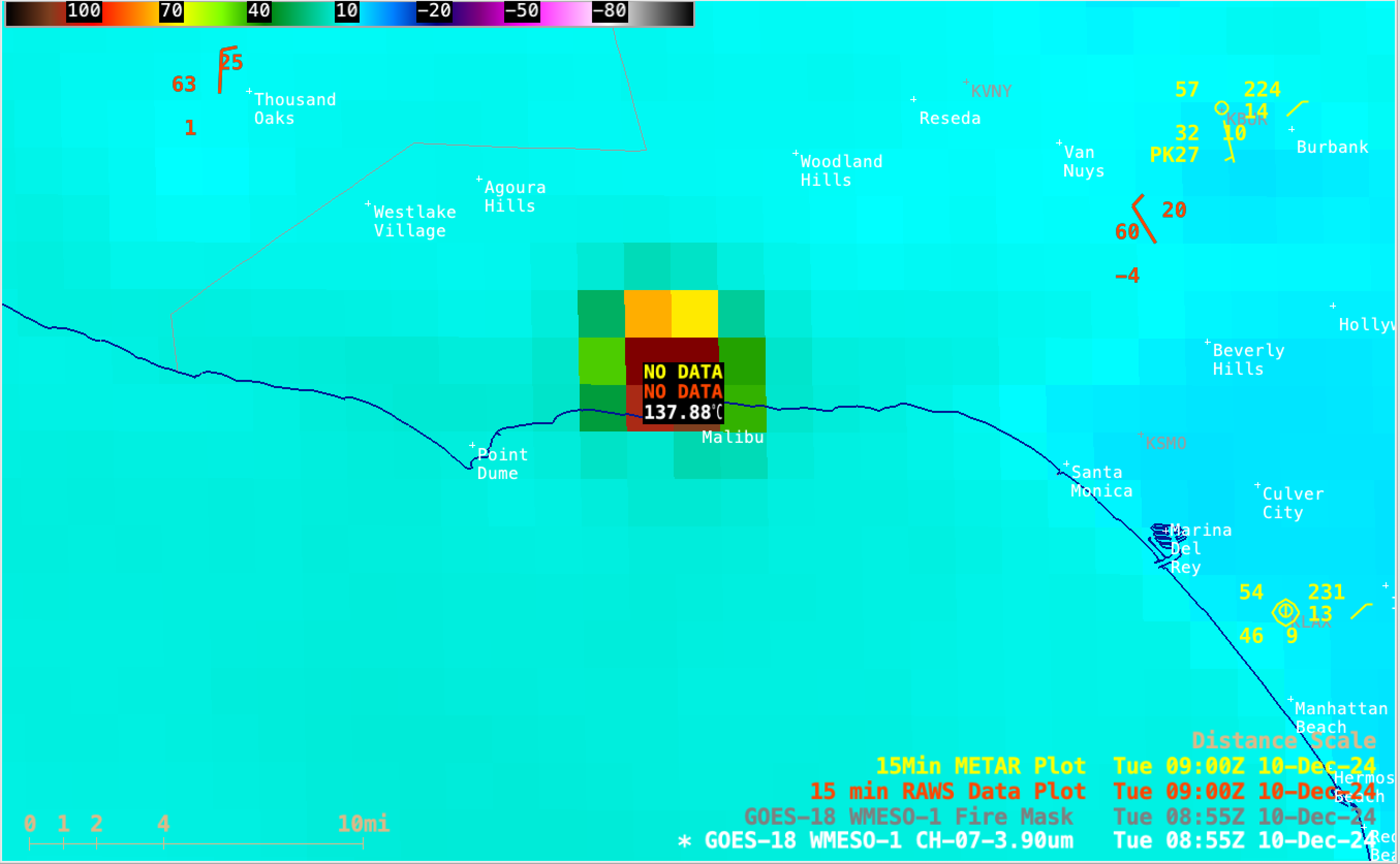
Sample of GOES-18 Shortwave Infrared (3.9 µm) brightness temperature NW of Malibu at 0855 UTC on 10th December [click to enlarge]
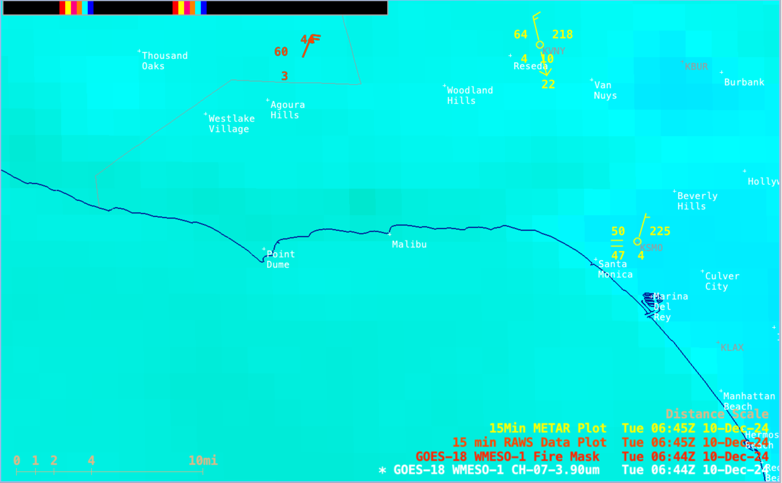
About 12 minutes after the Franklin Fire began to exhibit a thermal signature on GOES-18 Shortwave Infrared imagery, a
RAWS site just east of the wildfire reported a wind gust of 52 mph at 0656 UTC
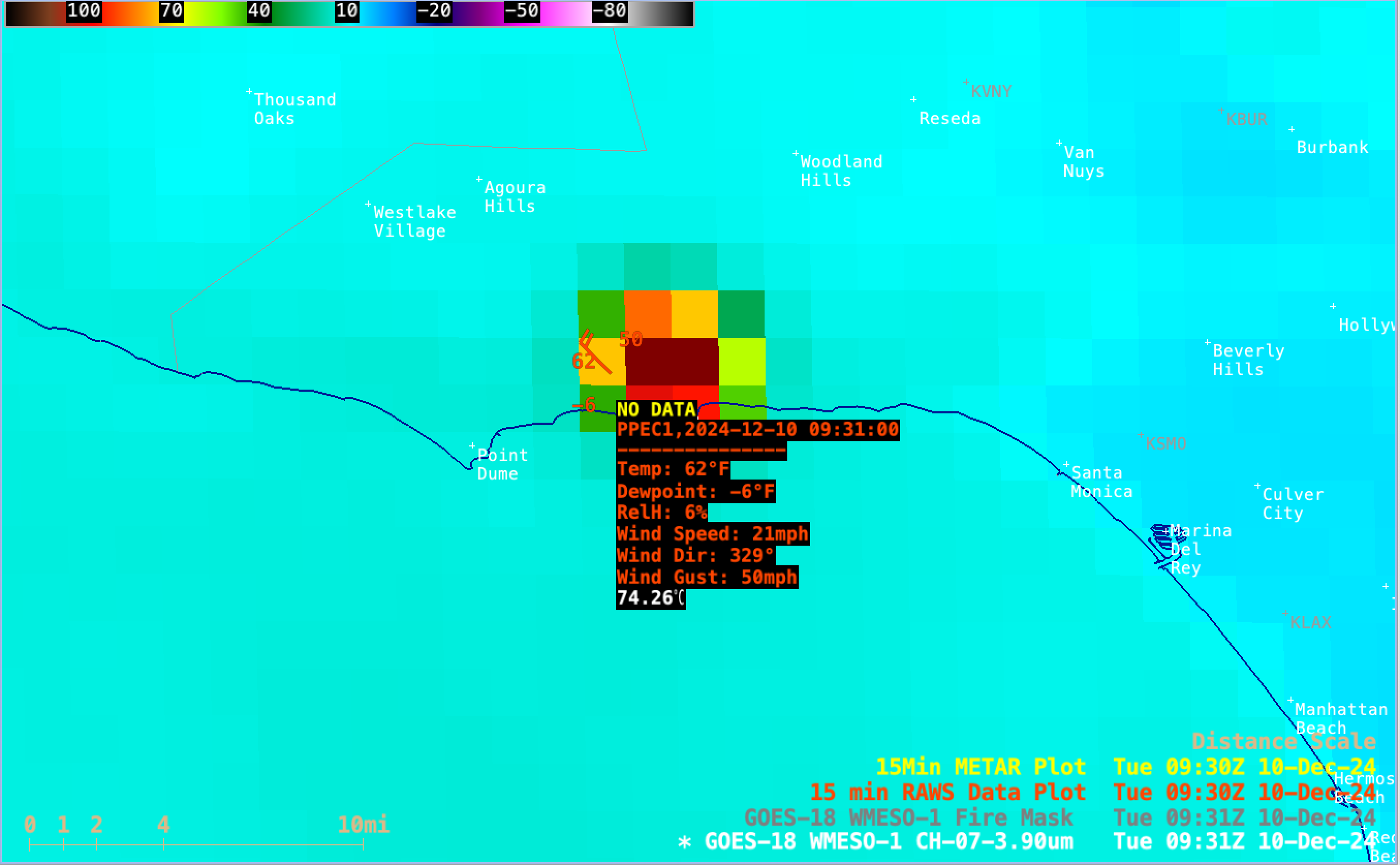
(below). About 2.5 hours later, a RAWS site just northwest of the fire reported a wind gust of
50 mph at 0931 UTC. In addition to the strong winds, relative humidity values at those nearby RAWS sites were generally 10% or less.
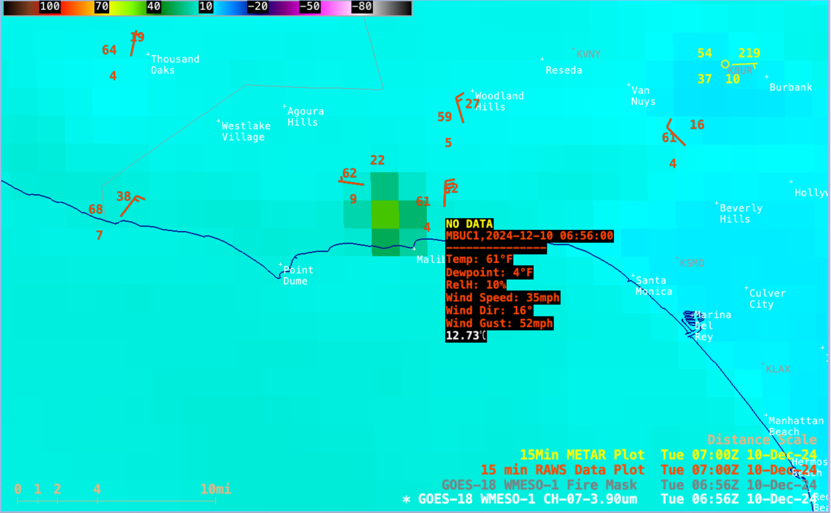
GOES-18 Shortwave Infrared image at 0656 UTC, with a sample of RAWS site observation data just east of the Franklin Fire [click to enlarge]
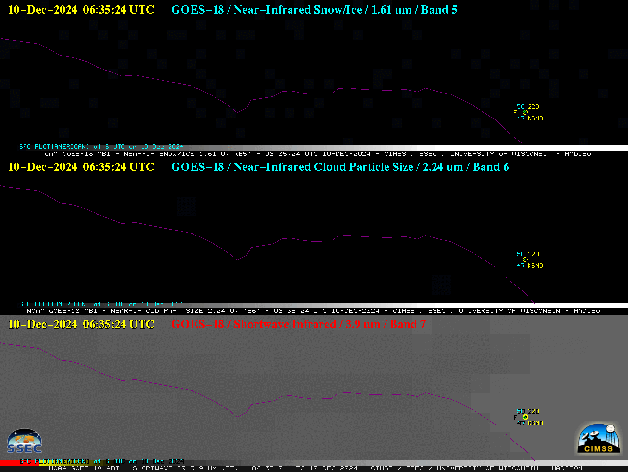
Since the Franklin Fire began and rapidly intensified during the nighttime hours, its thermal signature was also apparent in the Near-Infrared
1.61 µm and
2.24 µm spectral bands
(below).

1-minute GOES-18 Near-Infrared (1.61 µm and 2.24 µm, top and middle) and Shortwave Infrared (3.9 µm, bottom) images, from 0635-1430 UTC on 10th December [click to play animated GIF | MP4]
1-minute GOES-18 True Color RGB images from the
CSPP GeoSphere site
(below) revealed several pyrocumulus jumps over the Franklin Fire, in addition to a dense smoke plume drifting offshore.

1-minute GOES-18 True Color RGB images, from 1530-2359 UTC on 10th December [click to play MP4 animation]
View only this post
Read Less


