Using Polar2Grid to create MIRS imagery
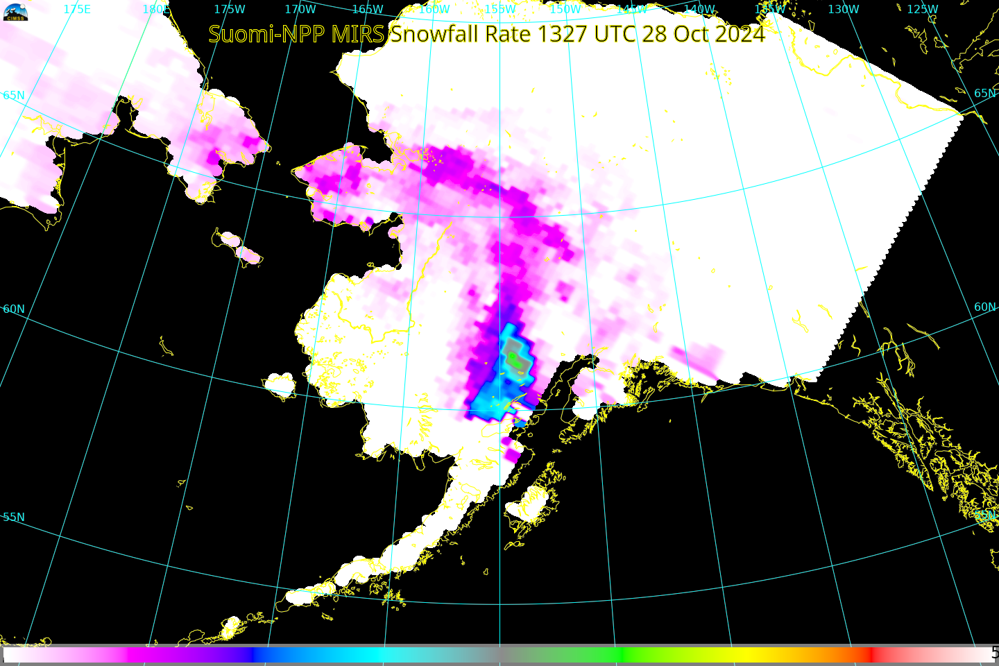
The Community Satellite Processing Package (CSPP) software Polar2Grid supports the creation of imagery using Microwave Integrated Retrieval Software (MIRS) algorithms. This is useful because on-line sources of imagery occasionally go missing. Consider, for example, the Snowfall Rate values that are available at this site from GINA. NOAA-20 was viewing parts of... Read More


