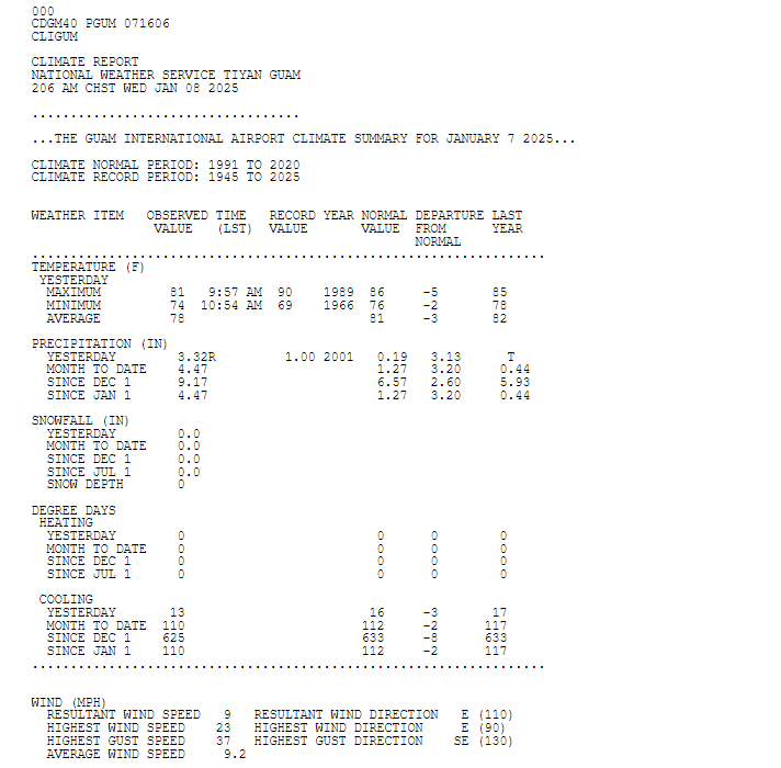
A record wet day on Guam
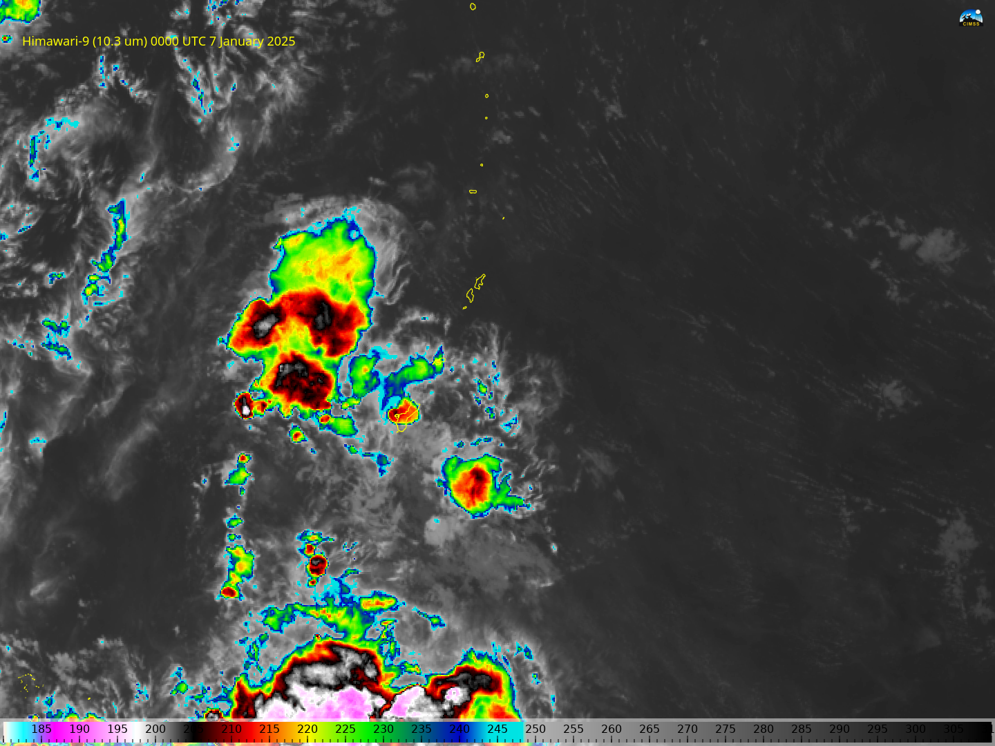
Antonio B. Won Pat International Airport on Guam experienced a record wet 7 January this year when 3.32″ of rain fell, mostly between 1700 UTC/6 January and 0500 UTC/7 January. Himawari-9 Band 13 imagery, above, for the 3 days ending at 0000 UTC 08 January 2025, show a region of thunderstorms approaching the Marianas. A slower animation covering... Read More

