Great Lakes Water Temperatures in mid-November

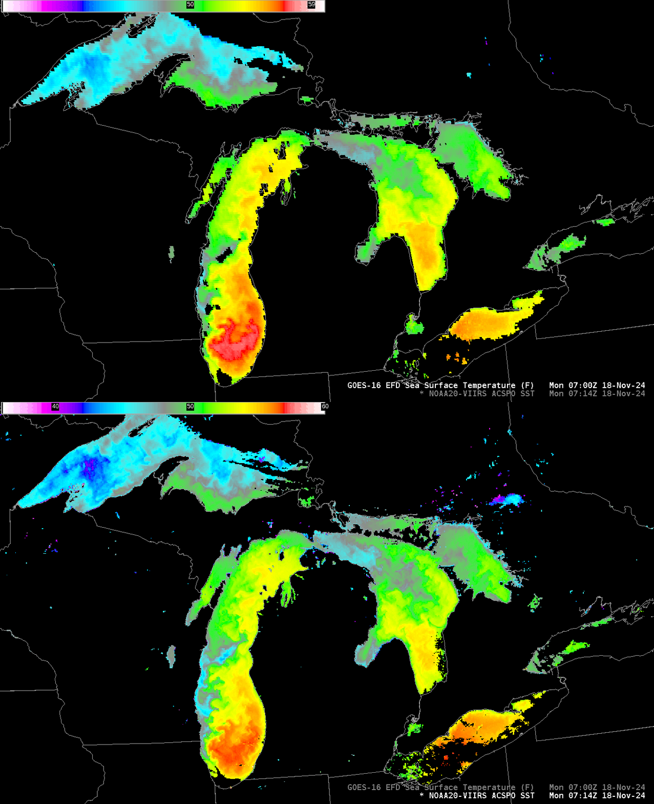
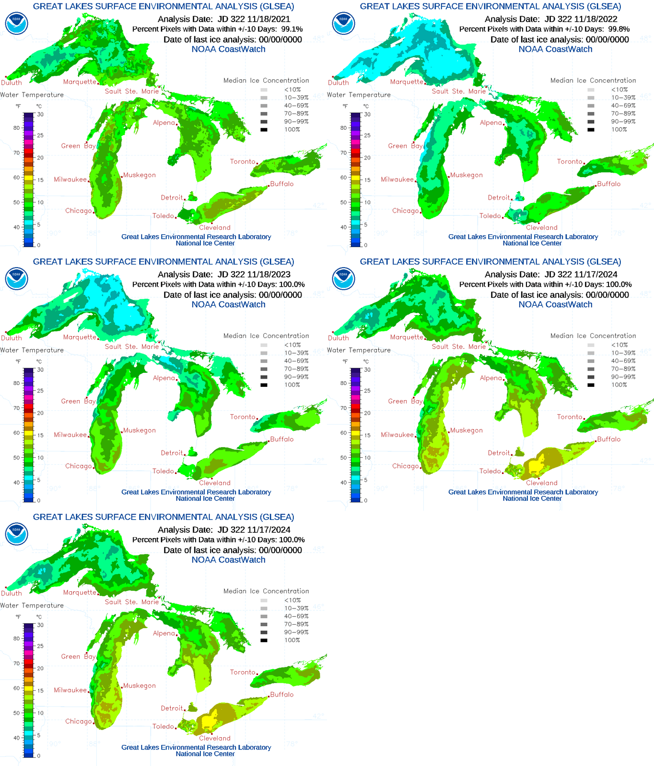
Mostly clear skies over the Great Lakes early on 18 November allowed for good satellite estimates of Lake Surface temperatures. They are, in a word, very warm. The toggle above compares estimates from NOAA-20 and from GOES-16. The stepped animation below (source) compares November 17th values this year with those from 2021, 2022 and 2023, and a tabular comparison for the past 4 years follows.

| Year | Superior | Michigan | Huron | Erie | Ontario |
| 2021 | 8.24 | 10.09 | 10.18 | 11.43 | 10.30 |
| 2022 | 5.49 | 7.95 | 8.89 | 9.44 | 10.15 |
| 2023 | 6.52 | 9.63 | 8.60 | 11.07 | 9.71 |
| 2024 | 8.28 | 11.86 | 10.83 | 13.95 | 11.07 |
Mean temperature plots of the five Great Lakes, shown below in comparison to the mean value (based on 1998-2023), also show the anomalous warmth (source).

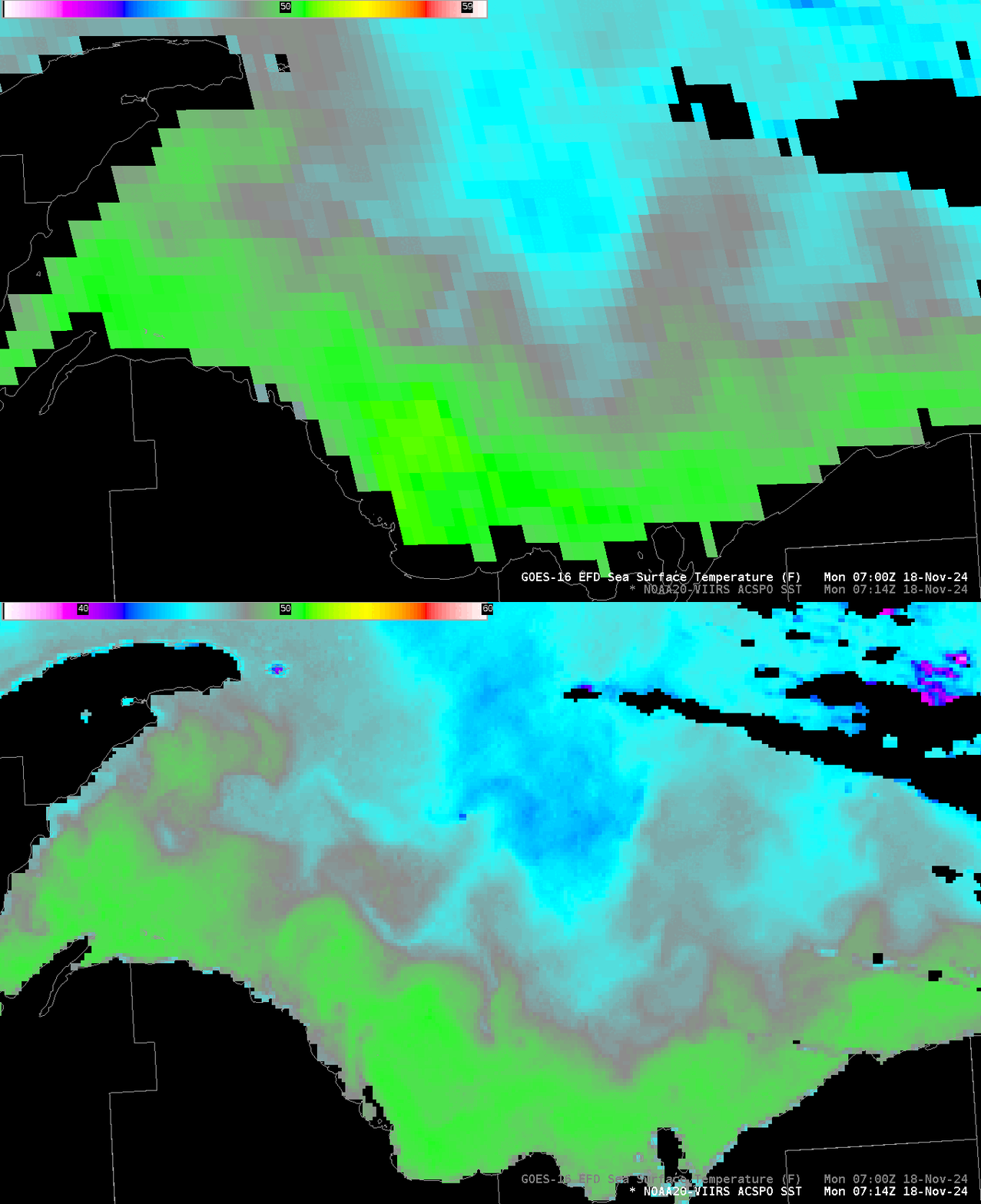
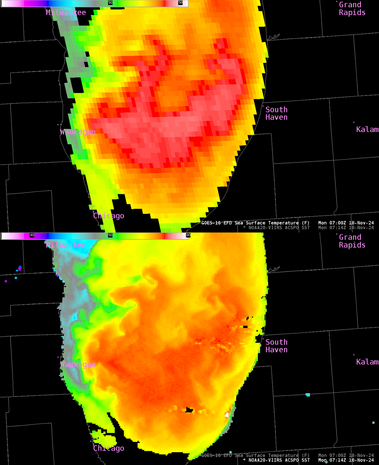
The ACSPO imagery above gives similar results from both satellites, although the higher resolution of VIIRS allows for better identification of small-scale features, and allows for values closer to the shoreline; values between the two satellites agree to within a degree of so Fahrenheit, with GOES estimates showing warmer temperatures generally. The zoomed-in toggles below compare GOES-16/NOAA-20 over Lake Superior to the east of the Keewenaw Peninsula, and over southern Lake Michigan. The pixel size difference is obvious in the zoomed-in imagery.


The unseasonably warm waters of the Great Lakes mean that when temperatures do cool enough to support Lake Effect Snow, that Lake Effect snow might, at least initially, be a lot more intense than in a year with more normal Lake Surface Temperatures. NOAA-20 ACSPO SSTs were created using CSPP software and the Direct Broadcast data downloaded via the antenna located at CIMSS. You can also view the ACSPO SSTs at this (transitory) website.

