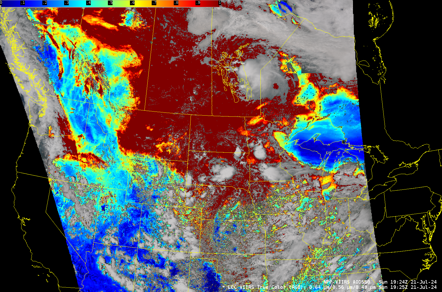
VIIRS [added: and GOES!] estimates of smoke over the central United States
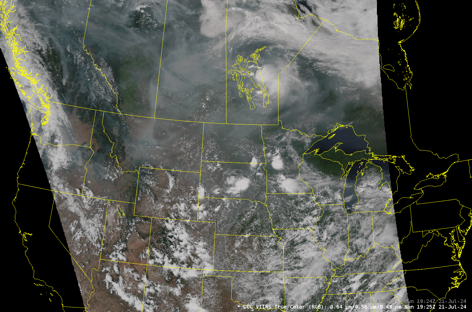
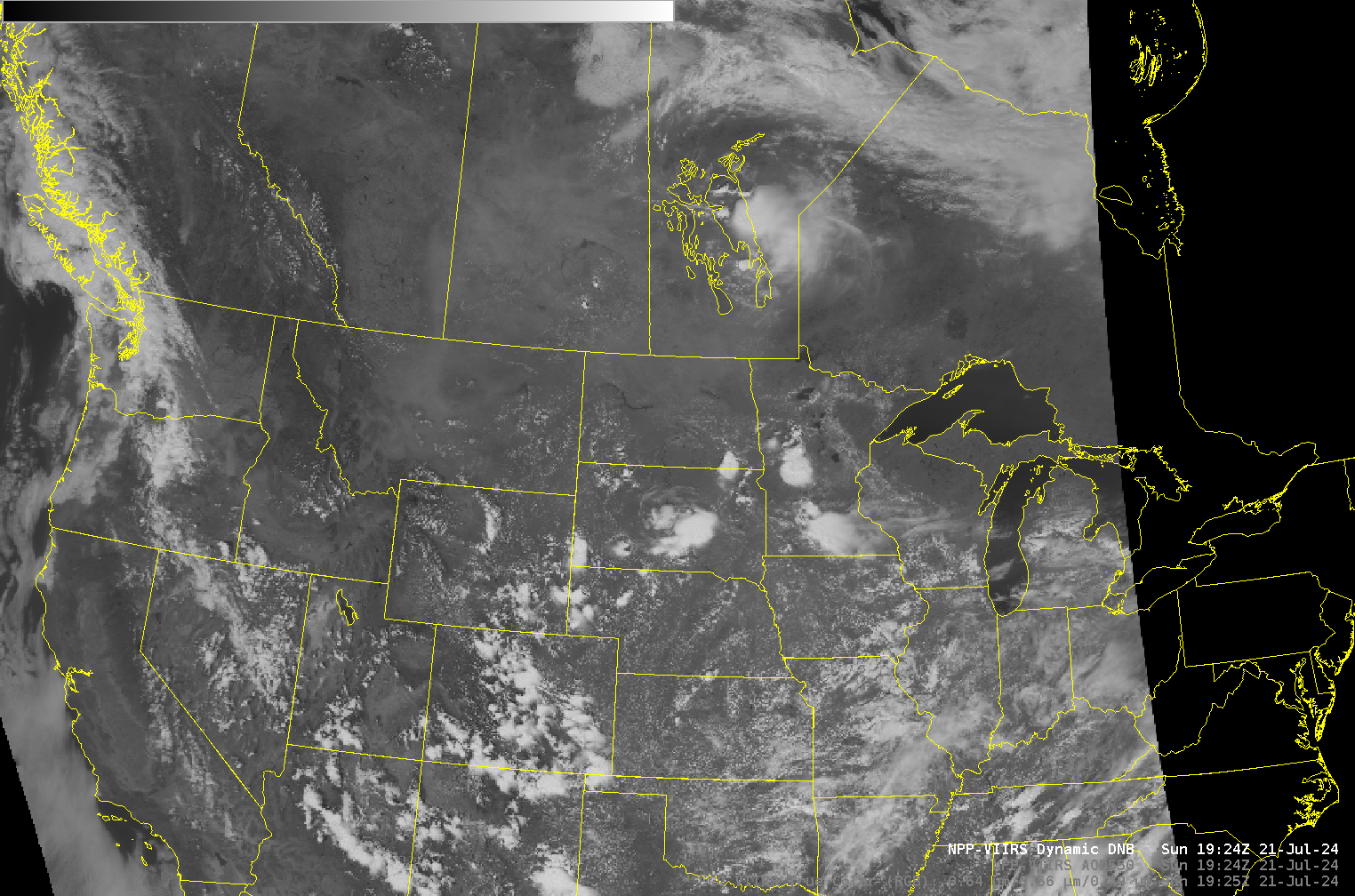
As noted here, CSPP software now includes the ability to show reprojected values of Aerosol Optical Depth, in this case within AWIPS. The AOD from the NOAA-20 afternoon pass on 21 July shows extensive smoke over the Plains of Canada and the northern Plains of the USA. Clean air is confined to the Upper Peninsula (UP) of Michigan. The Day Night band imagery at the same time is more distinct over the UP as well. Note, for example, how easy it is to see Lake Superior compared to Lake of the Woods on the Minnesota/Canada border, or Lake Manitoba.
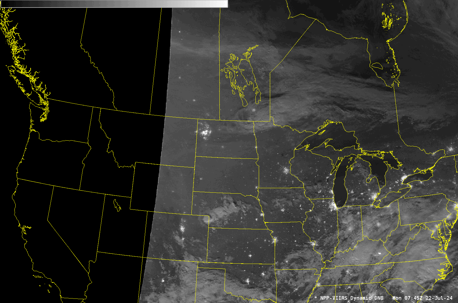
AOD computation with VIIRS data requires visible bands that give no information at night (the ATBD for VIIRS AOD is here). Day Night Band imagery — with a near-full moon — gives information on smoke distribution based on, as above, how well surface features can be viewed.
VIIRS data from the CIMSS Direct Broadcast site — the source of these AWIPS images — can also be viewed online here.
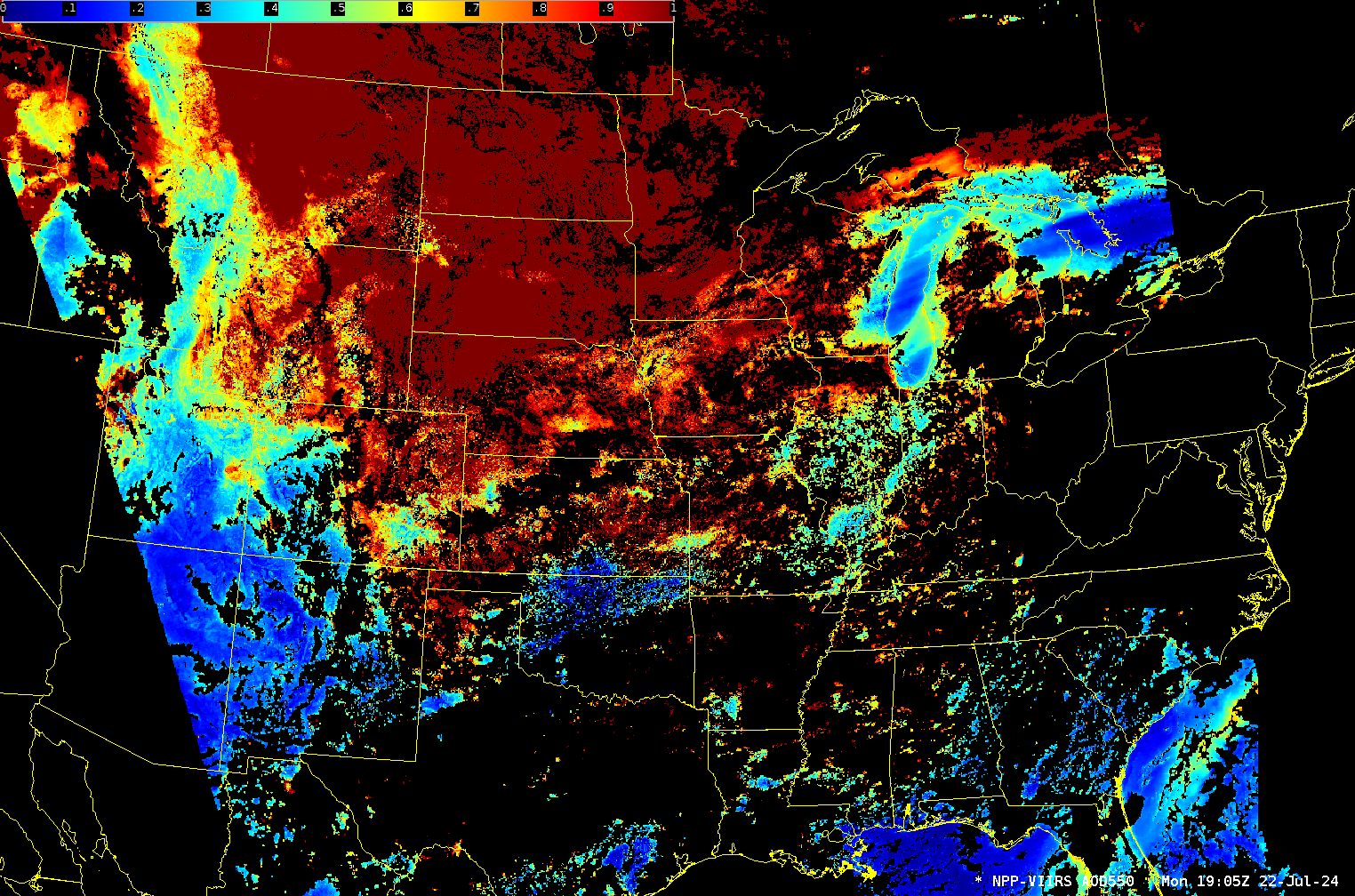
VIIRS AOD from the afternoon overpass on 22 July 2024, below, shows a general increase in AOD values over the midwest as the region of relatively clean air over the western Great Lakes shrinks.
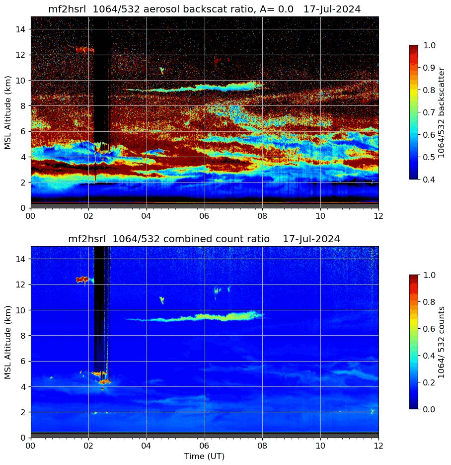
Earth-based observations at Madison from this site show the evolution of the particulate matter from 17-22 July. There is an increase an lowering in the particulates over the course of time. In particular, a defined layer near 4 km becomes apparent by 19 July 2024.
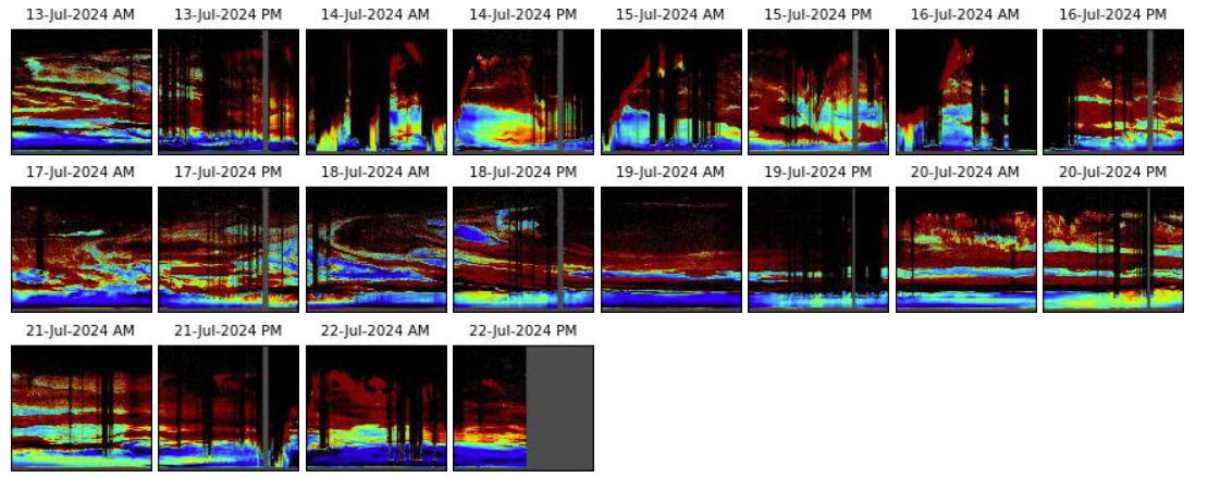
The smoke layer is also apparent in the series of small plots shown below, starting high in the atmosphere on 18 July, and descending to around 4 km on 19 July. A lower-layer of particulates was also present on 19-21 July 2024; showers on the 21st likely removed that lower layer.
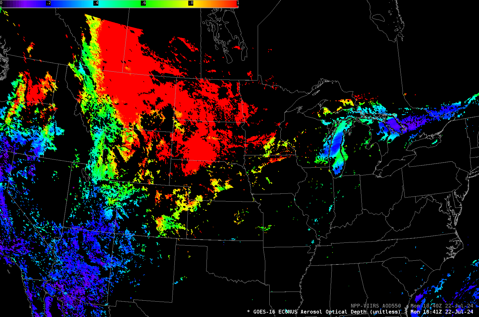
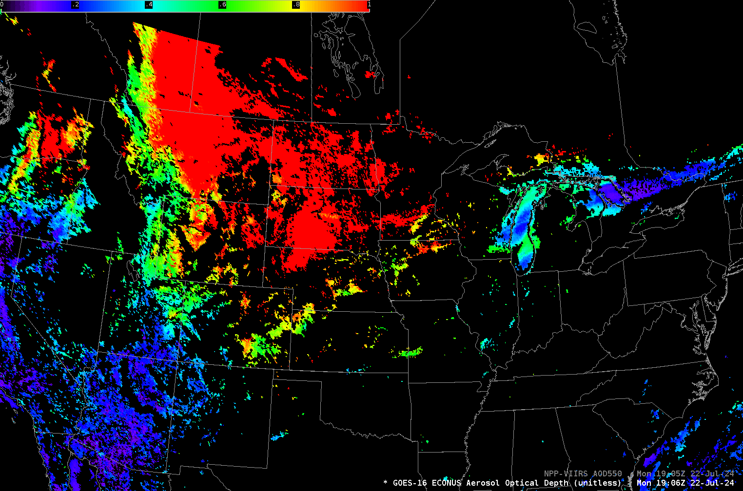
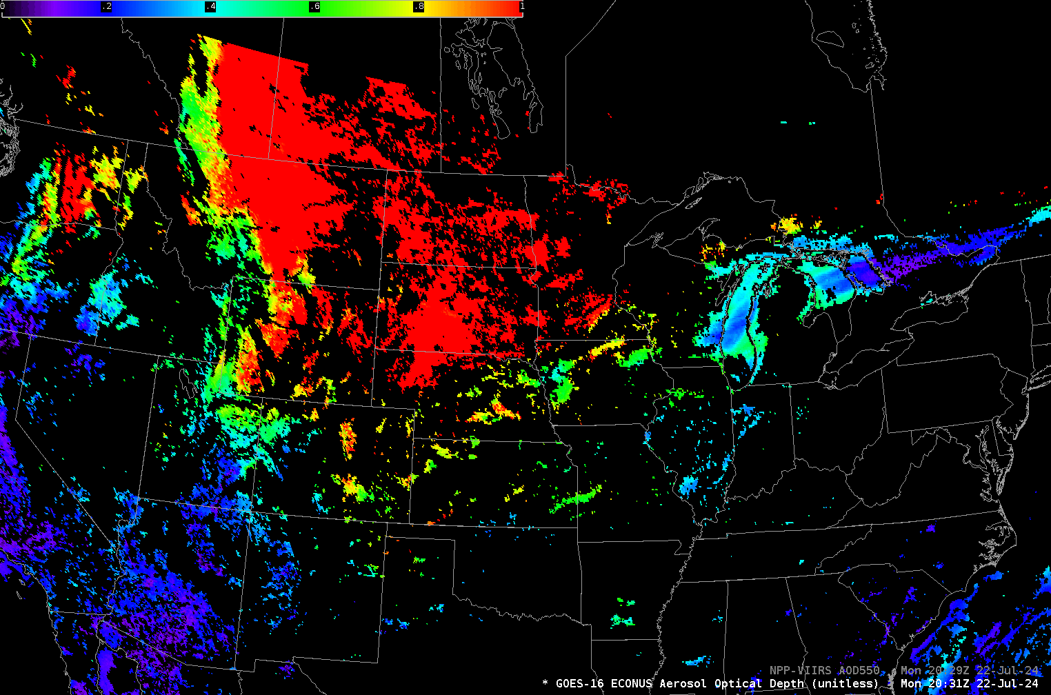
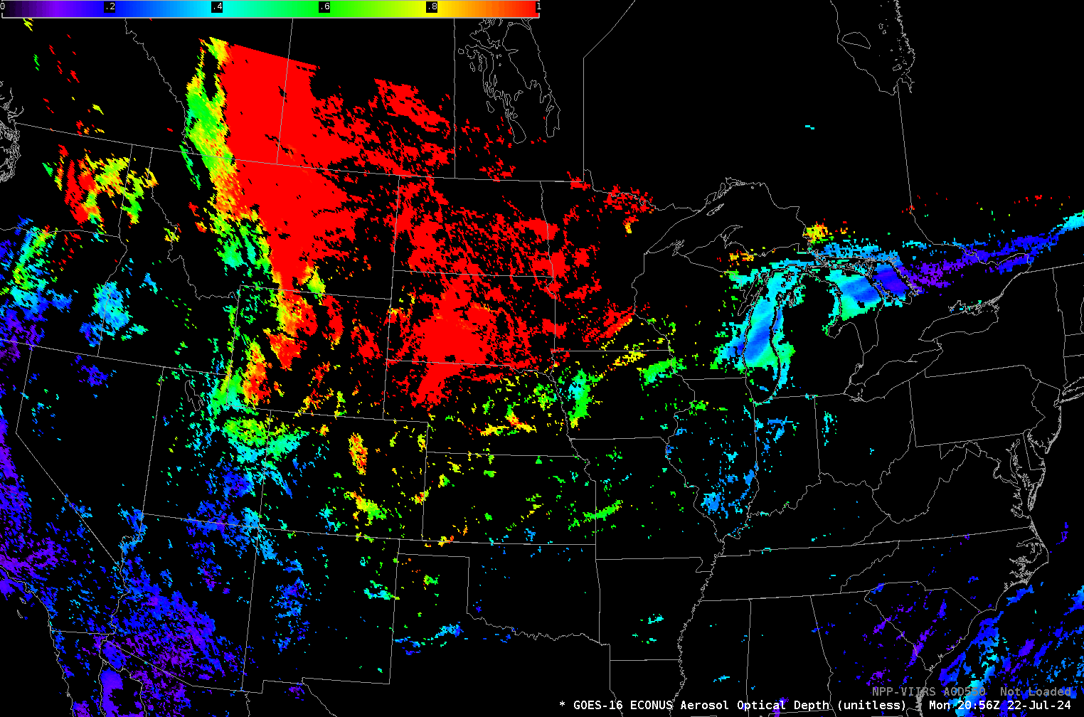
GOES-R Satellites also produce the Level 2 product Aerosol Optical Depth. The animation below shows GOES-derived values from 1756-2201 UTC on 22 July. The data are produced every 5 minutes, and the extensive smoke pall is captured.
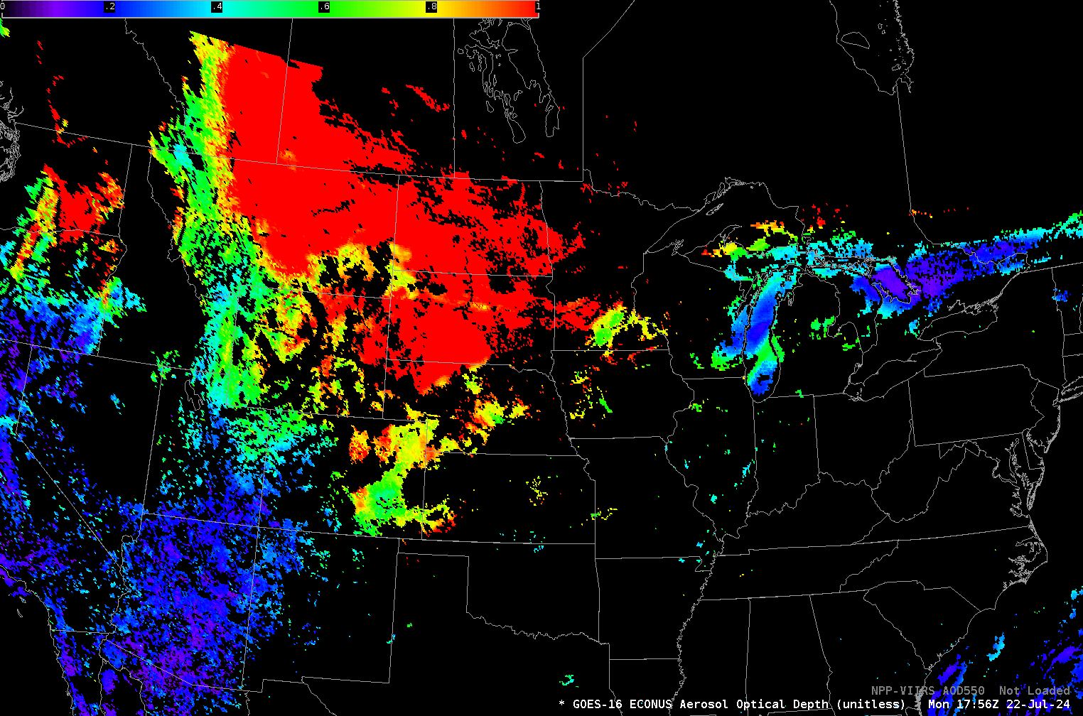
Four VIIRS overpasses occurred during the 5 hour animation shown above. The four toggles below compare the VIIRS and GOES-R AOD. The VIIRS product on this day shows more coverage. This is likely related to the different cloud masks.