PHS Model simulations with tornados over western Louisiana
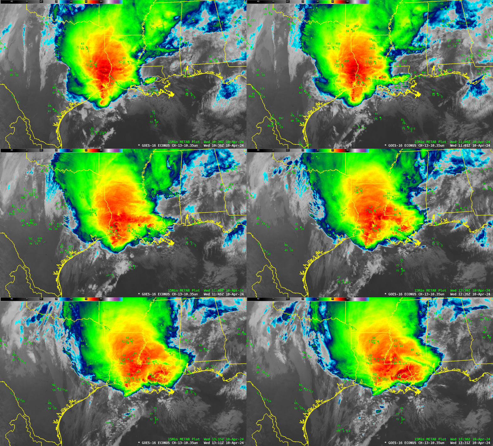
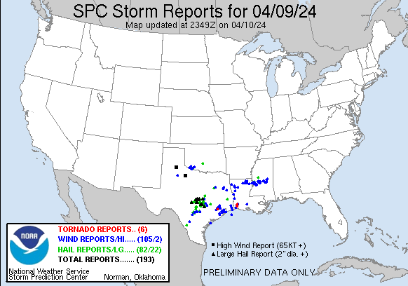
GOES-16 Clean Window infrared imagery (Band 13, 10.3 µm), above, shows a convective line moving into Louisiana around sunrise on 10 April 2024. SPC Storm Reports (below, and here), show tornadoes over extreme southwest Louisiana at around 1130 UTC on 10 April 2024 (Note the peak wind of 55 knots at the Lake Charles LA airport at 1136 UTC, within minutes of the times of the reported tornadoes nearby).
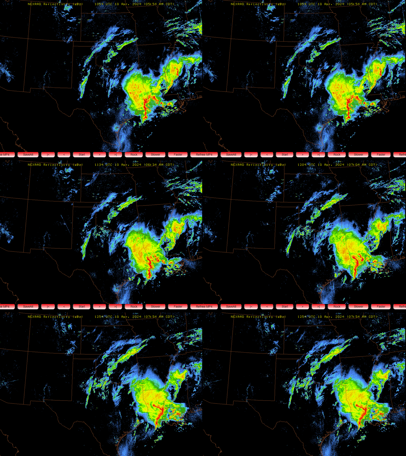
Composite Reflectivity radar fields (clumsily saved as screen captures from this site), show the line of convection responsible for the tornadoes.
CIMSS and Hampton University Scientists run a 4-km resolution WRF simulation that includes as its input information from Polar Hyperspectral Soundings. The great spectral resolution of the Sounders (both infrared and microwave) on Polar Orbiting Satellites (that is, CrIS and ATMS on NOAA-20/NOAA-21 and IASI and MHS/AMSU on Metop-B/Metop-C) is blended with the great spatial and temporal resolution of the ABI (via a fusion process described here and here) to provide assimilation data to the WRF model. How did this model perform (compared to other high-resolution mesoscale models) during this small outbreak of tornadoes?
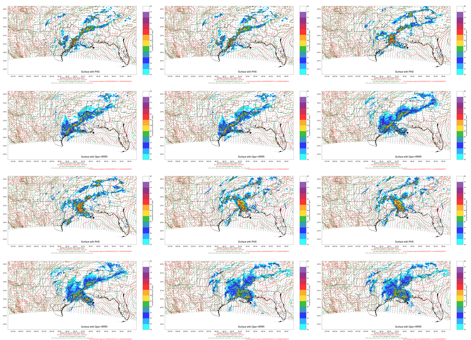
The surface fields below from the 4-km WRF model with PHS information and the 3-km HRRR model are shown below. The WRF simulation better represents the character and timing of the convection moving into southwestern Louisiana. It’s tempting to attribute this to a better representation of moisture that comes from the inclusion information from the Polar Hyperspectral Soundings.
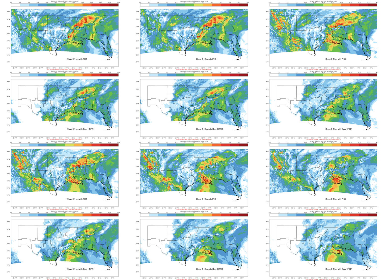
The model output shown below is the 0-1000m bulk shear. Shear values are larger and show small peak concentrations at the time and in the region of the observed tornadoes in the WRF model influenced by PHS data (top) compared to the HRRR model (bottom). The Shear at 1100 UTC is shown here.
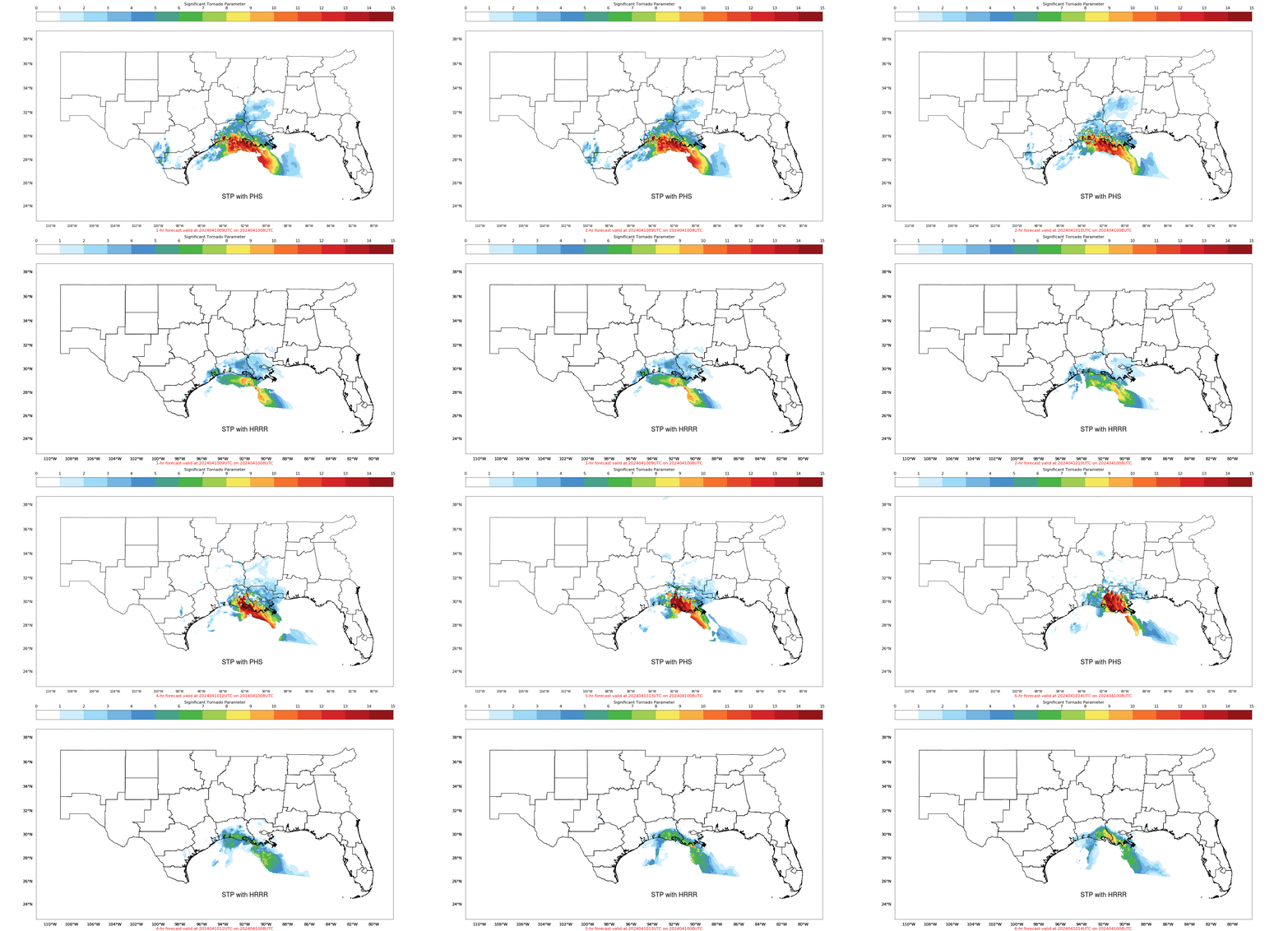
Significant Tornado Parameter (STP), below, also has smaller-scale features in the WRF model run influenced by PHS data compared to the HRRR model run. The model output at 1100 UTC is shown here (tornadoes occurred close to 1130 UTC; one was rated an EF-2).
PHS model output (available here online) will be demonstrated this year at the Hazardous Weather Testbed at SPC in Norman OK. One of the metrics available at the PHS Model website shows how many profiles are (or are not) assimilated into the model. Here‘s the field for 0800 UTC on 10 April: Many profiles are assimilated!!

