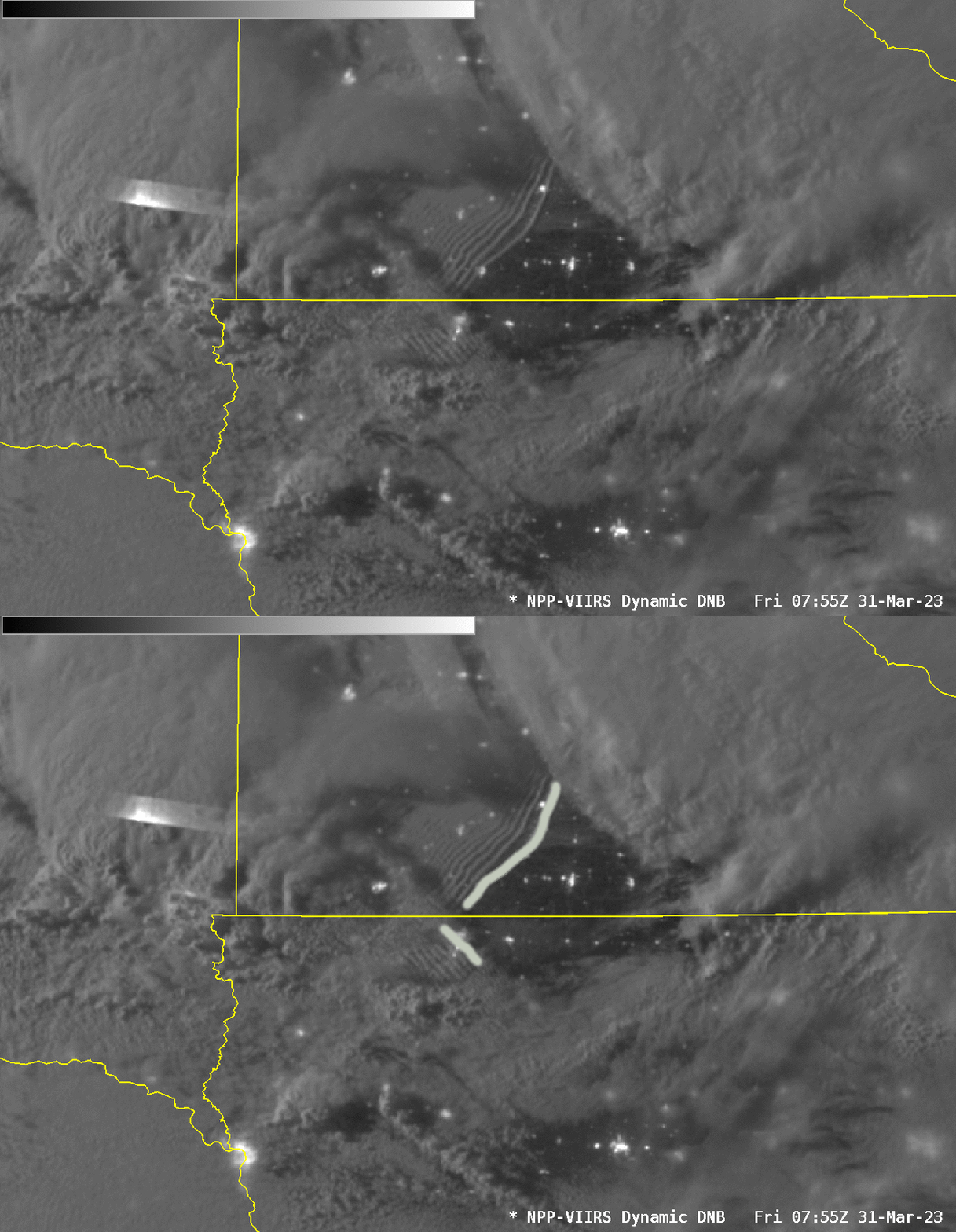
Bore features in the Day Night Band over Minnesota and Iowa

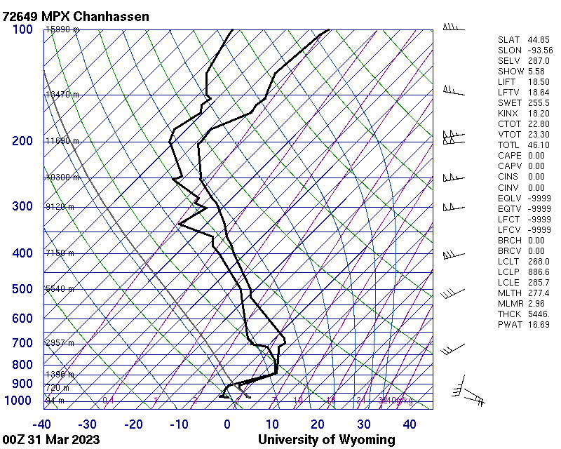
Much of the mid-Mississippi River valley was placed under a Moderate Risk of severe weather by the Storm Prediction Center on 31 March 2023. Day Night Band imagery from NOAA-20 (mislabeled as Suomi NPP), above, shows two bore-like features with very different orientations (there is also a notable lightning feature over eastern South Dakota!). The feature over Iowa is oriented southeast to northwest, the one over Minnesota — at a lower level (note the shadow cast by the higher clouds over Iowa on the lower clouds over Minnesota) — is oriented southwest to northeast. Winds are typically perpendicular to such cloud bands, so this one still image suggests very strong shear (consistent with the SPC forecast). The 0000 UTC SkewT from Minneapolis/Chanhassen, below, from the Wyoming Sounding site (here’s the AWIPS NSharp image), shows very strong low-level shear and veering winds. Winds below 850 are nearly perpendicular to the cloud bands in southern Minnesota; winds above 850 are nearly perpendicular to the cloud bands in north-central Iowa.

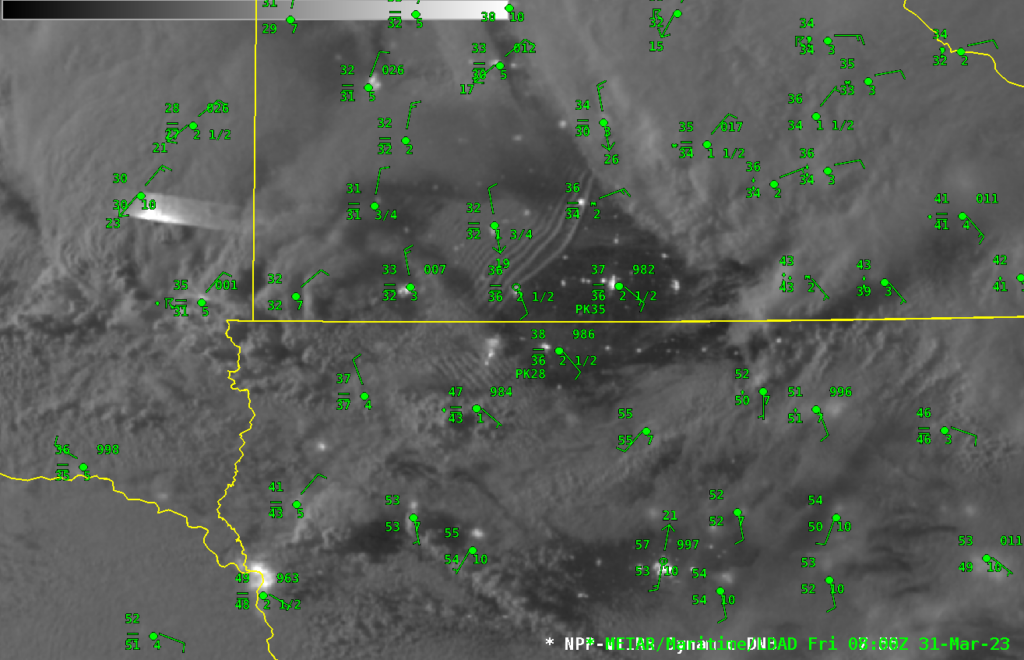
Surface observations overlain on top of the Day Night Band imagery, below, show a 180-degree windshift across the cloud band feature in Minnesota. The influence of the Iowa Bore does not appear to extend to the surface, perhaps because of the strong inversion present.

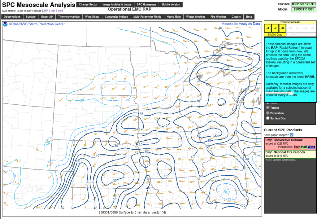
Shear Analysis (Surface to 3 km) from the Storm Prediction Center, below, for 0800 UTC, does show a change in shear from the environment near the northern bore feature over southern Minnesota to the environment surrounding the southern bore feature over northern Iowa.

The Day Night band image above is also available (for 5 days) at the CIMSS Direct Broadcast ftp site (here) and at the CIMSS VIIRS Image Viewer (here).

