Clear skies over the western Great Lakes
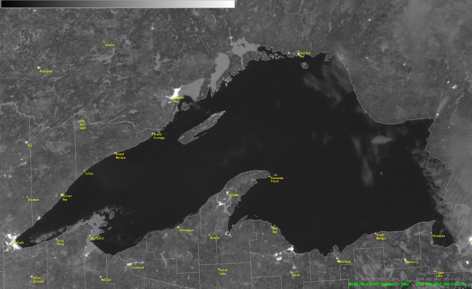
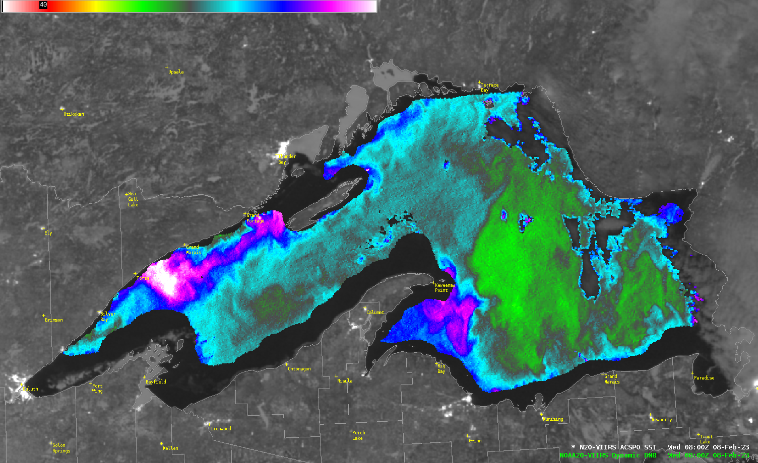
Predominantly clear skies and a waning Full Moon (the Full Moon was on 5 February) allowed for both Day Night Band imagery of the surface and Advanced Clear-Sky Processing for Ocean (ACSPO) sea-surface temperature (SST) fields using VIIRS data downloaded at the CIMSS Direct Broadcast antenna (and processed using CSPP and Polar2Grid software). The toggle above shows the Day Night Band image (there are some clouds over eastern Lake Superior, and ice is apparent near/around the Apostle Islands and along the Wisconsin and western Upper Peninsula shorelines) with and without an overlain SST analysis over Lake Superior. SST values over Superior range from 32o F (white in the enhancement) to a brisk 37o F (green in the enhancement). Of interest in the SST analysis is the surface front extending to the northeast of Keewenaw Point: Green values to the east are just above 37o F; cyan values to the west are cooler than 36o F.
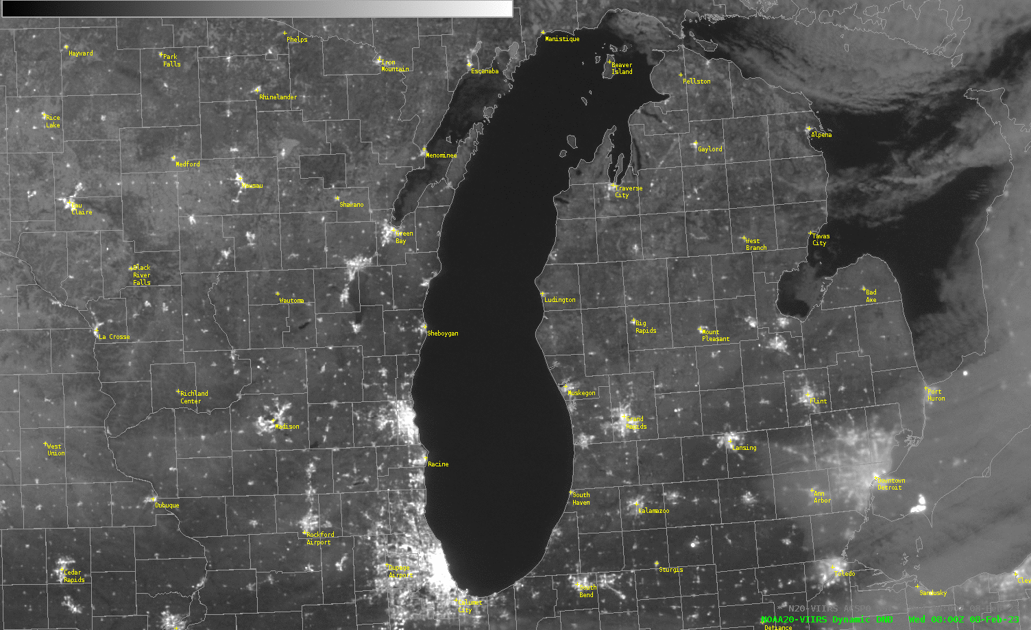
Fewer clouds were obvious over Lake Michigan. Lake Michigan is shows warmer surface temperatures, near 40o F (red enhancement) to the northeast of Chicago. Note the presence of ice over Green Bay.
You can also view imagery over the Great Lakes at the CIMSS VIIRS Imagery Viewer that packages imagery from the CIMSS Direct Broadcast site.