Polar Hyperspectral Modeling at the Hazardous Weather Testbed (Week 2)
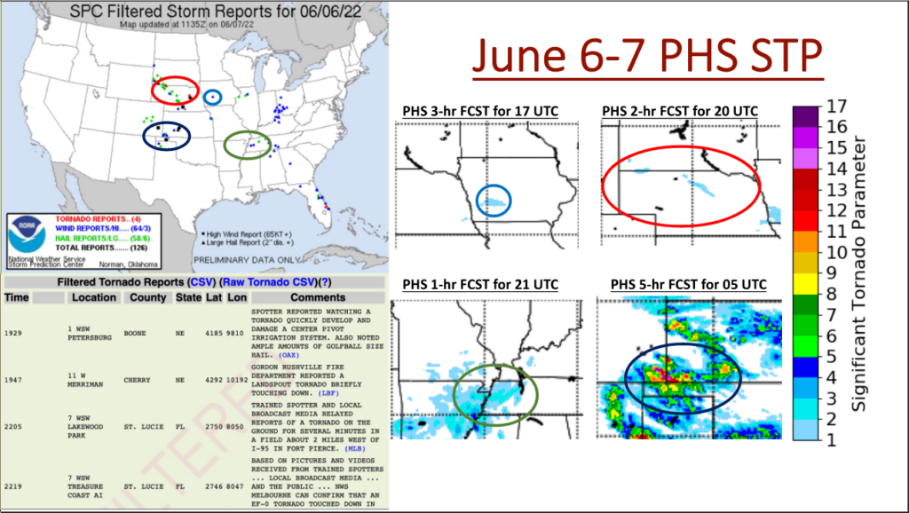
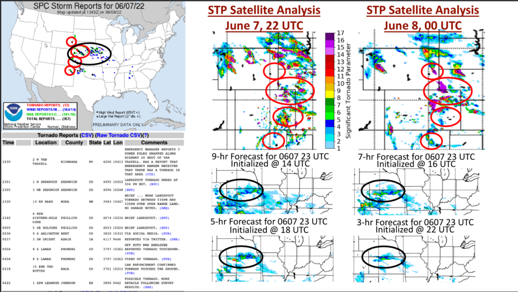
The second week of the Hazardous Weather Testbed (here is the blog site) ran 6-10 June 2022, and this blog post will discuss one or two of the events that happened this week. I was away from the Testbed on the first two days, and day #4 was not an active day for severe weather during the Testbed hours. The daily maps that summarize the short-term forecasts and the observed severe weather (courtesy Bill Smith, Sr) are shown below. On all days, the STP forecasts and analyses overlapped the region of severe weather.
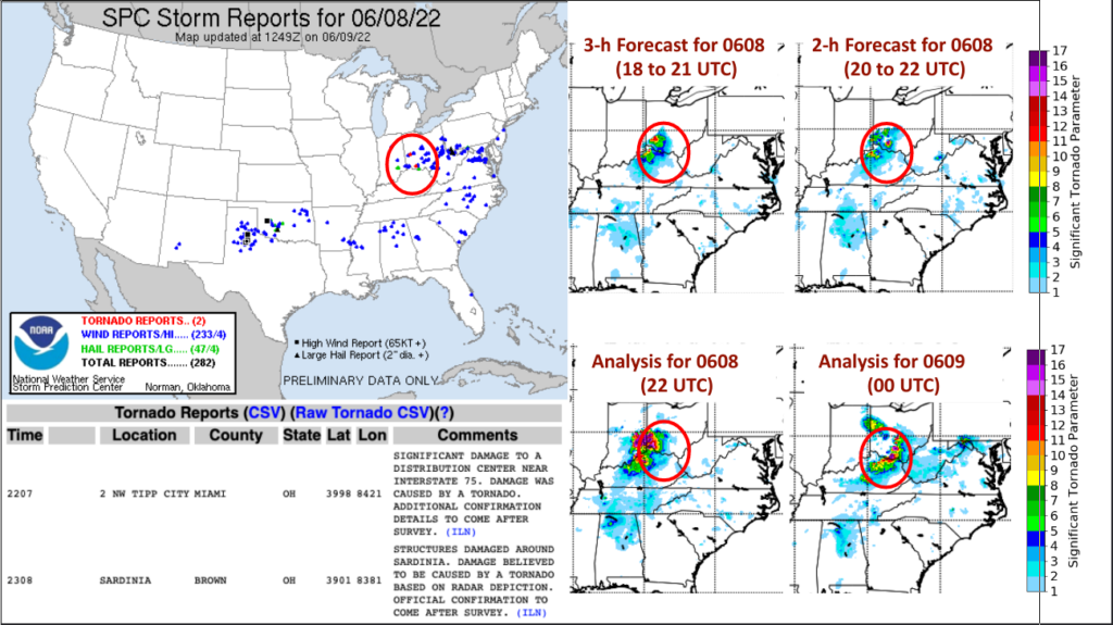
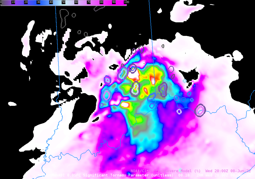
Wednesday’s STP example over southeast Indiana was one of the better predictions of the week (and it’s also discussed in this HWT blog post). The ProbSevere objects contours are surrounding maxima in the STP field. As during week 1, there were many examples that showed ProbSevere signals along the perimeter of large MUCAPE values (Most Unstable Convective Available Potential Energy; that is — in the MUCAPE gradient). Here’s an example from 2000 UTC on 8 June 2022 (the same time as the image below).
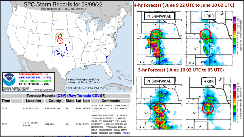
As with Week 1, forecasters found great utility in using PHSnABI model output in anticipating where convection might form; that is, it was most useful in the pre-convective environment, and forecasters found 0-4h forecasts most useful.

