Upper Midwest Derecho
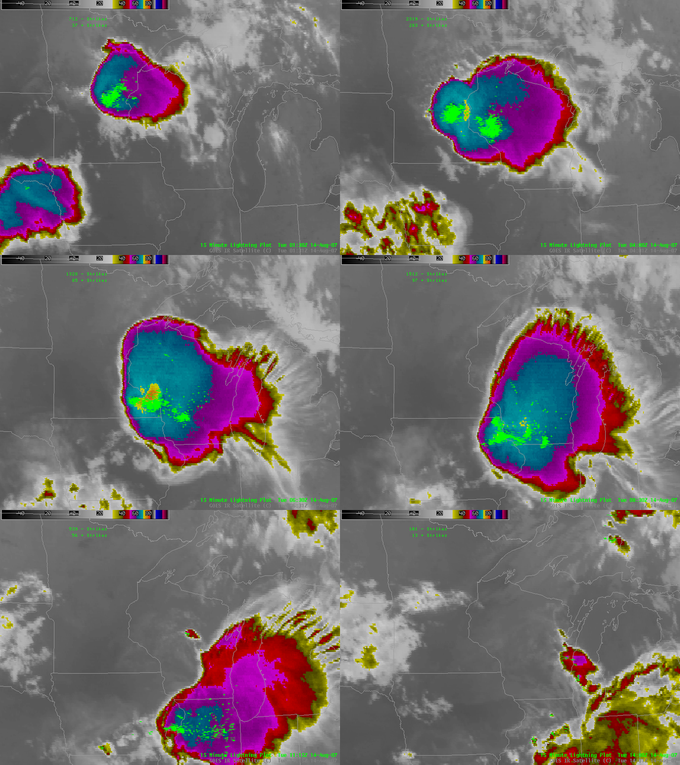
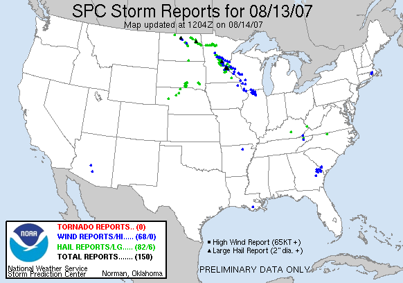
Derechos are long-lived convectively-driven wind storms. In the upper midwest, they typically form in northwesterly flow just poleward of very warm and moist air and then surge southward. Convection overnight on 13-14 August 2007 developed into a long-lasting complex with a bow echo that propagated from north of Minneapolis to Illinois. Although wind speeds weren’t as strong in historic events such as July 1983, numerous wind damage reports nevertheless were reported to SPC.
Monday August 13 was characterized by strong moisture contrasts over the upper midwest (see the 2100 UTC dewpoint plot here; the 2100 UTC temperature plot is here). Excessive heat and humidity over the high plains extended northeastward into central Minnesota where cooler and dryer air prevailed. Predictably, this was a region for the development of strong thunderstorms, and the 0000 UTC sounding for 14 August at Chanhassen (here) showed the potential for very strong convection.
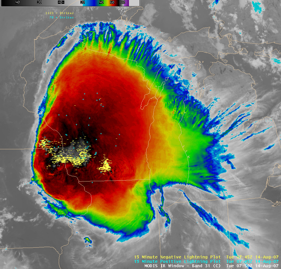
The AQUA satellite carrying the MODIS instrument flew directly over the mature thunderstorm complex at 7:50 UTC 14 August, and the color-enhanced IR window channel (10.8 micrometers) is below. Plotted on top of the clouds are the 15-minute cloud to ground lightning data. Two active regions of lightning are present; one is over south-central Wisconsin, near Madison, and a second stretches as an arc along the front of a southward-propagating bow echo over western Wisconsin, immediately in front of the coldest cloud tops. The vertex of the arc corresponds to the line of wind damage reports from SPC. This correspondence is even more striking when viewing animations of lightning data and satellite data (or the combination, at the top of this blog entry), or the radar loop with lightning superposed on top that is here. Note the striking roll-up at the eastern edge of the devloping bow echo that was captured in extreme western Wisconsin — next to the St. Croix River — in the radar image at 0554 UTC (here).
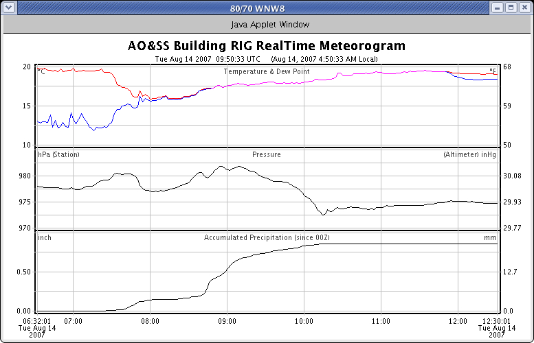
The propagating thunderstorm had a predictable influence on surface pressures. Pressures rose as the first region of lightning moved through Madison just before 08z, and again as the second region of lightning associated with the weakening bow echo moved across Dane County.
Note also the presence of a 38-knot wind gust from the southeast at 10:10 UTC as the mesolow moved through after most of the rain had fallen.


