NUCAPS Profiles before an historic snow in Portland Oregon

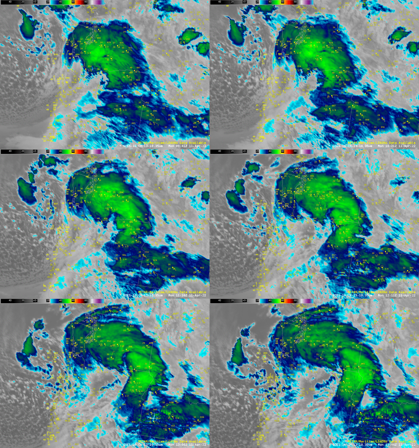
April 11 2022 saw the first measurable snowfall ever in April at the Portland OR airport (WFO Portland Tweet), where records have been kept since 1940. The GOES-16 animation above shows the weather system responsible for the weather.
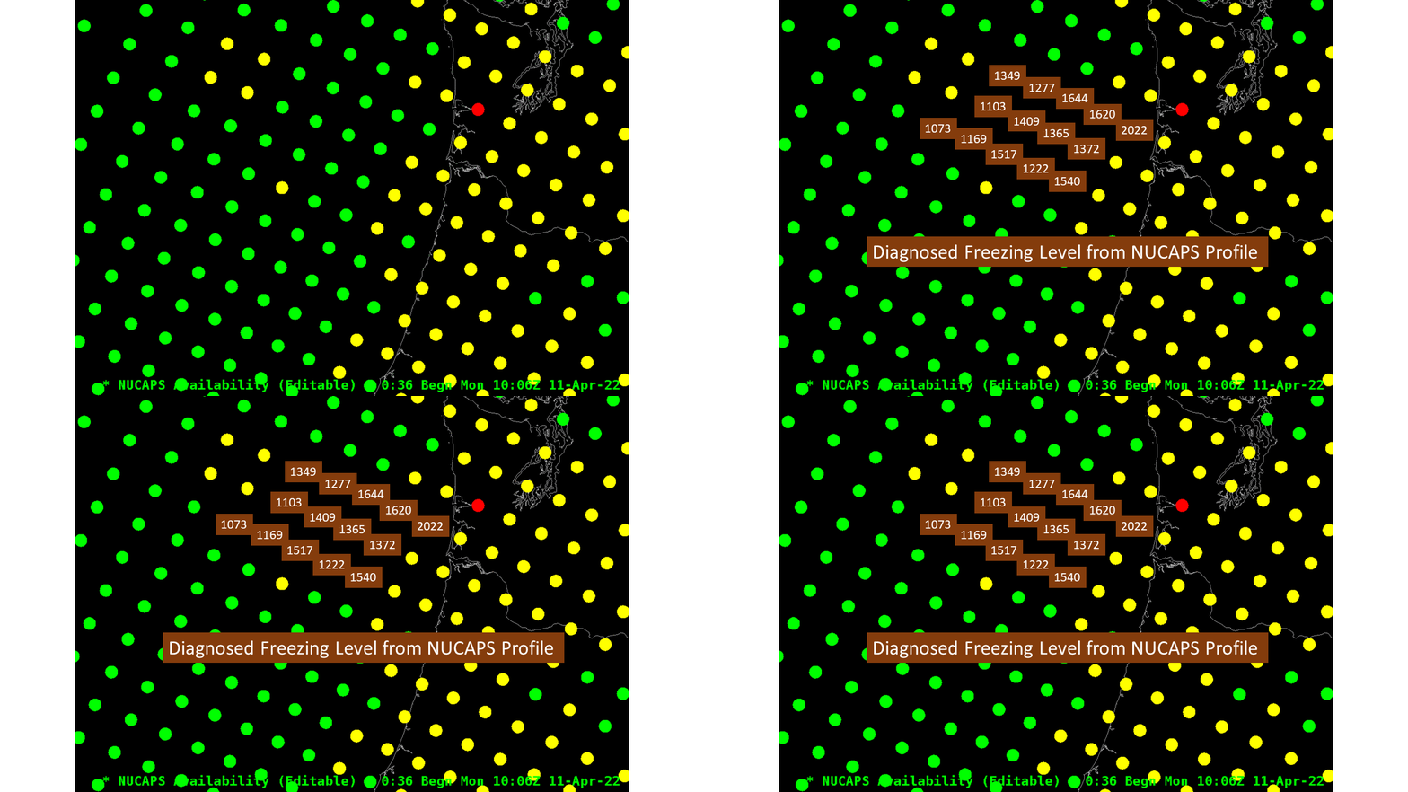
NOAA-20 overflew the west coast shortly after 1000 UTC (map of the orbit, from this website), and NUCAPS profiles derived from the CrIS and ATMS instruments on board helped define the cold airmass just offshore. The toggle below shows two soundings (green suggesting that the retrieval converged to a solution) just along the shoreline; 850-mb temperatures are -5oC and -4oC at the northern and southern profiles, respectively; the diagnosed freezing levels at both locations are higher than 2000′.

The toggle below shows Sounding Availability points (zoomed in) and diagnosed freezing levels farther offshore, suggesting colder air out over the open ocean.

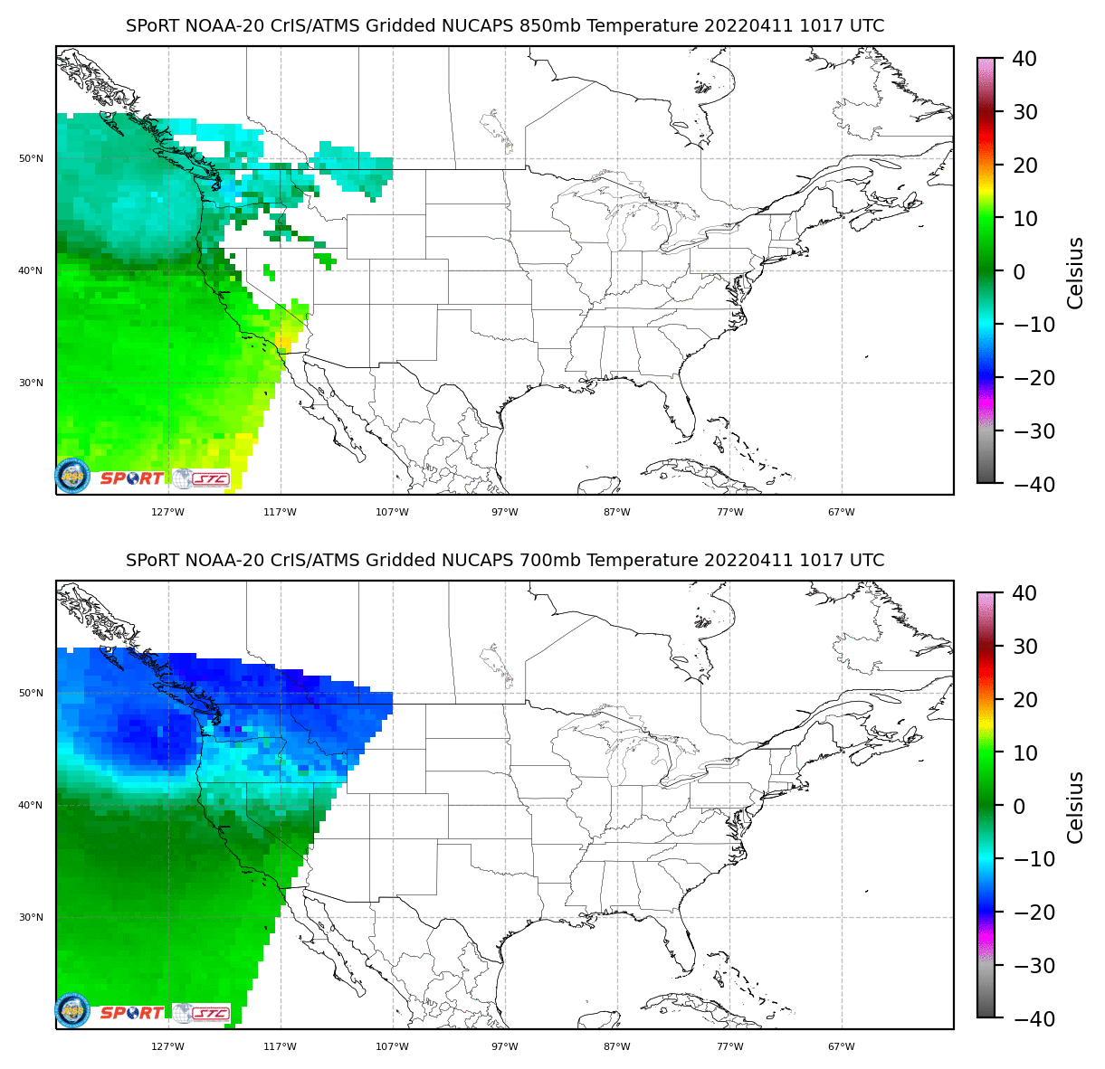
Gridded NUCAPS are available in AWIPS — and also at this site created by NASA SPoRT (and at RealEarth). The toggle below shows gridded 850- and 700-mb temperatures from the NOAA-20 overpass. The coldest air is shown over the Pacific Ocean at 1017 UTC.

NUCAPS profiles and gridded NUCAPS fields can give timely observations over large data voids (such as the Pacific Ocean) in advance of high-impact weather events.

