Ice on Lake Superior

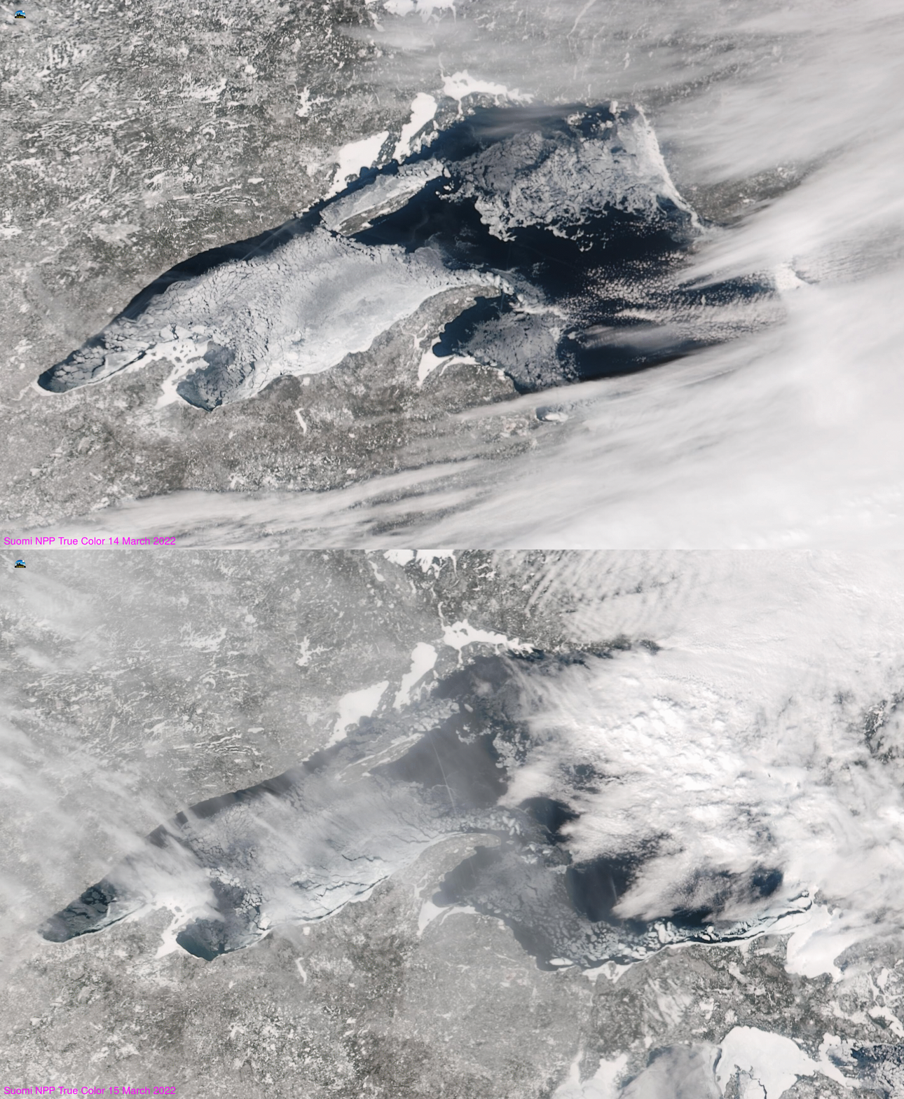
Ice coverage on Lake Superior has reached a seasonal peak. The image above shows VIIRS true-color imagery from Suomi-NPP (taken from the VIIRS Today website). Mostly clear skies over most of Superior on 14 March allowed for better estimates of ice cover on that day from VIIRS (more clouds were present on 15 March).
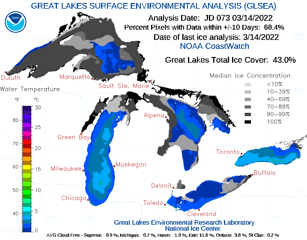
Ice-cover mapping from NOAA’s GLERL (The Great Lakes Environmental Research Laboratory), shown below (from this website) also shows extensive ice cover over Lake Superior. (Blue regions indicate open water.)

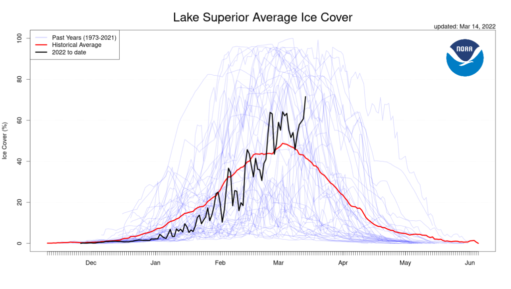
The analysis below (also from the GLERL site, at this link) shows how the ice cover has varied over the course of the winter over Superior. The present maximum is the largest ice extent of the season — and the ice cover is greater than normal. Ice cover over Superior typically peaks in early March.

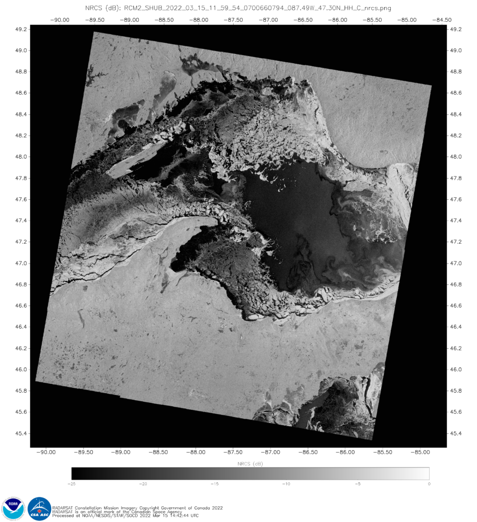
When clouds are present (and when they are not!), Synthetic Aperture Radar (SAR) imagery (available in near-real time at this website) gives very high-resolution information about ice formation on Lakes. The image below shows the Normalized Radar Cross Section (NRCS) from 15 March 2022 just before 1200 UTC. Open water is indicated (flat black surfaces) just east of the Keewenaw Peninsula, just east of Isle Royale, in a strip along the western shore of the lake, and in a large region in central Lake Superior to the east of the tip of the Keewenaw Peninsula.

NOAA/STAR does have a Great-Lakes specific SAR website that includes imagery mapped to all 5 Great Lakes. (Link). The mp4 animation below, using images from that website, shows the 11 most recent Lake Superior images of NRCS, ending at ca. 1200 UTC on 15 March. A lot of the views include Duluth Harbor.

