Using gridded NUCAPS lapse rate to identify (and track) Elevated Mixed Layers

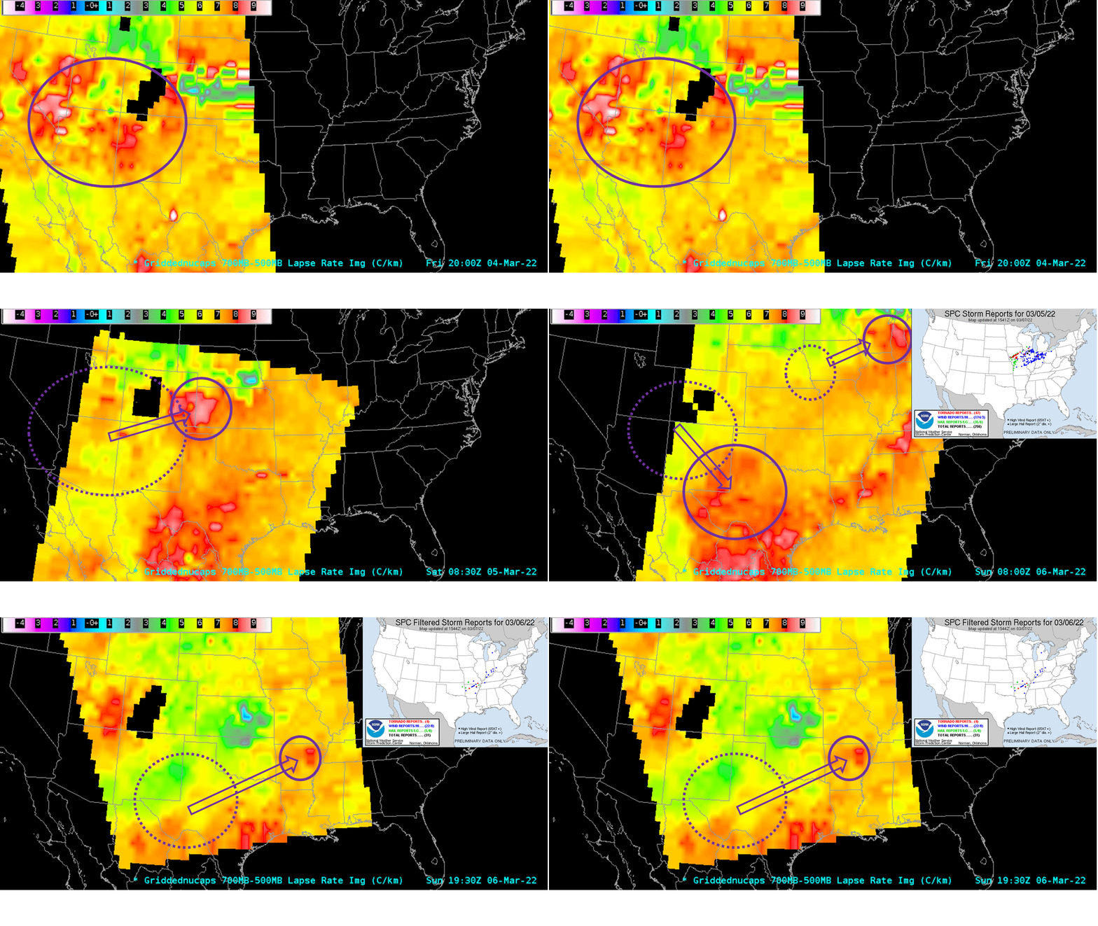
The animation above shows a progression of mid-tropospheric lapse rates between late on 4 March and late on 6 March 2022. The purple circles enclose regions of steep mid-level lapse rates; dotted purple circles show the location of the steep mid-level lapse rates in the previous image. This slow animation shows the progression of these steep lapse rates towards late-afternoon tornadic outbreaks, shown as the inset Storm Reports (5 March 2022 ; 6 March 2022) from the Storm Prediction Center.
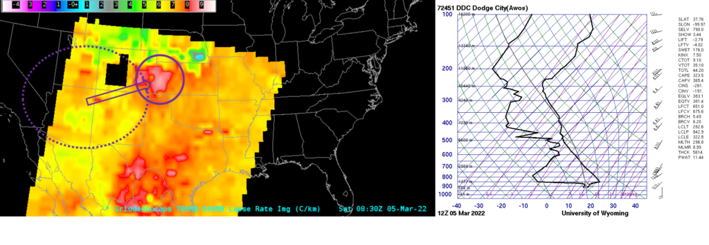
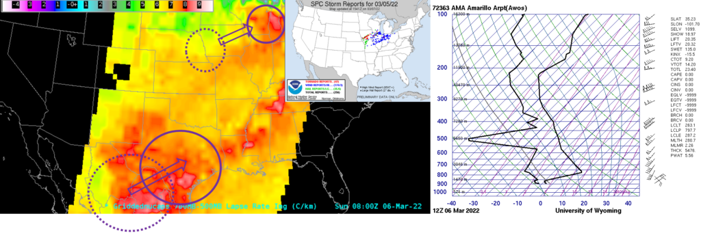
Are the steep lapse rates picking up on Elevated Mixed Layers? Compare the NUCAPS plot at 0830 UTC on 5 March and the adjacent Skew-T from Dodge City Kansas at 1200 UTC on the 5th, shown below; or the NUCAPS plot from 0830 UTC on 6 March and the adjacent Skew-T from Amarillo at 1200 UTC on the 6th, shown at the bottom.


Consider viewing gridded NUCAPS estimates of Lapse Rates every morning as part of your situational awareness to determine whether an Elevated Mixed Layer might influence subsequent weather. Gridded NUCAPS fields are available here (A NASA SPoRT site) and here (a RealEarth site).
Many thanks to Chris Gitro, MIC at WFO Duluth, for discussions about this case!

